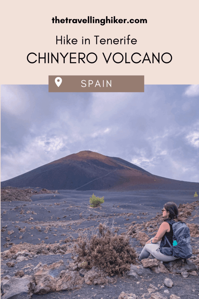
Tucked away in the heart of Tenerife’s volcanic landscape, the Chinyero Volcano offers one of the island’s most unique and otherworldly hiking experiences. As the site of Tenerife’s last volcanic eruption in 1909, Chinyero is not only a geological wonder but also a peaceful retreat surrounded by black lava fields, fragrant pine forests, and distant views of Mount Teide.
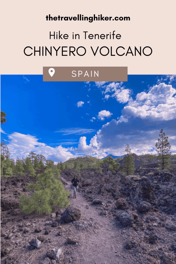
Hiking around Chinyero feels like stepping into another planet. The contrast between the dark, rugged lava and the vibrant green pines creates a surreal atmosphere that’s both calming and awe-inspiring. The circular trail is well-marked and fairly gentle, making it perfect for all levels of hikers. Along the way, you’ll encounter stunning viewpoints, quiet forest paths, and the kind of stillness that makes you forget the rest of the world exists. If you’re visiting Tenerife and want to escape the beach crowds for a day, this hike is a must.
TABLE OF CONTENTS
INTERESTING FACTS ABOUT CHINYERO VOLCANO
Everybody has heard of Teide but not so many people know about Chinyero. To help you know about your destination, here are some interesting facts about this volcano in Teide.
This is the site of the most recent volcanic eruption in Tenerife. In November 1909, Chinyero erupted and covered the area in lava.
The Chinyero Natural Reserve is a protected area that covers over 2,400 hectares. This area has a unique volcanic environment that includes pine forests, lava fields, and rare plant species.
Chinyero is part of the Volcanic Dorsal Ridge, which is a line of volcanoes that are located in the center of the islands.
On clear days, you will get stunning views of Teide from the area.
PRACTICAL INFORMATION ABOUT THE HIKE
Before we get into the hike guide, let’s focus on some practical information. How do you reach the trailhead? Do you need any specific equipment? Trust me, you will be happy to know this before you start your hike!
HOW DO YOU REACH THE TRAILHEAD?
Chinyero is a volcano located in the Chinyero Natural Reserve, near the town of Santiago del Teide. Here’s a step by step on how to reach the trailhead for this hike.
🚗By Car
The only way to reach this hike is by car so if you want to do this hike, you will have to rent a car.
From Santa Cruz de Tenerife: All you have to do is take TF-1 highway until you reach exit TF-82 towards Chío. Right before you reach this small town, take road TF-38 until you reach Los Poleos Viewpoint (Mirador de Los Poleos). This drive will take you approximately 1 hour and 15 minutes.
🅿️ Parking: Los Poleos Viewpoint has a small parking lot next to it that has places for more or less 12 cars. Many people just stop here for a 10 minutes to admire the views and leave after that. If the parking lot is full when you arrive, just wait for a few minutes and very soon, someone will leave.
EQUIPMENT NEEDED
The hike is not very demanding but the following hiking essentials will make your hike more enjoyable.
Sturdy hiking shoes. A big part of the trail goes through a lava field. Wearing hiking shoes that offer a good grip and ankle support are a must! I saw some people doing this hike with regular trainer shoes and even though it is possible, your feet will thank you if you were the appropiate footwear.
Reusable water bottle. There is no water source along the trail so make sure to bring a water bottle with enough water to stay hydrated during the hike.
A hat and sunscreen. The day we did this hike the sky was partially clouded so we didn’t need to use them. However, if you do this hike on a clear day, you will be happy to have something to protect you from the sun. There is barely any shadow on this trail.
BEST TIME TO DO THIS HIKE
Good news! This hike can be done all year round! But if I have to recommend something, I would say this hike is best done during spring (March to May) and autumn (September to November) when the weather is milder. This will make your experience more enjoyable with comfortabale temperatures and fewer people on the trail.
Summer hikes are less recommended here due to high temperatures and intense sun. If you still want to hike it, then I would recommend to start your hike early to avoid the warmer parts of the day.
Regardless of the season, always check the weather forecast before you start your hike. You should also dress appropriately and bring plenty of water to stay hydrated.
CHINYERO VOLCANO HIKE
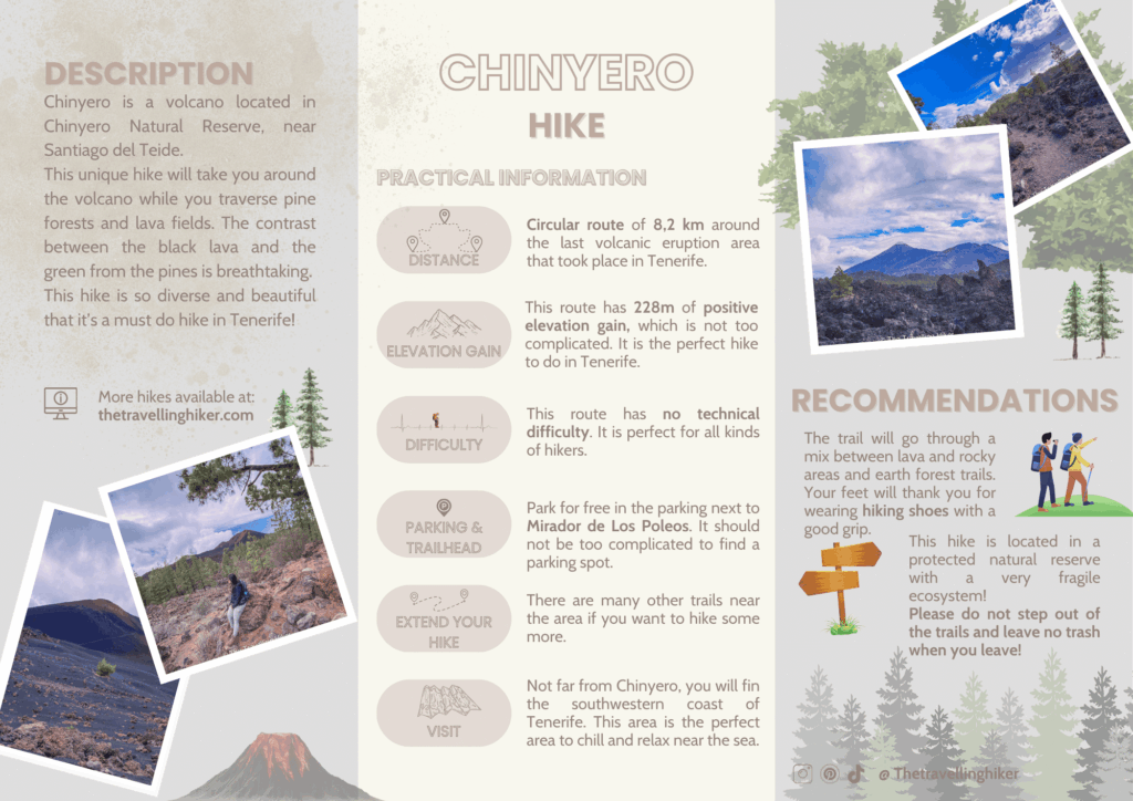
HIKE STATS
Trail Start/End – Mirador Los Poleos Parking
Distance – 8,2 km
Elevation Gain – 228 m
Level – Moderate
Route Type – Circular Route
Estimated Time Needed – 3 hours and 30 minutes. This includes plenty of time to stop for a picnic, relax, and enjoy the scenery.
Best Time To Visit – This can be done all year round! If you’re lucky, on a clear day, you will get impressive views of Teide.
HIKE MAP
I always use the AllTrails App during my hikes. The app has a GPX map that can help you stay on the right trail during your hikes. For this hike, we followed the PR-TF 43 Chinyero Volcano hiking route.
CHINYERO VOLCANO - STEP BY STEP GUIDE
Los Poleos Viewpoint
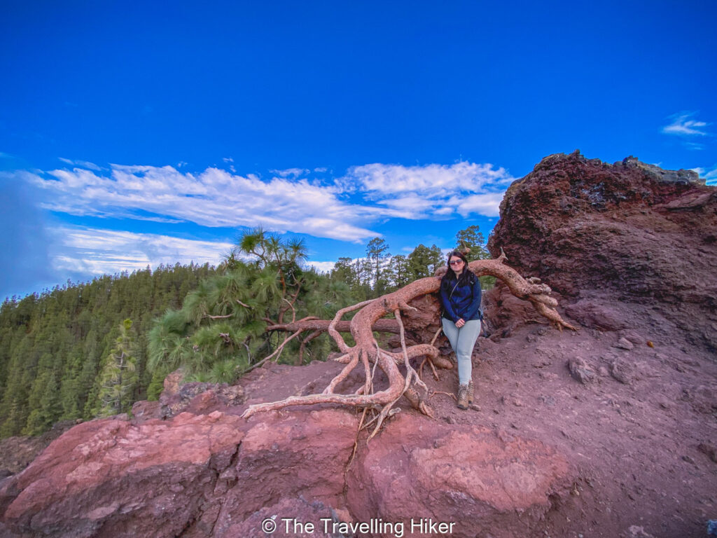
This hike begins at Mirador de Los Poleos (Los Poleos Viewpoint). Park your car in the small parking lot next to the viewpoint and before you start your hike, make sure to enjoy the views of the surrounding area. If you are lucky to get a clear day, from this viewpoint, you will be able to see La Gomera island.
The day we did this hike was a bit overcast with low clouds so the views were not very impressive. Nevertheless, I did like a crooked tree next to the viewpoint.
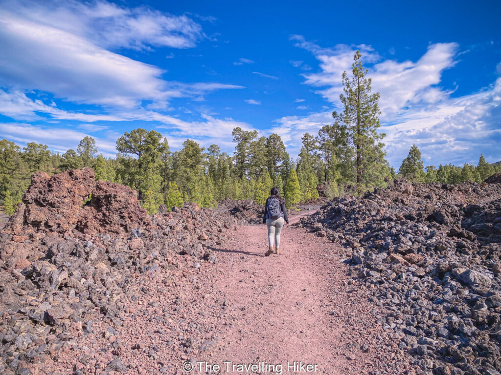
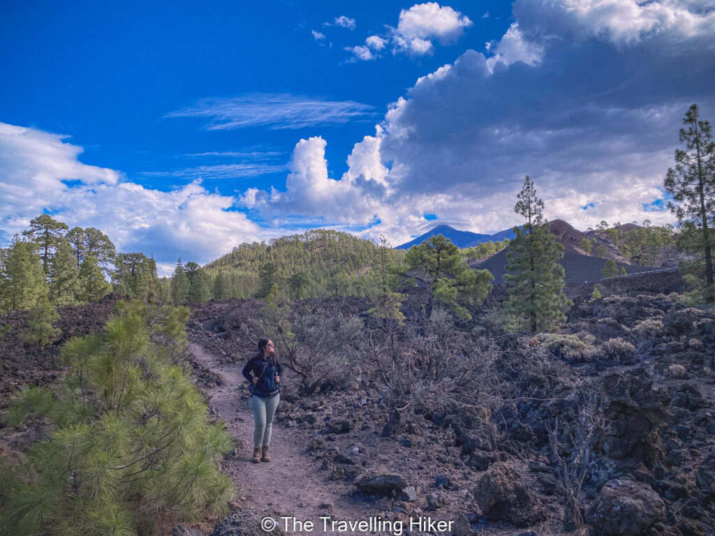
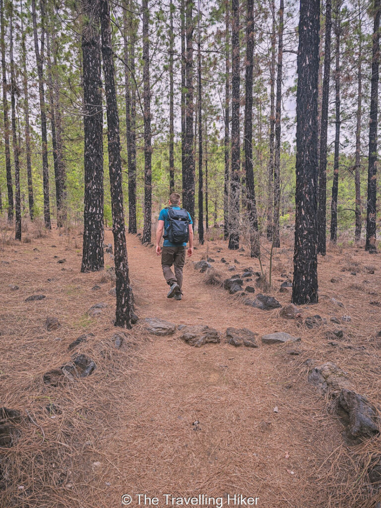
Once you’re done admiring the view, you will have to walk for 400 meters next to the road (don’t worry there is a path next to it) until you reach a sign that says you are entering Chinyero Natural Reserve. Follow this trail until you reach an area full of pines. At this point you can choose whether to the loop clockwise or counterclockwise. We followed the AllTrails map and turned left to follow the trail clockwise.
As you walk between the pines, you will have Los Poleos Mountain on your left but it difficult to see it between the trees.
Important: This area is a protected natural reserve due to its fragile ecosystem. Please stay on the trails and do not step out of it in order to protect it.
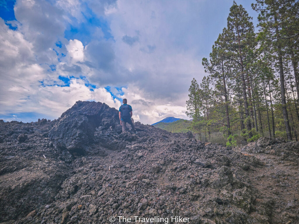
Walking through the lava flows
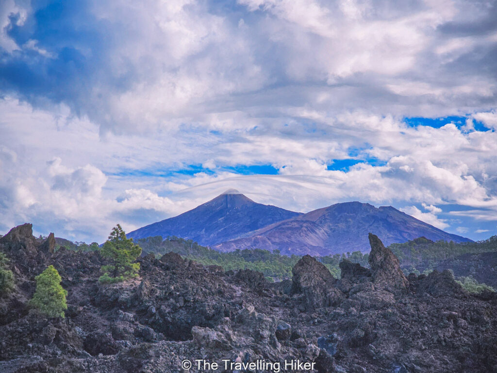
At some point, the forested area will stop and you will enter some lava fields. You will be crossing the lava flows from the latest volcanic eruptions from Chinyero that happened in Tenerife. All you will see around you is solidified lava rocks with Teide towering in the distance.
In this part you will cross two different lava zones. The first one is the lava flow for the latest volcanic eruption that happened in 1909 while the second lava field is an older one.
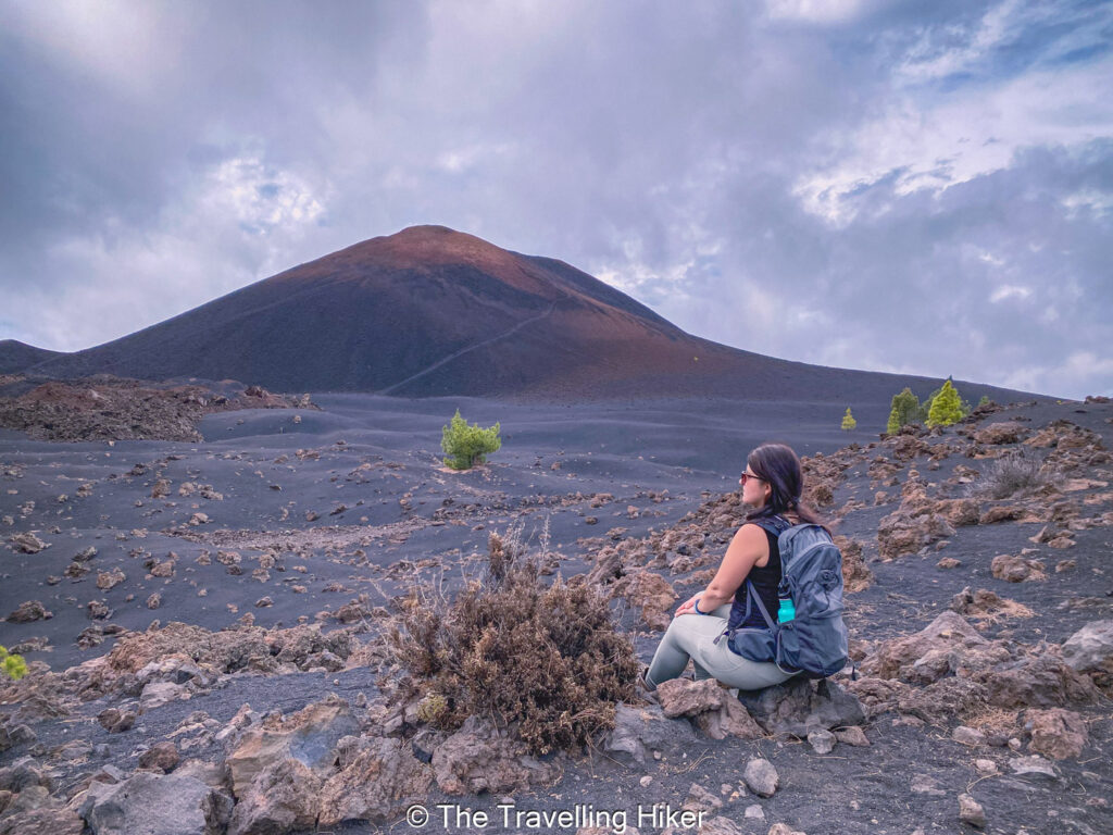
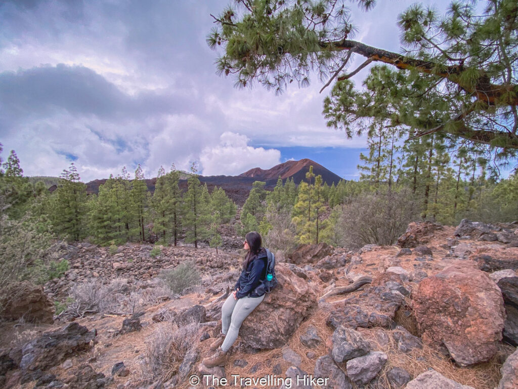
Chinyero lookout points
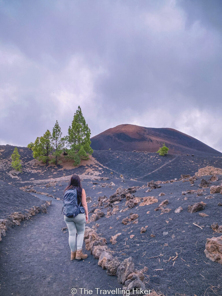
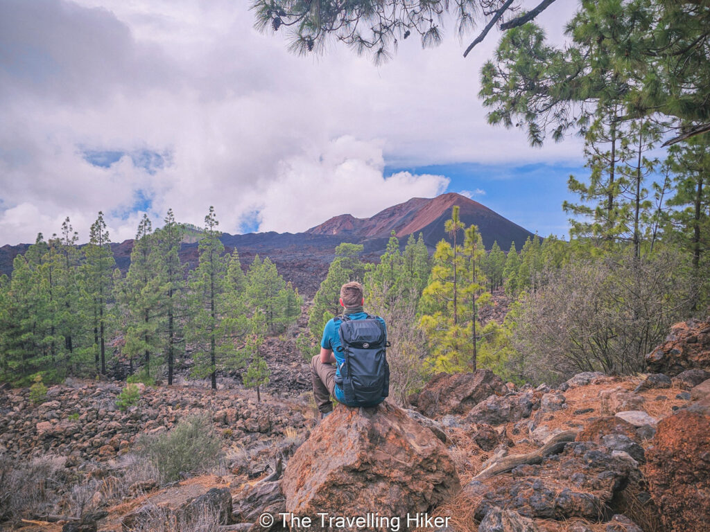
After the lava fields, the traill will reach a more smooth area with fine black gravel. From this area you will get perfect views of Chinyero Volcano cone . The contrast of the black gravel with the few green pine trees that have manage to grow in this arid conditions is so impressive.
This part was definitely my favorite part of the trail. It was so beautiful and unique!
As the trail goes on, you will enter one final forested part to close the loop around the volcano. In between the trees, you will get a few more stunning lookouts to Chinyero.
If you haven’t done so yet, this part is the perfect area to find a rock that looks comfortable, relax and admire the views.
Return to the parking lot
Once you complete the loop around Chinyero, you will have to walk back to the parking lot. Just follow the trail you walked at the beginning of your hike back to your car. If you’re lucky and the day is clear, you will have Teide in front of you. It is the perfect way to close this beautiful and lesser-known hike in Tenerife.
OTHER THINGS TO DO NEAR CHINYERO
After your hike, here a some other things you can do to complete your day.
Hike Roques de Garcia. If you are still full of energy, you can attempt to tackle a second hike on the same day. Roques de Garcia is a beautiful short hike next to Teide.
Relax at the coast. Not too far from Santiago del Teide, you will have many coastal towns where you will be able to relax and chill at beach.
Visit Los Gigantes and admire the breathtaking views of these cliffs.
ACCOMMODATION NEAR THE HIKE
Looking for a good place to stay not too far from this hike? Then I recommend you book a hotel near the southwestern coast of the island. If I was to stay in the area I would choose MYND Adeje. This 4-star hotel is equiped with everything you might need: fitness center, swimming pool, lounge area, private parking, etc. To make it even better, the hotel is located just 350 meters from the beach!
HOW TO USE THIS MAP: Click the star next to the map title to add this map to your google maps account. To view it on your phone while traveling, open Google Maps, click on the menu button and go to “Your Places”, click on Maps and you’ll see this map in your list.
HIKE SUMMARY AND INFOGRAPHIC
No time to read the full blog post? Here’s an infographic I’ve created with the most important information about this hike.
And that’s it for this week’s blog. I hope you liked it and found it useful. Let me know what you think in the comments!
Happy hiking!
DISCLAIMER: Did you know? This blog uses affiliate partnerships. When you click and book or make a purchase through one of my blog posts, I may receive a small commission (at no extra cost to you). Thank you for supporting The Travelling Hiker!