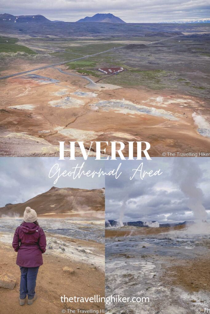
Have you ever wondered what it would feel like to walk on Mars? Hverir Geothermal Area feels like you have landed there… Of course, nobody knows what it feels like to walk on Mars but these small sulfur fields near Lake Myvatn are what I imagine it would feel like.
If you too, want to feel like you have landed on Mars, you should keep reading! In this blog post, you will find everything there is to know about Hverir, including a small hike to the top of Namafjall mountain. From there you will enjoy breathtaking views of these fields.
TABLE OF CONTENTS
HVERIR GEOTHERMAL AREA
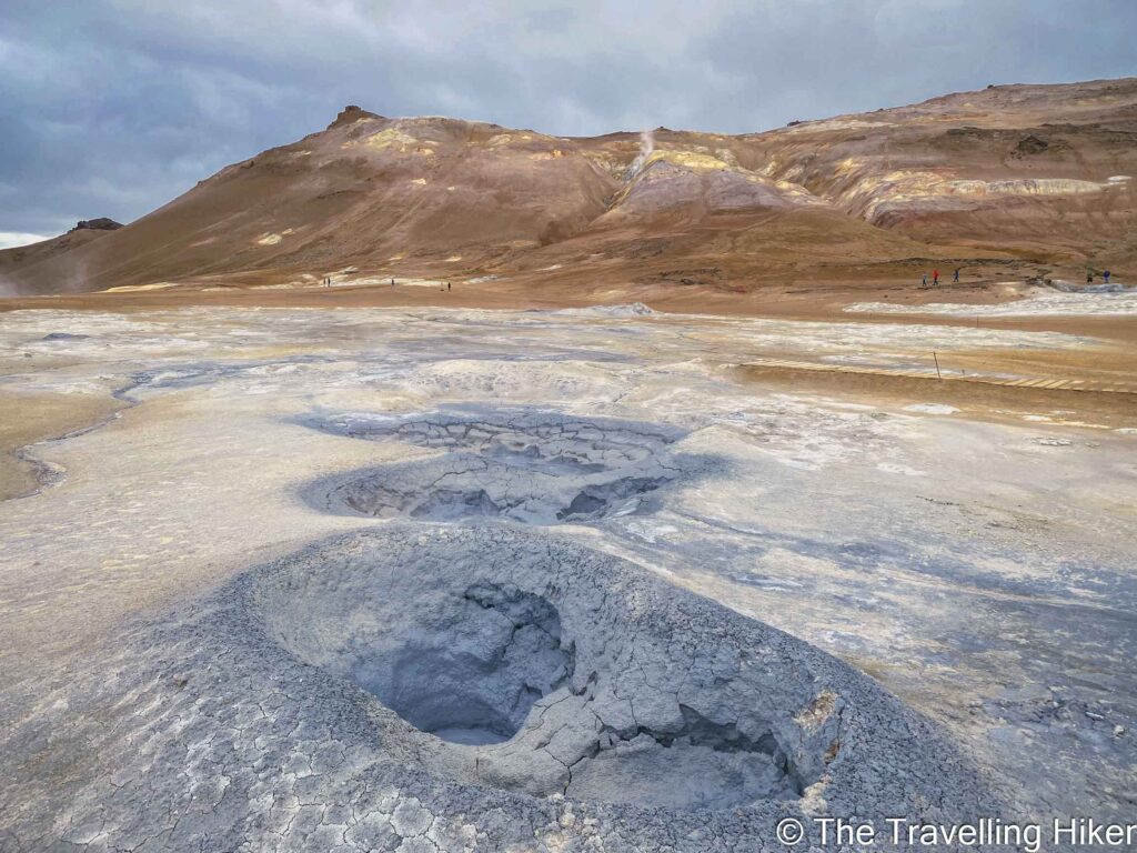
Hverir is a geothermal area in the North of Iceland, not far from Lake Myvatn. It is located on the foothill of Namafjall mountain and Namaskard pass.
The area is full of:
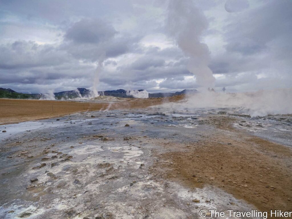
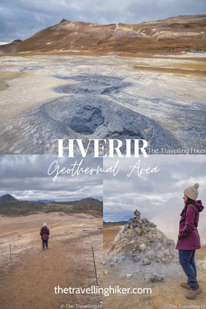
Fumaroles
Boiling mud pools
Steam vents
Sulphurous crystals that contrast with the orange and red land.
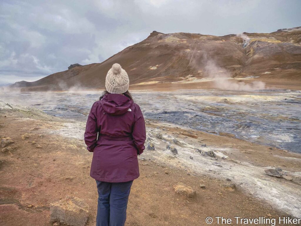
The sulphur in the area makes it smell like rotten eggs! But the discomfort only lasts a few minutes. Afterwards, you will get used to it and not even notice it!
PRACTICAL INFORMATION ABOUT THE HIKE
GETTING TO HVERIR
Hverir is located 6km east of Lake Myvatn, next to the Route 1 (Ring Road) in the North of Iceland.
The best way to reach it is by renting a car and driving there yourself. Driving times will vary depending on where you are coming from.
From Akureyri, it is approximately 1 hour and 15 minutes.
From Reykjahlid, the main village near Myvatn, it is only 10 minutes.
Good to know: You will have to pay 750 ISK to park at Hverir. To do so, you will have to scan a QR code that will guide you to the paying site. The day we visited Hverir, the QR code was not working and everyone was facing this issue. We parked there without paying and never got any fine. However, please pay your parking fee if you do visit this beautiful site.
If driving is not your thing, you can always join a guided tour, like this one departing from Akureyri. This tour includes among other things, a stop at Hverir Geothermal area.
EQUIPMENT NEEDED
Here’s a short and friendly list of what you’ll need to hike here.
Sturdy hiking shoes. The ground is uneven, sometimes muddy, sometimes gravelly. Sneakers won’t cut it.
Waterproof jacker (and layers!). Icelandic weather changes faster than you can say “geyser”. Wind and rain pop up often.
Light gloves & hat. Even in summer, the breeze on the mountain can feel chilly.
Refillable water bottle. There’s no clean water on-site (and you definitely don’t want to sample the sulfur pools!).
Camera or phone. The steaming vents and Martian-like landscape are unreal.
Respectuf feet. Stick to marked trails. The geothermal ground can be fragile and dangerous.
VISITING HVERIR GEOTHERMAL AREA & NÁMAFJALL MOUNTAIN
HIKE STATS
Trail Start/End – Parking lot near Hverir and the Ring Road
Distance – 2,7 km
Elevation Gain – 122 m
Level – Easy
Route Type – Circular Route
Estimated Time Needed – 2 hours (including plenty of time to stop for photos). Remember to stay within the marked trails.
Best Time To Visit – July to September to ensure the best weather conditions.
HIKE MAP
I always use the AllTrails App during my hikes. The app has a GPX map that can help you stay on the right trail during your hikes. For this hike, we followed the Namafjall via Hverir Trail.
MY EXPERIENCE HIKING IN HVERIR GEOTHERMAL AREA - STEP BY STEP GUIDE
Visiting Hverir
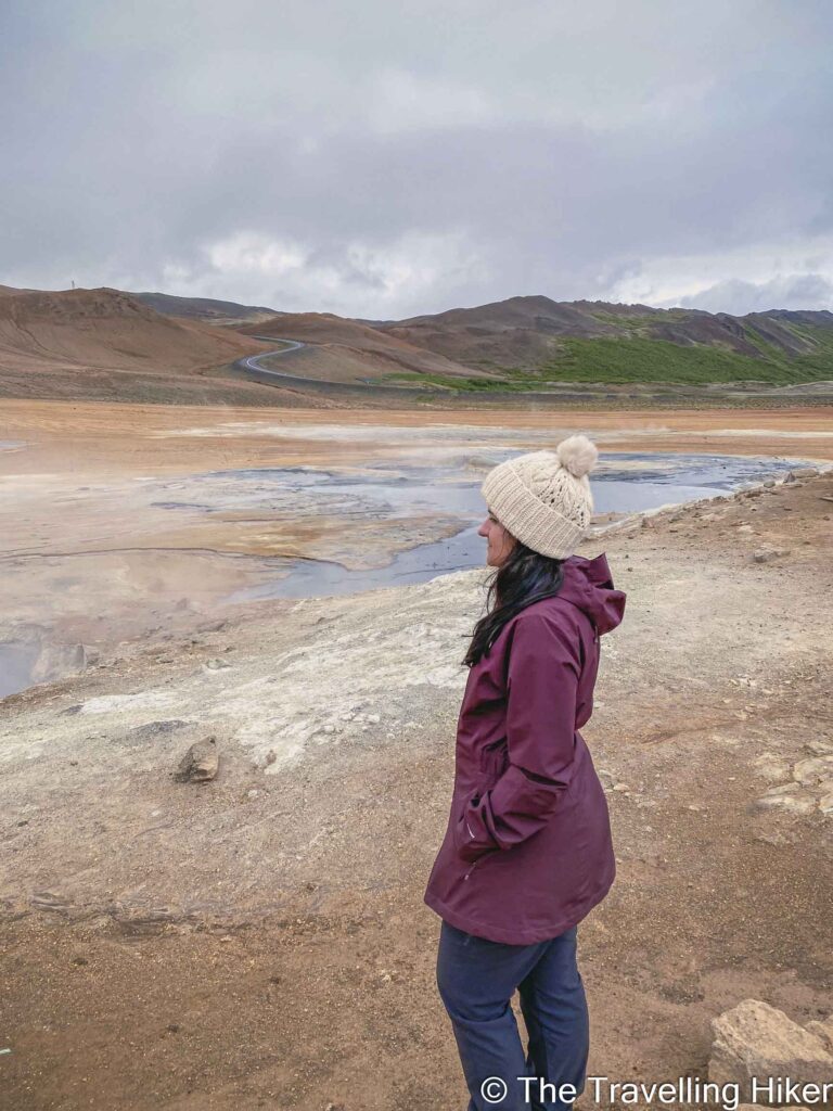
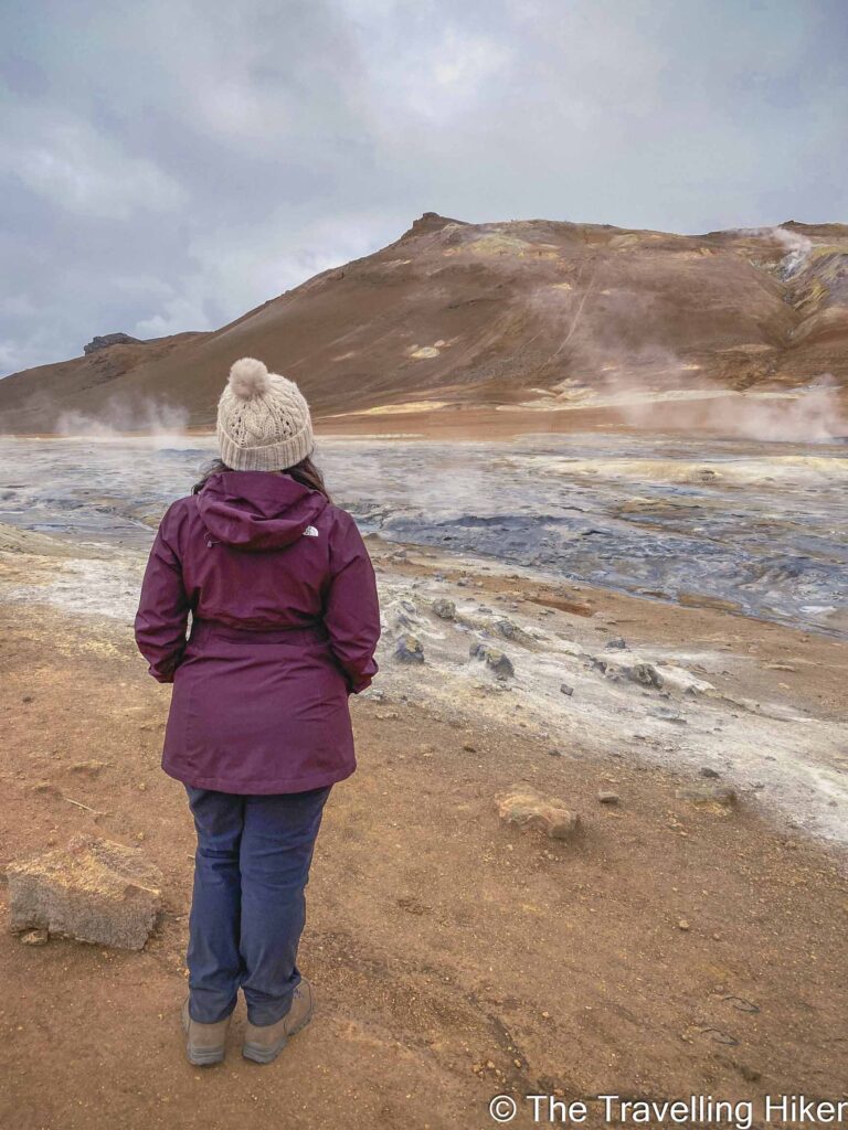
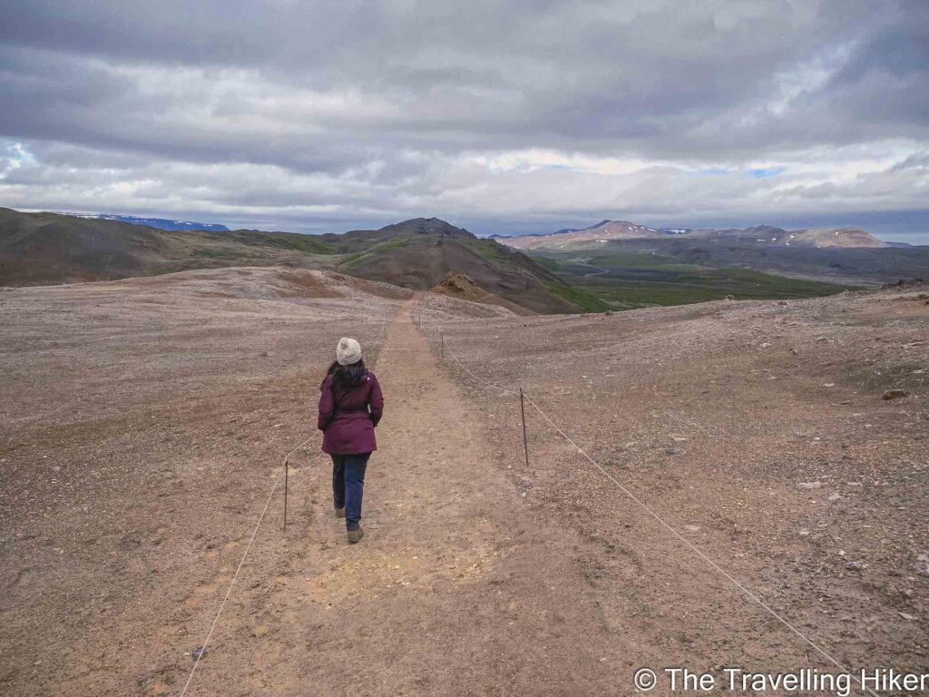
Hverir is located only a few meters away from the parking lot. As soon as we got out of the car, the smell of rotten eggs from the sulphur hit us. At first, it was quite disgusting but very soon we got distracted by the beauty of the place and forgot about it. Everywhere we looked we saw boiling mud potholes and fuming fumaroles. We were amazed by the contrast of the grey and blueish from the sulphur with the orange land and couldn’t stop taking photos.
Walking around Hverir was easy. I had downloaded the hike on my phone but the best way is to just wander around and stop wherever you want. It is impossible to get lost.
Important: Please make sure to stay within the marked paths as this is done for your own safety!
Hiking up to Námafjall Mountain
Once we were done with the area, we decided to complete the hike and go up to Námafjall mountain. We followed the suggested path on the app and took the trail that is to the left of Hverir site.
Right at the beginning, we saw a sign that warned us that this trail could be dangerous and slippery in wet conditions and it was completely true! The trail is very steep and narrow with nothing to protect you. At some points, I even had to put my hands on the ground to be able to keep going! I thought about turning around many times!
Amazed by the Views on Top
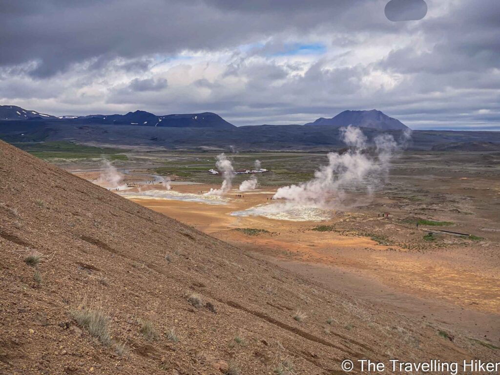
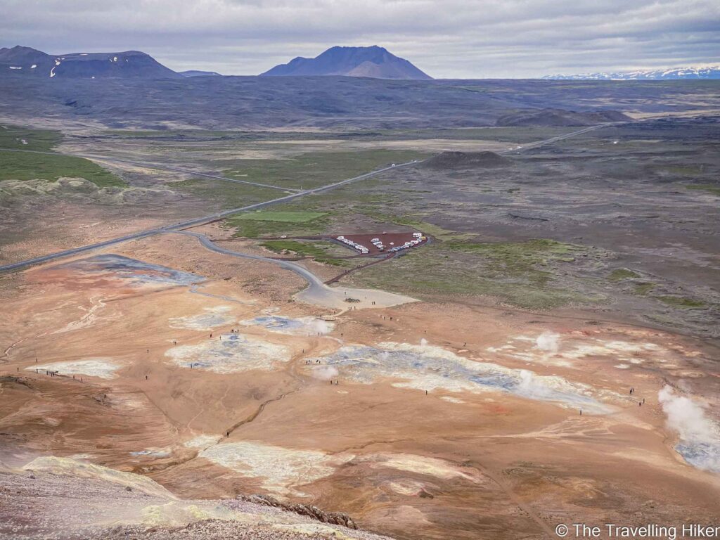
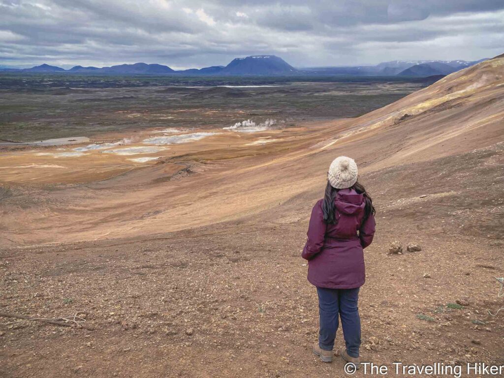
Nevertheless, this adventure was worth it! The view from the top of the Námafjall was so impressive. I could hardly believe what I had in front of me.
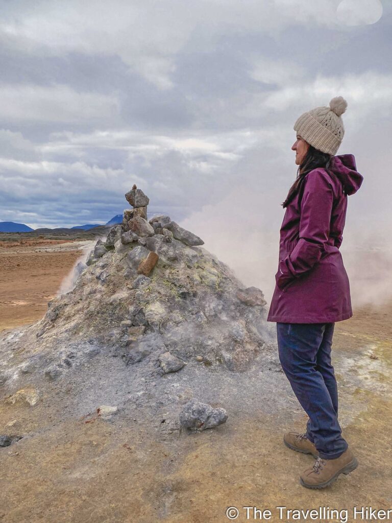
At the top, there is a complete view of the Hverir area and Lake Myvatn. To top it off, there are some more sulphur and mud pots up there too. And we were completely alone! This was definitely one of the highlights of our road trip in Iceland.
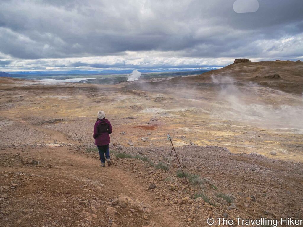
Descending via the Námaskard Pass
The descent is done via the Námaskard pass next to the Ring Road and finishes at the right-hand side of the Hverir site. Being next to the road, it makes the descent less special but it was easier than the going up part.
RECOMMENDATION: Going up to Namafjall mountain is really worth it. However, if you are in bad fitness shape, scared of heights or it has been raining, I recommend going up and down the mountain via the Namaskard pass. It is not necessary to take the risk of going up the left-hand side.
ACCOMMODATION IN MYVATN
There are many things to see and visit around Lake Myvatn. To be able to enjoy this beautiful region in the North of Iceland, I recommend spending a minimum of one night here. Here are some hotel and guesthouse recommendations.
Skútustadir Guesthouse (€€)
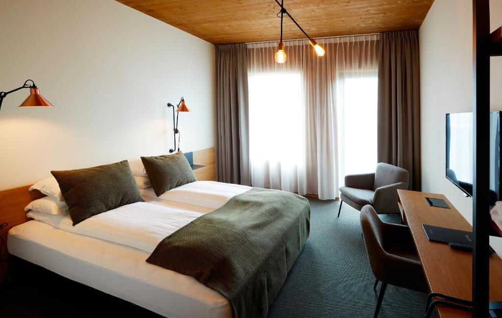
Skútustadir Guesthouse is family-owned guesthouse set on a farm by the southern shore of Lake Mývatn. Rooms are cleaned and comfortable and you can choose between rooms with a private or shared bathrooms. They also offer a shared kitchen where you can cook your own meals and save some extra morney.
We stayed 2 nights here and we had a fantastic time there. The staff here was super helpful and friendly.
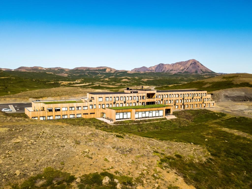
If you’re looking for a more traditional hotel experience, then I recommend you stay at Fosshotel Myvatn. All rooms are super comfortable and have every amenity that you might think of.
HOW TO USE THIS MAP: Click the star next to the map title to add this map to your google maps account. To view it on your phone while traveling, open Google Maps, click on the menu button and go to “Your Places”, click on Maps and you’ll see this map in your list.
DISCLAIMER: This post contains affiliate links. Clicking and buying from them will be at no additional cost to you but I will get a small commission.