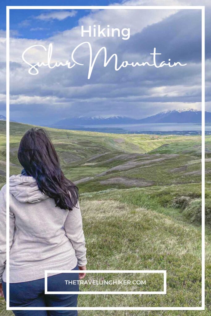
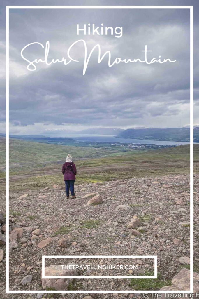
If you are looking for a small challenge during your visit to Akureyri, you should consider hiking Sulur Mountain. Sulur is just outside Akureyri town and the hike is a moderate to difficult one. However, when you reach the summit you will see the best views of the fjord.
Does this sound interesting? Then keep reading this blog to find out everything you need to know about this hike.
TABLE OF CONTENTS
SÚLUR MOUNTAIN
Súlur Mountain is just 9 km outside of Akureyri and it is a very popular destination for both locals and tourists who want to enjoy the beauty of this region.
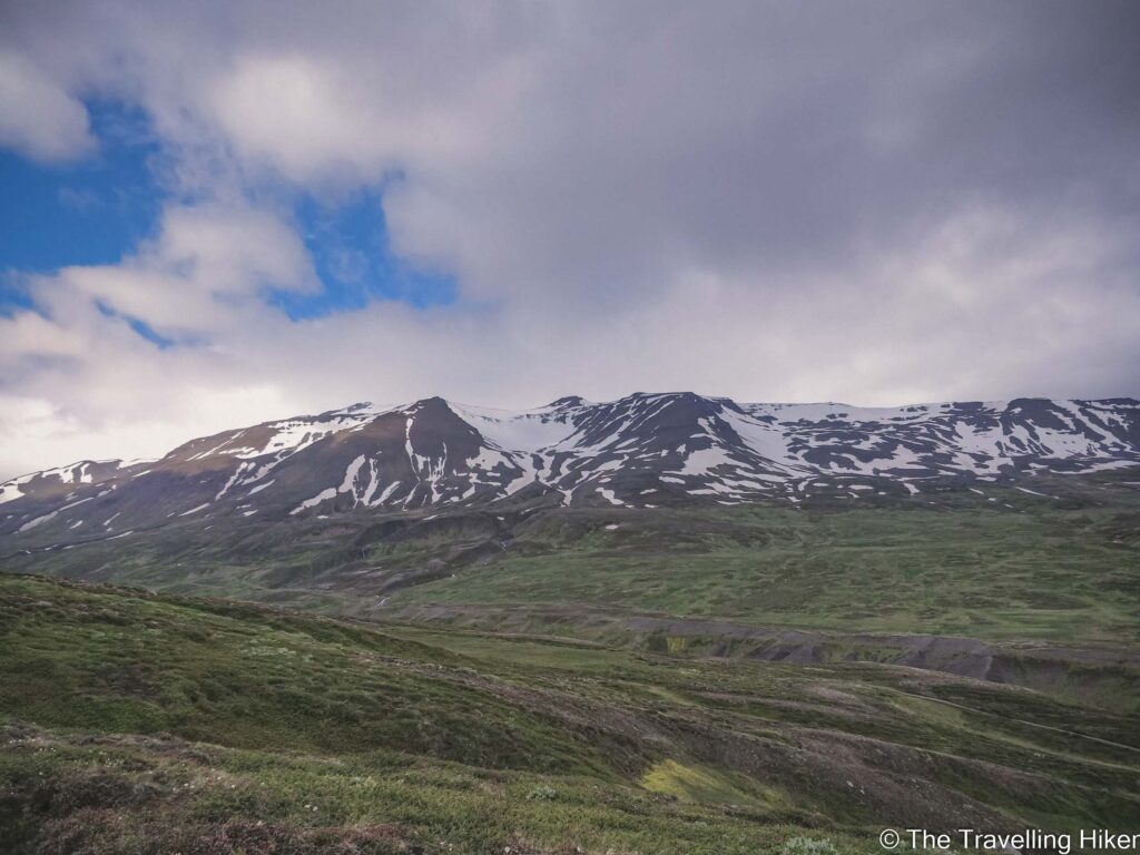
The mountain has two peaks, the highest being 1.213 meters.
The lower part of the mountain is mainly an endless green marsh.
The peaks, on the other hand, are made of light rhyolite which is a volcanic material from eruptions that happened 9 million years ago.
PRACTICAL INFORMATION ABOUT THE HIKE
GETTING TO SÚLUR
The hike begins at the parking located at the end of Súlurvegur road (exact location on the map on the right).
The best way to reach the trailhead is by driving your car. It is only a 10-minute drive from Akureyri.
If you don’t have a car, then you can always start your hike directly from Akureyri but this will add 3 to 4 km to an already challenging hike (depending on where you’re staying).
Here’s a friendly little checklist of the equipment that you’ll need to hike Súlur Mountain near Akureyri.
Sturdy waterproof hiking boots. The trails can be rocky and uneven, so give your ankles some love by wearing them. In addition, you will have to cross a few creeks along the trail, you will be thankful for those waterproof shoes.
Layered clothing. The weather in North Iceland changes fast; think base layer, fleece, and a waterproof shell.
Hat & Gloves. Even in the summer, the wind up there can bite.
Crampons. While not absolutely mandatory, it is common to find some snow patches (even during the summer months).
Backpack with snacks & water. There is not mountain hut at the summit.
Map or GPS App. I always use the AllTrails App which works great.
Hiking Poles. These are optional but will be helpful for your knees.
Camera or Smartphone. The views over Akureyri and Eyjafjordur are spectacular.
SÚLUR MOUNTAIN HIKE NEAR AKUREYRI
HIKE STATS
Trail Start/End – Parking at the end of Súluvegur Road
Distance – 11,4 km
Elevation Gain – 897 m
Level – Difficult
Route Type – Circular Route
Estimated Time Needed – 6 hours. This will depend on the weather conditions. Remember to stay safe and don’t take unnecessary risks.
Best Time To Visit – July to September to ensure there is no snow on the mountain.
HIKE MAP
I always use the AllTrails App during my hikes. The app has a GPX map that can help you stay on the right trail during your hikes. For this hike, we followed the Súlur Mountain Trail.
MY EXPERIENCE HIKING SULUR MOUNTAIN
The Beginning Of The Hike
The hike began right next to the car parking. Only a few meters in, we had to cross over a fence with some ladders that were available.
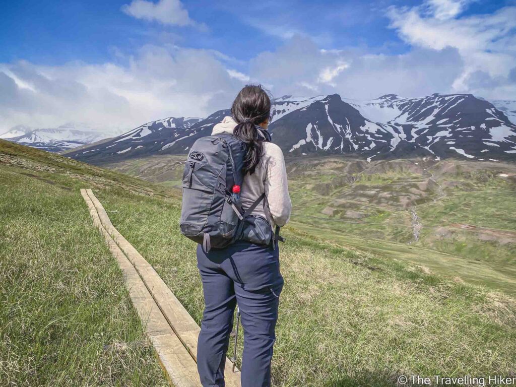
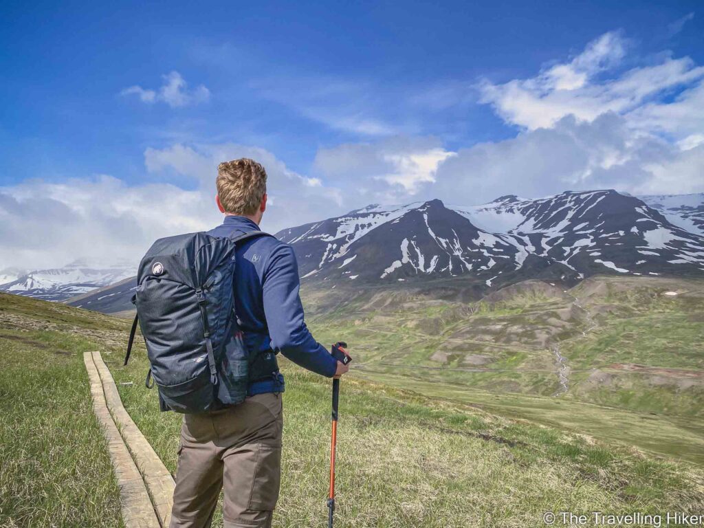
Immediately after that, the trail split into 3 different hikes, but there was a sign showing us the way to Sulur and the remaining distance (5km). At this moment, we were very confident about this trail since we had done way longer trails in the past. Little did we know that it was 5 km of constantly going uphill.
The first part of the trail is relatively easy. However, you have to cross two creeks along the way. The second one is a bit wide and unless you have waterproof shoes, you will most likely get your feet wet.
Endless Marshlands
After crossing the two creeks we started slowly walking uphill through endless fields of moss and marsh. The hike might seem easy but the progress was very slow due to the mud that was there because of the rain. We had to constantly deviate from the trail to avoid it.
There were some wood bridges that would help you cross the biggest parts. However, in many parts, you either had to do a little detour or go through the mud which kept slowing us down.
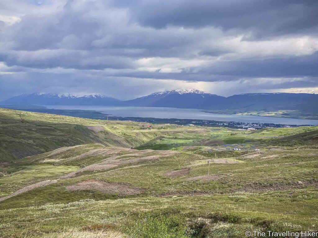
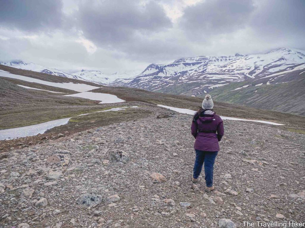
The views in front of us and behind us were amazing though!
Getting Higher
The progress was very slow and the trail kept getting steeper. In addition, the weather started to change and it began raining.
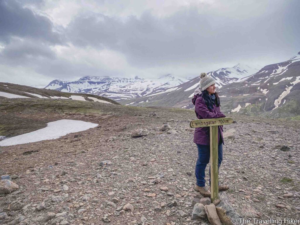
We had to cross several snow patches, which kept getting larger as we got higher. To make it a bit more interesting we did not have any crampons so we had to cross them very slowly. We got to another cross paths in which you could either keep going up or turn right to Lambagatan.
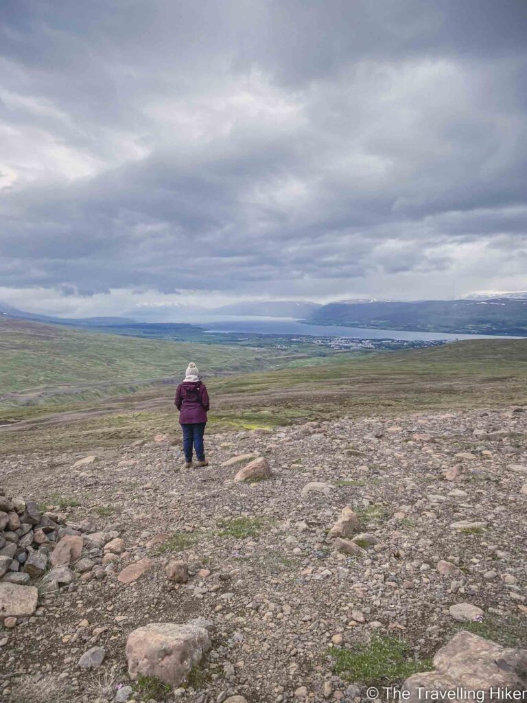
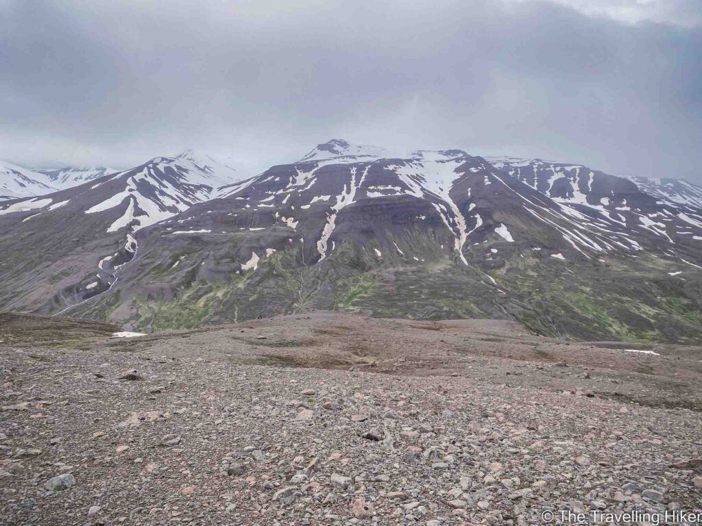
By the time we were approximately 3 km into the hike, the sky was completely covered and the rain was getting stronger. We still had a long way ahead of us but visibility was getting very low. The views in front of us were fantastic but, we decided that the safest thing was to turn around and descend.
The Descent
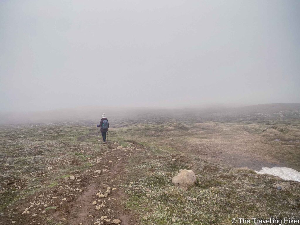
We were very disappointed that we had to turn around and start descending. However, this was the best decision to take as very soon after we were covered in super dense fog. We could barely see a few meters in front of us.
The whole descent was a mix of foggy and rainy weather. By the time we got back to our car, we were completely soaked.
ACCOMMODATION IN AKUREYRI
There are many options for places to stay in Akureyri depending on your budget. Here are some options I recommend.
Camping Hamrar (€)
This will be your go-to option if you are traveling with a camper van. Camping Hamrar is convieniently located just outside Akureyri.
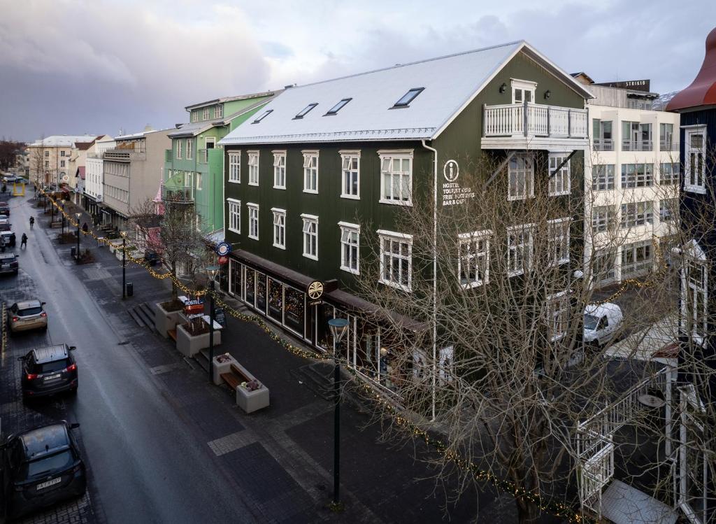
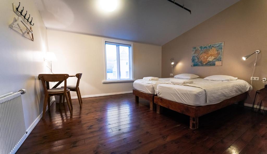
Akureyri Backpackers (€€)
Another budget-friendly option is to stay in a hostel and Akureyri Backpackers is located right in the center of Akureyri. Plus their restaurant is a must-visit while in the city.
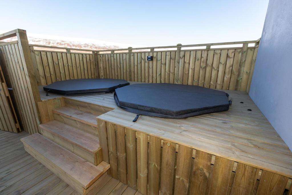
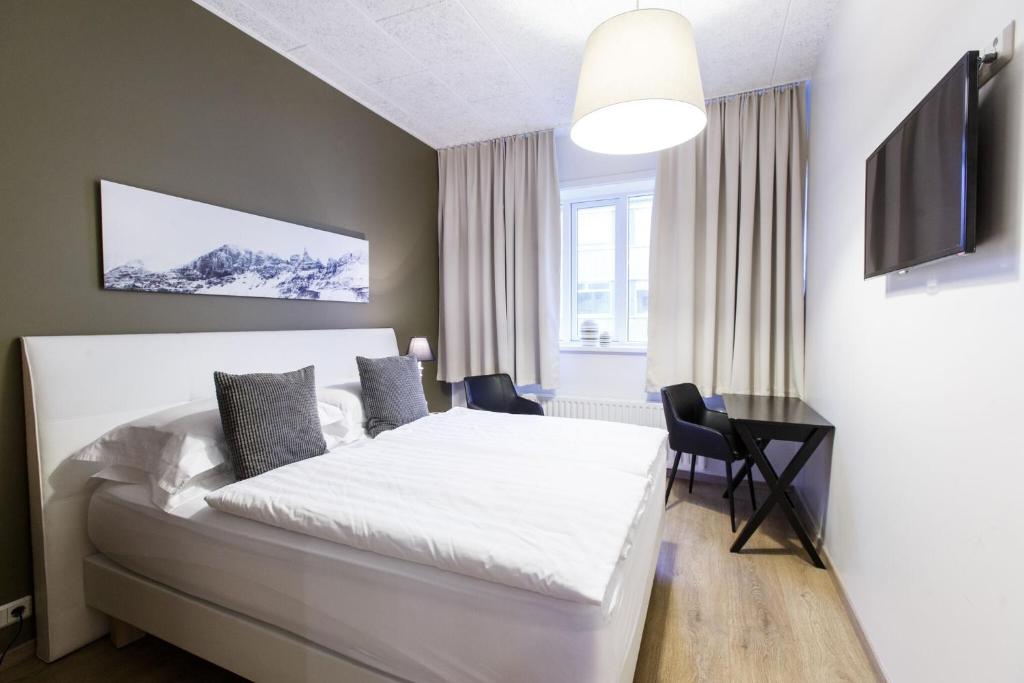
These apartments are located a bit far from the center of Akureyri but they have everything you can imagine to guarantee your a fantastic stay in the city. They even have a hot tub where you can relax after a day of hiking!
We stayed here during our stay in Akureyri and they were really comfortable!
HOW TO USE THIS MAP: Click the star next to the map title to add this map to your google maps account. To view it on your phone while traveling, open Google Maps, click on the menu button and go to “Your Places”, click on Maps and you’ll see this map in your list.
Hope you enjoyed this blog about Hiking Súlur Mountain! Let me know what you think in the comments and if you reached the top!
DISCLAIMER: This post contains affiliate links. Clicking and buying from them will be at no additional cost to you but I will get a small commission.