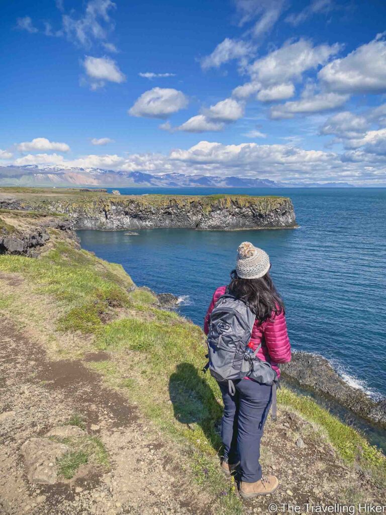
Between the small villages of Arnarstapi and Hellnar, you can find the Arnarstapi Cliff Walk, one of the prettiest hikes you can do in the Snaefellsnes Peninsula. This short trail will take you along the coastline where you will be able to enjoy the fantastic views of the cliffs and the natural rock formations along them. Do you want to know more? Then keep reading to find out everything there is to know about this beautiful hike!
TABLE OF CONTENTS
ARNARSTAPI, ONE OF ICELAND'S MOST BEAUTIFUL VILLAGES
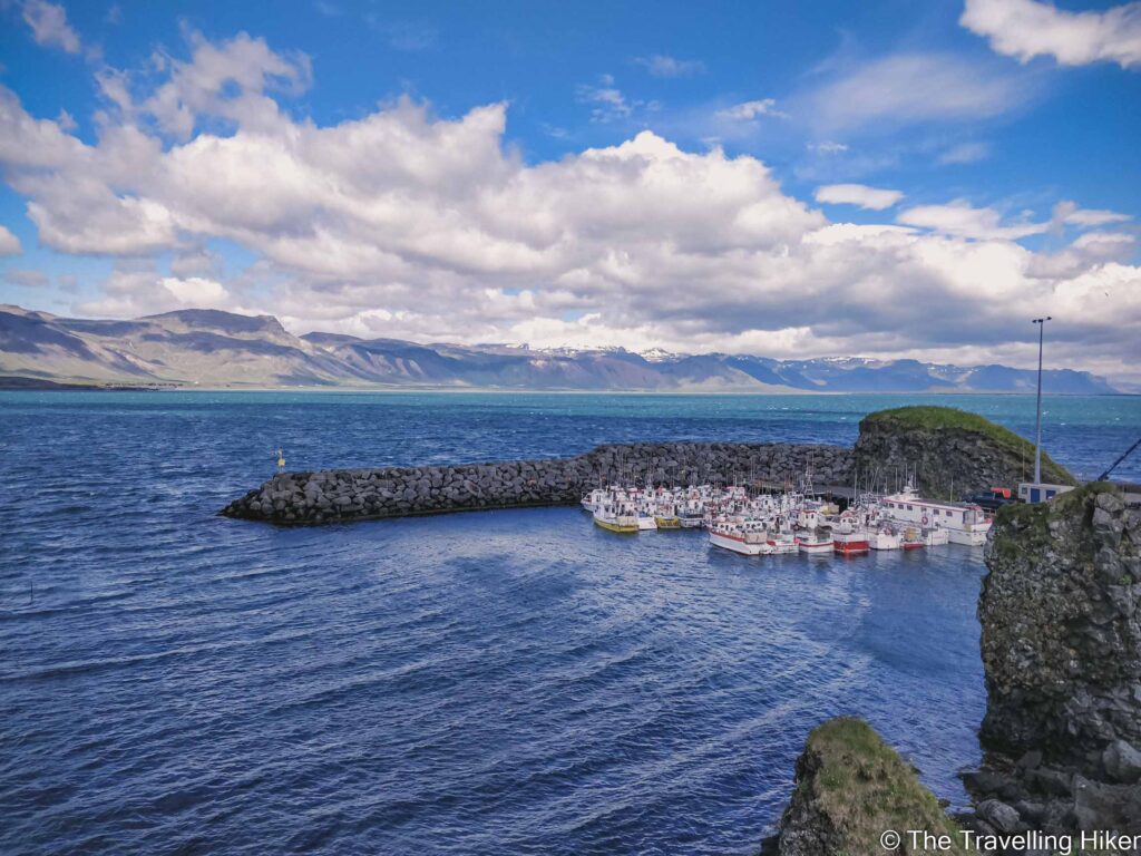
Arnarstapi is a small village on the southern coast of the Snaefellsnes Peninsula that once used to be a big fishing hub. These days, there are only a few houses remaining, a small port, and the most beautiful scenic walk along the nearby cliffs. It is also one of the last villages before entering the Snaefellsjökull National Park.
BRIEF HISTORY OF ARNARSTAPI
In the 18th and 19th centuries, Arnarstapi was a very popular region with many settlers. The region gave the perfect fishing conditions, with its natural harbor and its waters rich in herrings.
However, with the industrial revolution, Arnarstapi’s population decreased and people started moving to the capital, Reykjavik.
These days, Arnarstapi’s main economy is based on tourism and services. Its natural scenic views of the sea and cliffs on one side and the glacier on the other side, have made it one of the main sites to visit in the Sanefellsnes Peninsula. However, fishing and trade still play an important role in it as well.
PRACTICAL INFORMATION ABOUT THE HIKE
GETTING TO ARNARSTAPI
Arnarstapi is located in the southern part of the Snaefellsnes peninsula, not far from Budakirkja, the famous black church.
The best way to reach it is by renting a car and driving there yourself. Especially if you want to do the complete hike between Arnarstapi and Hellnar. Many day tours to the Snaefellsnes peninsula include Arnarstapi but the time allocated to this stop is not enough to hike it.
The parking in Arnarstapi is right next to the small port (the exact location on the map at the end of this blog).
Driving times will depend on where you are driving from:
From Reykjavik, it will take you approximately 2 hours and 30 minutes.
From Grundafjordur, it takes approximately 40 minutes to drive.
This hike is relatively easy and well-marked. However, Icelandic conditions can be unpredictable, so it’s smart to come prepared. Here are the essentials you should bring with you.
Hiking Boots. The first part of the trail is paved and easy but the second part is rocky and uneven. Solid ankle support and good grip are key.
Hat & Gloves. Even in the summer, the wind off the ocean can be biting. Lightweight but warm options are perfect.
Snacks or a Light Lunch. It’s a short hike (approximately 1 hour and 30 minutes round trip), but a thermos of coffee or a sandwich with a view of the sea is hard to beat. If you do bring some snacks, always pack your trash and leave the place as you found it.
Phone or Camera. You’ll want photos of the lava formations.
Map or GPS App (like AllTrails). The trail is pretty straightforward, but it never hurts to have a backup.e
ARNARSTAPI CLIFF WALK
HIKE STATS
Trail Start/End – Arnarstapi Parking
Distance – 6,2 km
Elevation Gain – 44 m
Level – Easy
Route Type – Out & Back
Estimated Time Needed – 2 hours. This will depend on how often you stop to admire the beautiful views.
Best Time To Visit – June to September will grant you the best weather conditions to complete this hike.
HIKE MAPS
I always use the AllTrails App during my hikes. The app has a GPX map that can help you stay on the right trail during your hikes. For this hike, we followed theArnarstapi to Hellnar Trail.
WALKING BETWEEN ARNARSTAPI AND HELLNAR
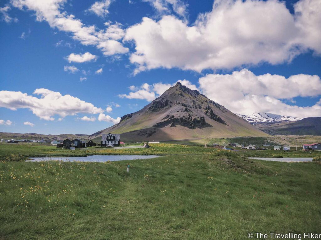
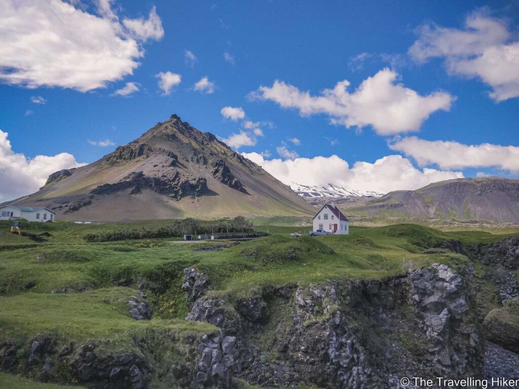
Arnarstapi Village
This hike begins in the beautiful village of Arnarstapi. Even though it is quite small, it has a lot of charm. There are a few houses and buildings spread in front of the triangular mountain Stapafell and a cute little harbor. Just for the beautiful location, it is worth it to make a quick stop here.
The views were so pretty, we couldn’t resist starting to take photos even though the real hike had not started yet.
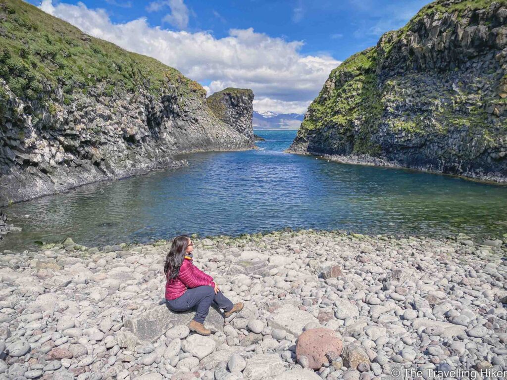
Pumpa Beach
Once we had admired the views from Arnarstapi, we were ready to properly begin our hike. To the right of the harbor, there is a small wooden path that we started following.
After approximately 500 meters, we arrived at Pumpa Beach. This is a small pebbled beach in between the cliffs. There is a small bench next to the trail where you can sit and admire it from above. However, it was such a nice sunny day and it looked so pretty that David insisted that we went down to it.
Going down was a bit difficult as there is a very small way but it was the best decision we could have taken. The beach was completely empty and it was so peaceful there. We spent a long time just enjoying it and relaxing.
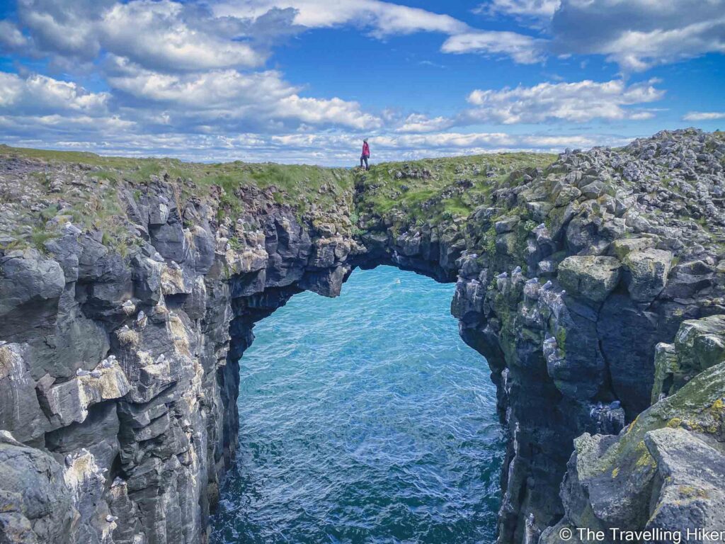
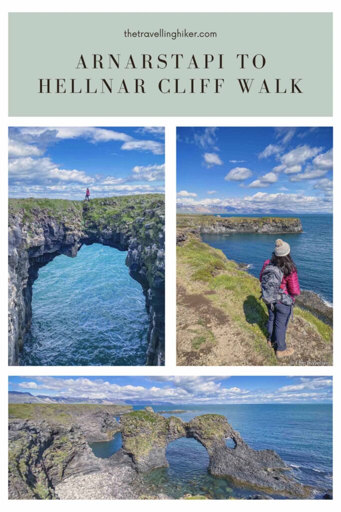
Arnarstapi Stone Bridge
Not far from Pumpa Beach we found another one of Arnarstapi’s famous points, the stone bridge. This is a big natural bridge over the water, that has quite a drop.
On the other side, it looks quite amazing to be walking on this bridge over the sea. However, in reality, is quite wide and easy to cross. However, I would not cross it if the weather is not good.
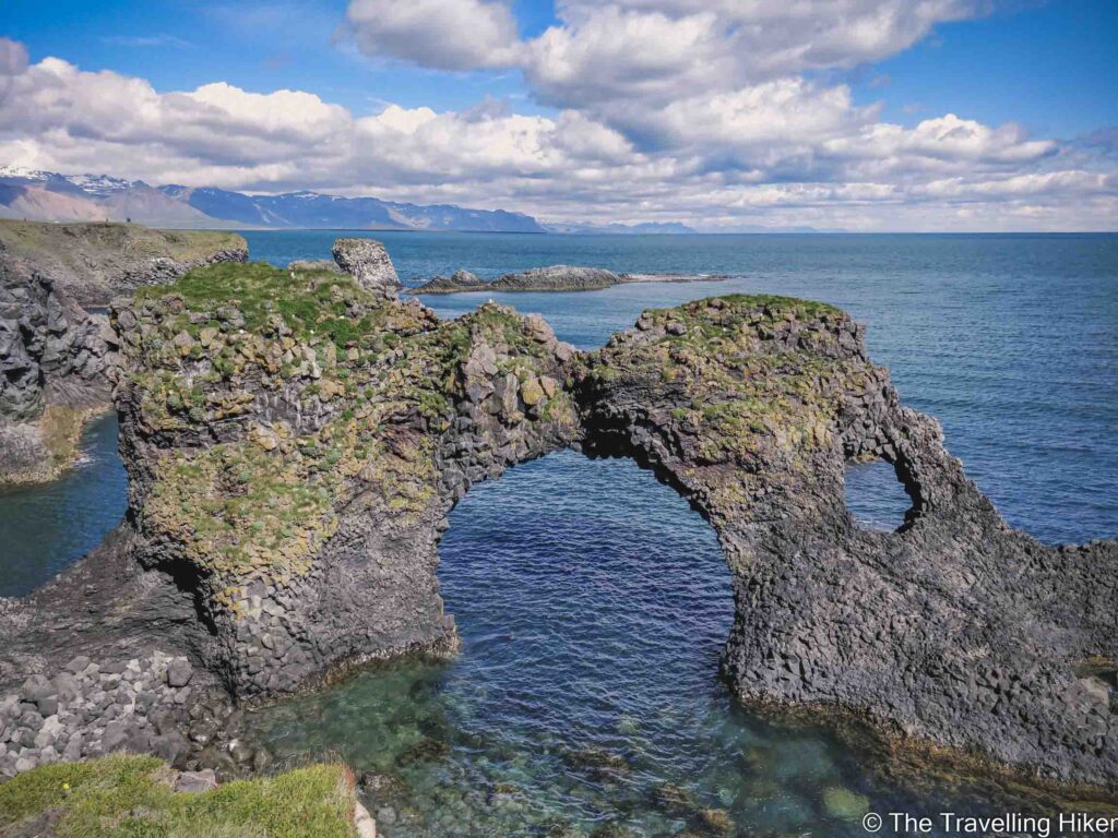
Gatklettur
Following the trail, we reached the last highlight of Arnarstapi, Gatklettur. It is a stone arch through which you can see the waves crash on a stormy day.
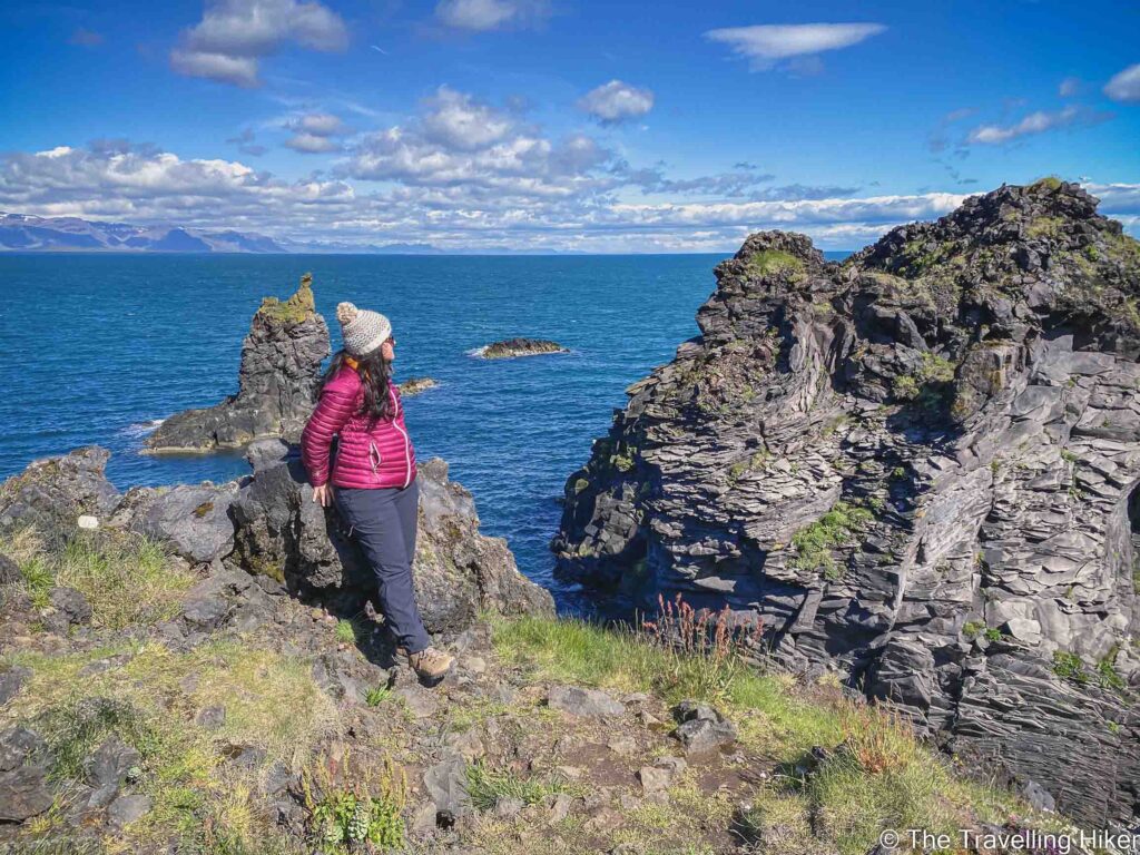
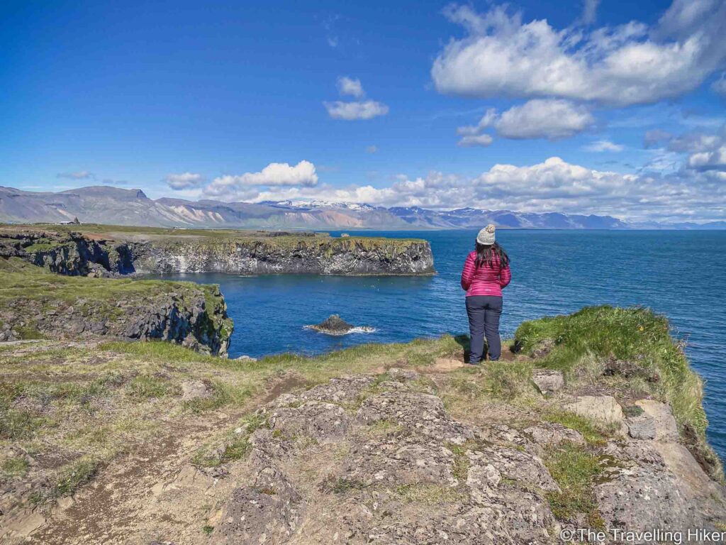
After Gatklettur, we kept following the trail towards Hellnar. There are plenty of viewpoints along the way with amazing views of the cliffs. In addition, if you love birds you can also watch all the colonies of Arctic Tern that live on these cliffs.
Halfway through the trail, there is a small door and after that, the path is not conditioned anymore. Please make sure to close the door after you. This door and fence are to prevent animals from getting out of someone’s property.
Even though the trail is not paved anymore, the views of the ocean and the rocky cliffs were not any less pretty. We continued the trail all the way until we reached Hellnar.
At Hellnar we turned around and returned to Arnarstapi. This could be the only “bad” thing about this hike. However, the views are so pretty that I didn’t care at all.
This was one of my absolute favorite hikes of the Snaefellsnes peninsula and Iceland!
ACCOMMODATION IN THE SNAEFELLSNES PENINSULA
The Snaefellsnes Peninsula is not that big so no matter how many nights you’ve planned to stay, you can choose one location and make it your base. Here are some suggestions for different kinds of budgets.
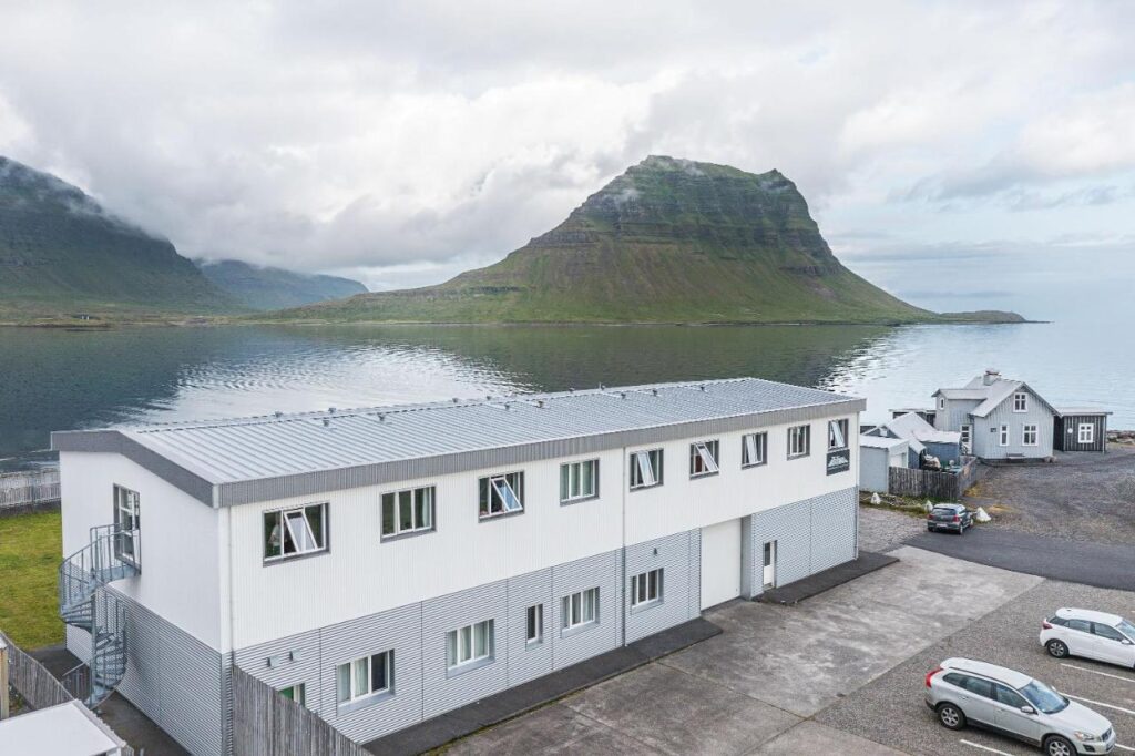
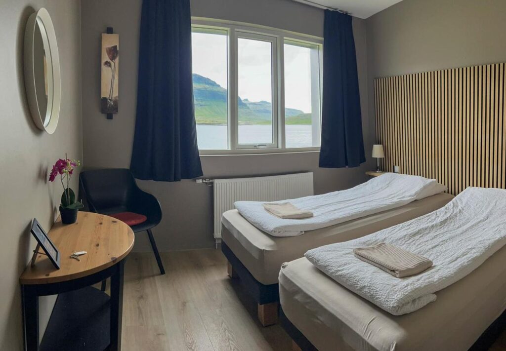
Stod Guesthouse and Apartments
Simple but comfortable guesthouse in Grundafjordur which is the perfect option if you want to save some money in accommodation. The guesthouse has a shared kitchen available with everything you may need to prepare your meals. We stayed here for two nights during our visit to the Snaefellsnes Peninsula and we were happy with it.
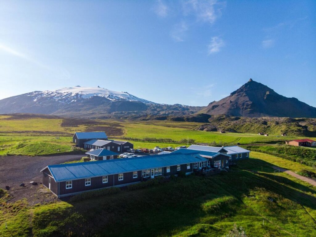
If you have some extra budget and want to stay in a more fancy place, then you should consider staying in Fosshotel Hellnar. You will be able to wake up with beautiful views over the Arnastapi Cliffs.
HOW TO USE THIS MAP: Click the star next to the map title to add this map to your google maps account. To view it on your phone while traveling, open Google Maps, click on the menu button and go to “Your Places”, click on Maps and you’ll see this map in your list.
I hope you liked my blog about Arnarstapi. Let me know what you thought in the comments.
DISCLAIMER: This post contains affiliate links. Clicking and buying from them will be at no additional cost to you but I will get a small commission.