If you are looking for a beautiful hike in the Snaefellsnes peninsula, then you should consider the Londrangar Cliffs Hike. This short hike is perfect if you don’t want to go for a long exhausting hike but still want to enjoy the beautiful scenery along the coast that Snaefellsnes has to offer.
It is also possible to admire Londrangar without hiking (more about it later) but I really recommend this hike. It is not very demanding and you will be able to enjoy the views from different perspectives.
TABLE OF CONTENTS
LONDRANGAR CLIFFS
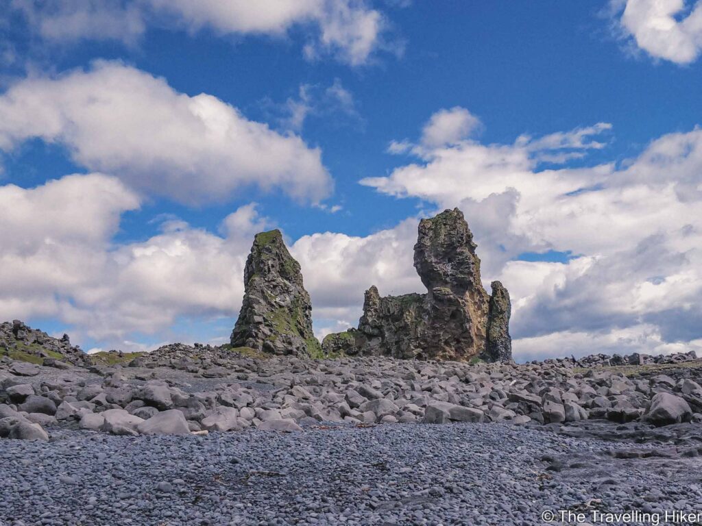
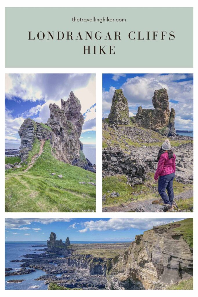
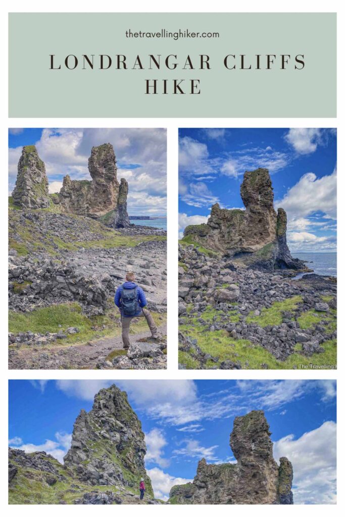
Lóndrangar is a cliff area in the Snaefellsjökul National Park with two pinnacles made of basalt, which are respectively 75 and 61 meters tall.
According to Icelandic folklore, the Londrangar rock formations used to be two trolls, a man and his wife who liked to enjoy the sea and sat at the edge of the cliffs to admire the ocean at night. However, one day they were so consumed in their passion that they didn’t notice that the sun was coming out. Since these creatures turn into stone in the presence of the sun, they turned into these pinnacles.
PRACTICAL INFORMATION ABOUT THE HIKE
GETTING TO LONDRANGAR
Londrangar is located in the southwest part of the Snaefellsnes peninsula, within the Snaefellsjökull National Park.
The best way to reach it is by renting a car and driving there yourself. Especially if you want to hike in the area. Many day tours to the Snaefellsnes Peninsula include Londrangar but the time allocated to this stop is not enough to hike it.
There are two ways to visit Londrangar Cliffs and depending on which one you choose, you will have to park your car in different places:
You can just enjoy the cliffs from the Londrangar Viewpoint. If you’re going to do this, then park your car in the Londrangar Parking shown on the map at the end of this blog.
Hike along the Londrangar Cliffs. If you’re going to do the hike, then park your car nar the Snaefellsjokull Visitors Center.
Driving times to reach Londrangar will depend on where you are driving from:
From Reikjavik, it will take approximately 2 hours and 40 minutes.
From Grundafjordur, it takes approximately 40 minutes to drive.
EQUIPMENT NEEDED
This hike is relatively easy and well-marked. However, Icelandic conditions can be unpredictable, so it’s smart to come prepared. Here are the essentials you should bring with you.
Waterproof Hiking Boots. The path is uneven and can be slippery, especially after rain. Solid ankle support and good grip are key.
Hat & Gloves. Even in the summer, the wind off the ocean can be biting. Lightweight but warm options are perfect.
Snacks or a Light Lunch. It’s a short hike (approximately 1 hour and 30 minutes round trip), but a thermos of coffee or a sandwich with a view of the sea is hard to beat. If you do bring some snacks, always pack your trash and leave the place as you found it.
Phone or Camera. You’ll want photos of the lava formations.
Map or GPS App (like AllTrails). The trail is pretty straightforward, but it never hurts to have a backup.e
THE BEAUTIFUL LONDRANGAR CLIFFS HIKE
HIKE STATS
Trail Start/End – Snaefellsjokull Park Visitors Center
Distance – 4,7 km
Elevation Gain – 63 m
Level – Easy
Route Type – Out & Back
Estimated Time Needed – 2 hours. This includes plenty of time to stop for a picnic, relax, and enjoy the scenery.
Best Time To Visit – June to September will grant you the best weather conditions to complete this hike.
HIKE MAPS
I always use the AllTrails App during my hikes. The app has a GPX map that can help you stay on the right trail during your hikes. For this hike, we followed the Londrangar Cliffs Trail.
LONDRANGAR CLIFFS HIKE - sTEP BY STEP GUIDE
Feeling like kids again next to the Malarrif Lighthouse
We parked our car next to the Snaefellsjokull Visitors Center and started our hike. The first part of the hike takes you to the Malarrif Lighthouse but we decided to skip this part since we had already seen plenty of lighthouses during our road trip in Iceland.
Next to the lighthouse, there was a small zip line which was mostly meant for kids but we decided to ride it a couple time. It felt like we were little kids again. In addition, the Malarrif Lighthouse was just in front of us, so even though we skipped this part of the hike, we still got to admire it.
After having some fun at the zip line, we continued our hike through some mossy dunes. This part of the hike was a bit dull but fortunately, it went by fast. Soon enough the Londrangar pinnacles appeared in the distance, and the best part of the hike began.
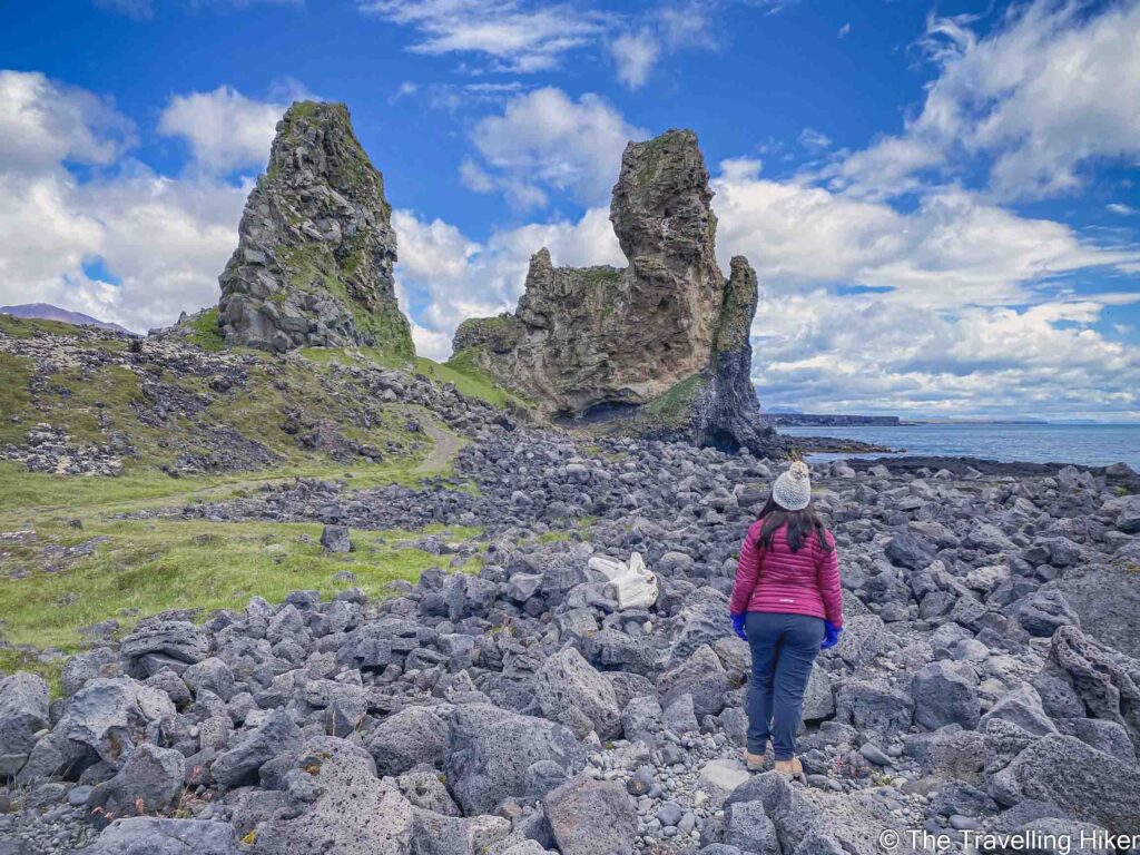
After the mossy dunes, we arrived at a small pebbled beach and since it was already past noon, we decided to have a little picnic here and have lunch. The beach was empty so it felt like it was our private beach. It was the perfect spot for our lunch enjoying the sun and the sea. Definitely plan your visit to have a picnic here, especially if you’re as lucky as we were to get a sunny day.
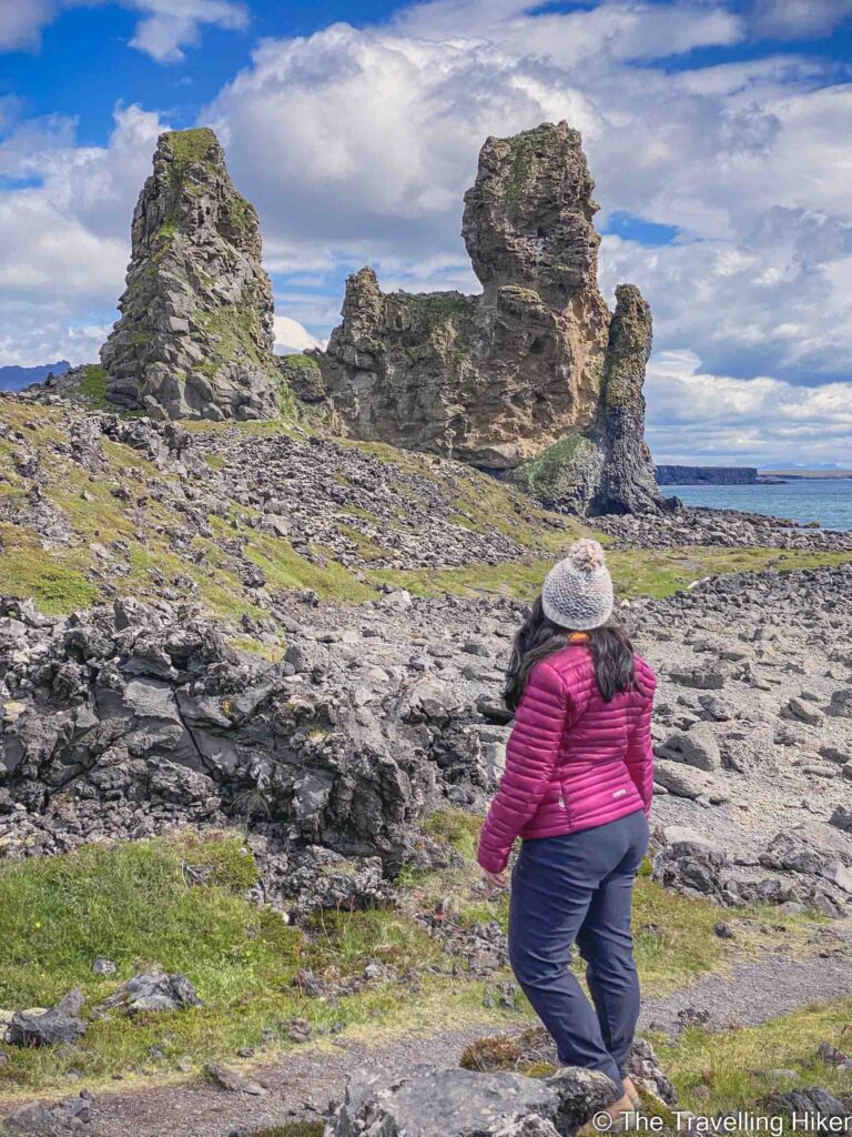
Walking next to the Londrangar Pinnacles
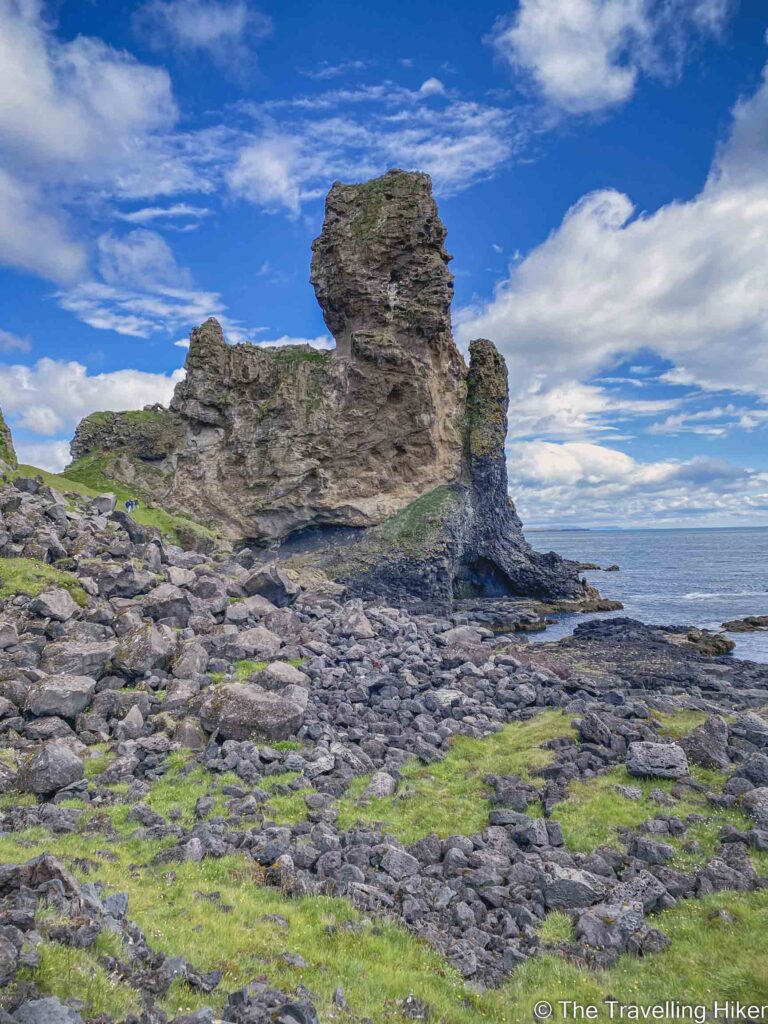
Once we had soaked in as much vitamin D as possible, we continued our hike and started approaching the two Londrangar main rock formations. As we got closer, they kept getting more and more impressive. I wanted to stop to admire them and take photos every few meters.
Next to the biggest pinnacle, you will see a small path that leads up to it. However, you should not attempt to climb them. The wind is quite hard and it is very dangerous.
No matter from which angle you admire these rocks, there are very impressive!
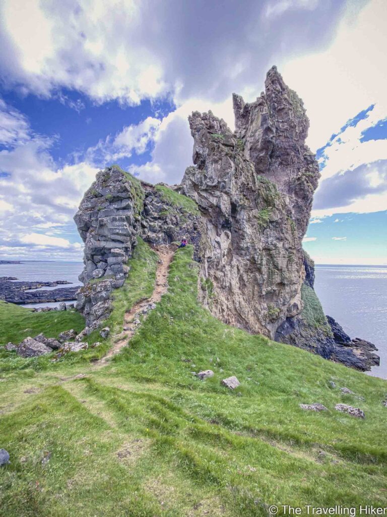
Pufurbjard Bird Cliffs
Once we were done admiring the two rock towers from up close, we kept walking past them along the coast. We reached the Pufurbjard Cliffs which are home to many bird colonies. This is the only “difficult” part of the hike as you have to go up a steep hill to reach a viewpoint. However, the small effort is worth it to get these magnificent views.
We stayed some time here admiring the view and relaxing before going back the same way we had arrived to return to our car.
ACCOMMODATION IN THE SNAEFELLSNES PENINSULA
The Snaefellsnes Peninsula is not that big so no matter how many nights you’ve planned to stay, you can choose one location and make it your base. Here are some suggestions for different kinds of budgets.
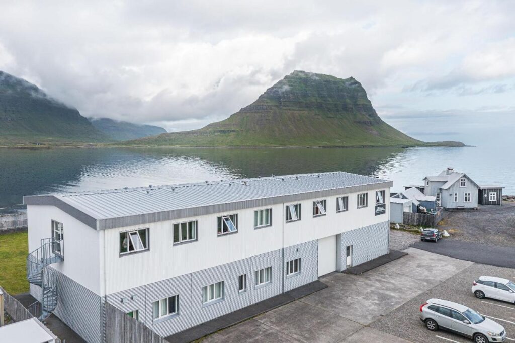
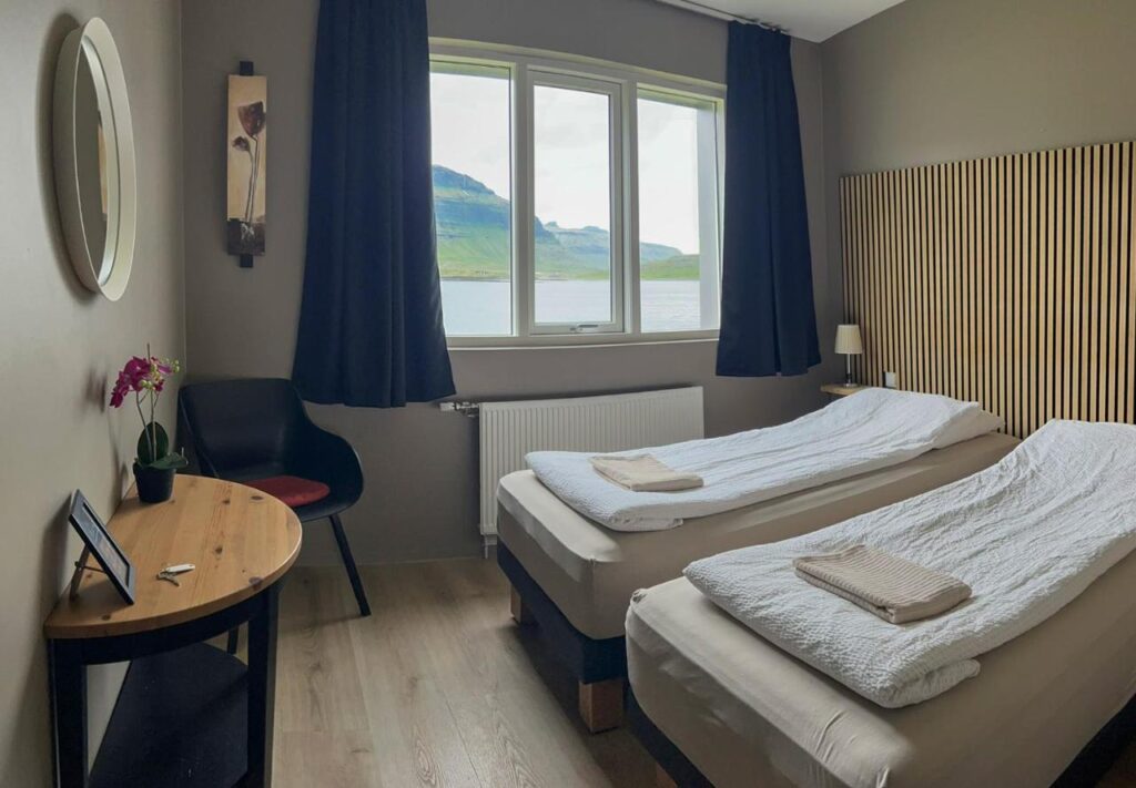
Stod Guesthouse and Apartments
Simple but comfortable guesthouse in Grundafjordur which is the perfect option if you want to save some money in accommodation. The guesthouse has a shared kitchen available with everything you may need to prepare your meals. We stayed here for two nights during our visit to the Snaefellsnes Peninsula and we were happy with it.
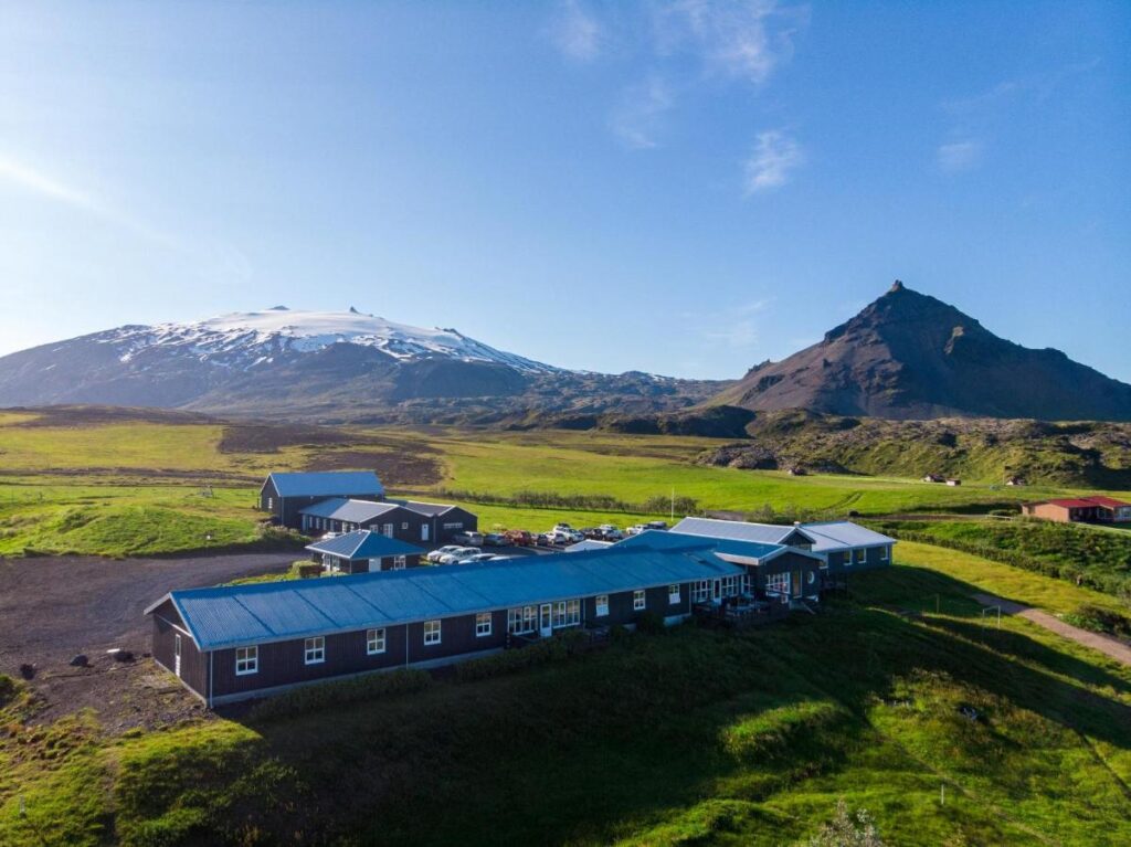
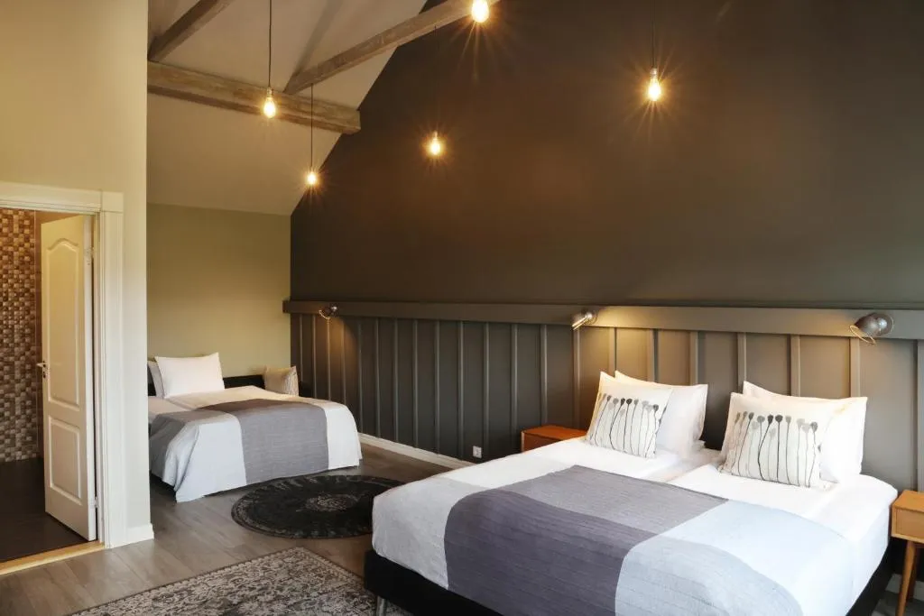
If you have some extra budget and want to stay in a more fancy place, then you should consider staying in Fosshotel Hellnar. You will be able to wake up with beautiful views over the Arnastapi Cliffs.
HOW TO USE THIS MAP: Click the star next to the map title to add this map to your google maps account. To view it on your phone while traveling, open Google Maps, click on the menu button and go to “Your Places”, click on Maps and you’ll see this map in your list.
I hope you liked my blog about Londrangar. Let me know what you thought in the comments.
DISCLAIMER: This post contains affiliate links. Clicking and buying from them will be at no additional cost to you but I will get a small commission.