A BEAUTIFUL DAY HIKING THE NARZISSENROUTE TO BIELEY ROCK
May 10, 2025
Tucked away, somewhere in between the scenic Eigel region of Germany and the High Fens nature reserve in Belgium, lies a hidden gem for nature lovers and hiking enthusiasts: Bieley Rock. This dramatic sandstone outcrop rewards adventurers with sweeping views of the surrounding forested hills and valleys, making it a perfect photo stop and picnic spot. The trail leading to Bieley Rock is part of a larger, enchanting route that burst into life every spring – the Narzissenroute, or Daffodil Trail – where thousands of wild daffodils blanket the meadows in brilliant yellow.
Hiking the Narzissenroute is like stepping into a flower fairytale. The fresh scent of pine, the sound of babbling brooks, and the golden glow of daffodils in bloom make this trail a dream for those looking to connect with nature. Whether you’re looking for a peaceful stroll, scenic rock formations, or simply to enjoy the springtime charm, this hike delivers on all fronts. In this blog, I’ll take you through the highlights of the trail, share tips for making the most of your hike, and show you why this route deserves a top spot on your outdoor bucket list.
TABLE OF CONTENTS
INTERESTING FACTS ABOUT ROCK BIELEY AND THE NARZISSENROUTE
Before we jump into the hike itself, here is a fun little list of interesting facts about Bieley Rock and the Narzissenroute to spark your wanderlust.
Get ready to see a sea of daffodils! Every spring (usually from March to April), the Narzissenroute explodes with millions of wild daffodils (Narcissus pseudonarcissus), transforming the meadows into a golden wonderland.
It’s a cross-border gem. Parts of the Narzissenroute meander through both Germany and Belgium, giving hikers a taste of two countries in one relaxing walk.
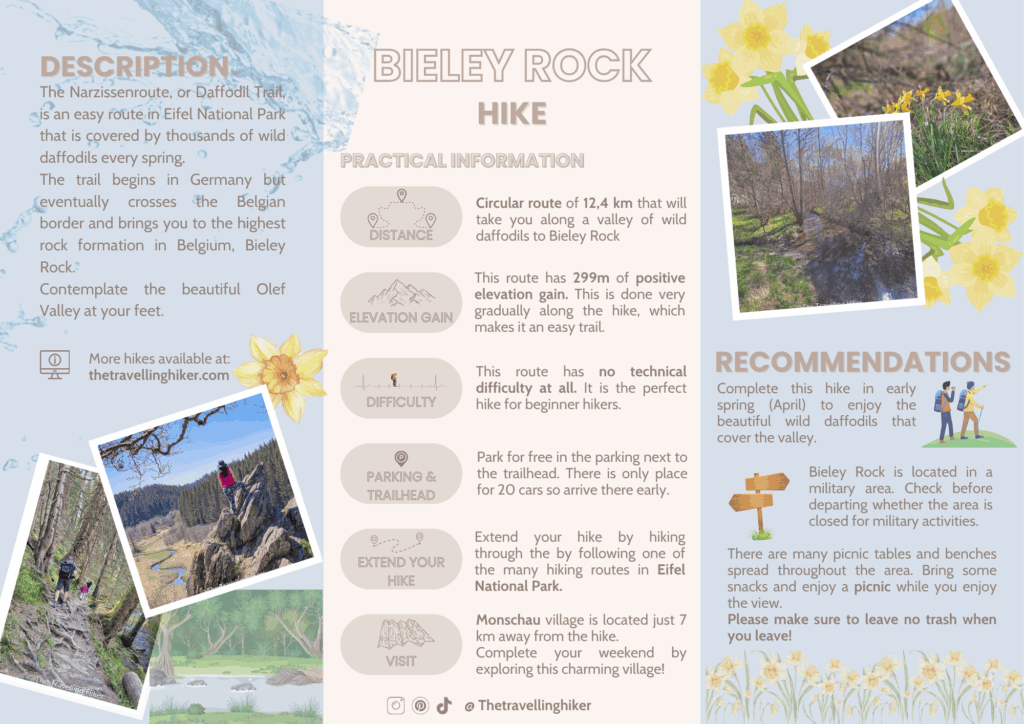
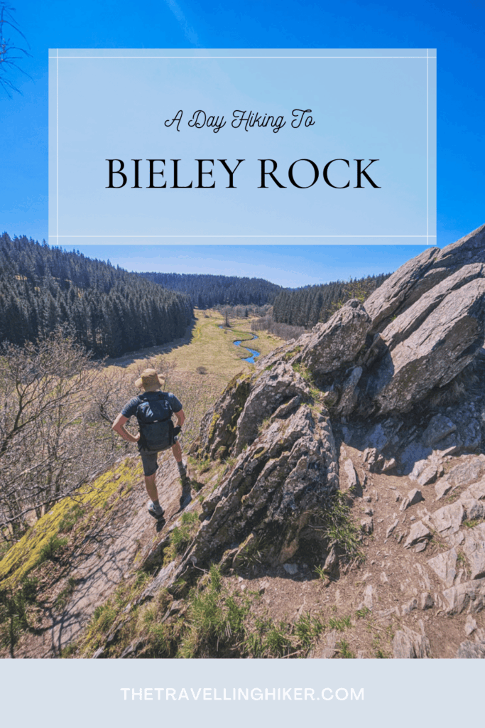
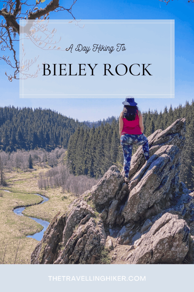
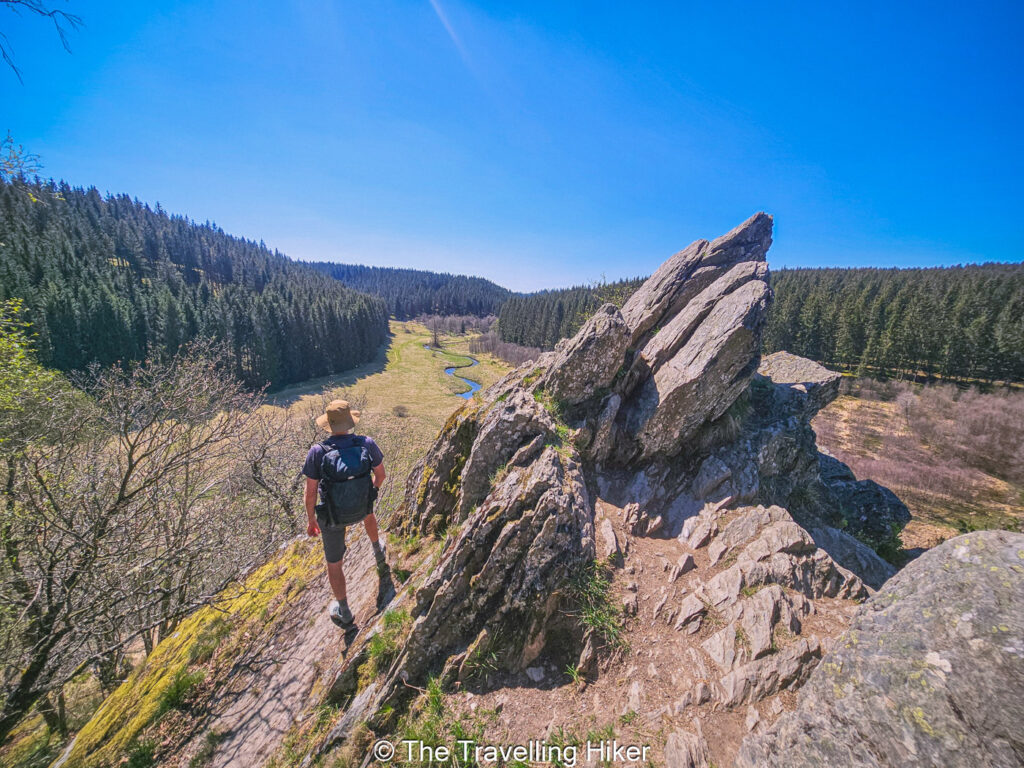
Bieley Rock is Belgium’s highest rock formation. Bieley Rock is a sandstone formation perched at around 560 meters above sea level, offering panoramic views over the Belgian-German border and the beautiful Olef Valley.
Despite being located in Belgium, Bieley Rock is only accessible through Germany. The rock is in the middle of a military red zone (the Elsenborn military base) which is not accessible to the public.
It’s a local secret. While it’s a popular walking route for locals, this trail remains under-the-radar for international tourists.
PRACTICAL INFORMATION ABOUT THE HIKE
Let’s focus on the practicalities of the hike. How do you get there? Do you need any specific equipment? Well, just keep reading to find out.
HOW TO GET TO THE TRAILHEAD?
This hike is located near the Belgian and German border, in the Eifel National Park and near the charming town of Monschau.
🚗By Car
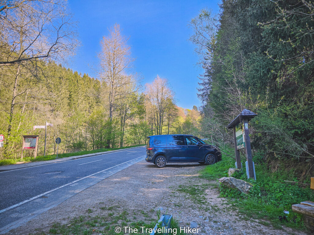
The only way to reach this hike is with a car. From Brussels, it will take you approximately 2 hours to reach it. Just search in your GPS Parkplatz Perlenbacher Mühle / Narzissen Wanderweg and it will guide you the parking lot.
🅿️Parking: The parking lot is not very big, it can only host 18 cars. Make sure to arrive on the earlier side to ensure you find a parking spot.
EQUIPMENT NEEDED
This trail is relatively easy and has no technical difficulty at all. However, the following essentials will help you have a wonderful time during this hike.
Comfy hiking boots. The trail can be a bit uneven and muddy at some parts, especially during spring, so sturdy and waterproof hiking boots are a must.
Weather-ready layer. The Eifel weather can be a bit unpreddictable! Bring a breathable rain jacket and dress in layers.
A light backpack with some trail snacks. Pack some fruits, nuts, or a sandwich for a snack break while you enjoy the views from Bieley Rock.
Trail Map or App. While the route is generally well-marked, it’s always safe to have a GPS app just in case. I always use AllTrails App and it works fantastically.
Camera or Smartphone. You’ll definitely want to capture the daffodil fields and the panoramic views from the rock!
BEST TIME TO DO THIS HIKE
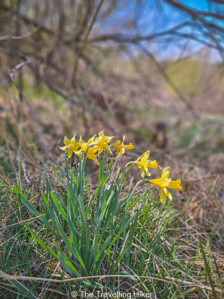
The best time to this hike is, of course, April. During this month, the daffodils will bloom and the fields will all turn yellow. It will feel as if you are walking through an enchanted forest!
However, this hike is beautiful at other months of the year too. I did this hike in early May and even though almost all daffodils were already gone, I still loved it.
THE NARZISSENROUTE AND BIELEY ROCK HIKE
HIKE STATS
Trail Start/End – Parkplatz Perlenbacher Mühle / Narzissen Wanderweg (exact location at the map at the end of this blog)
Distance – 12,4 km
Elevation Gain – 299 m
Level – Easy
Route Type – Circular Route
Estimated Time Needed – 3 hours and 30 minutes. This includes plenty of time to stop for a picnic, relax, and enjoy the scenery.
Best Time To Visit – April if you want to enjoy the daffodils.
HIKE MAP
I always use the AllTrails App during my hikes. The app has a GPX map that can help you stay on the right trail during your hikes. For this hike, we followed the Daffodil Extended Loop Hike.
THE NARZISSENROUTE TO ROCK BIELEY - STEP BY STEP GUIDE
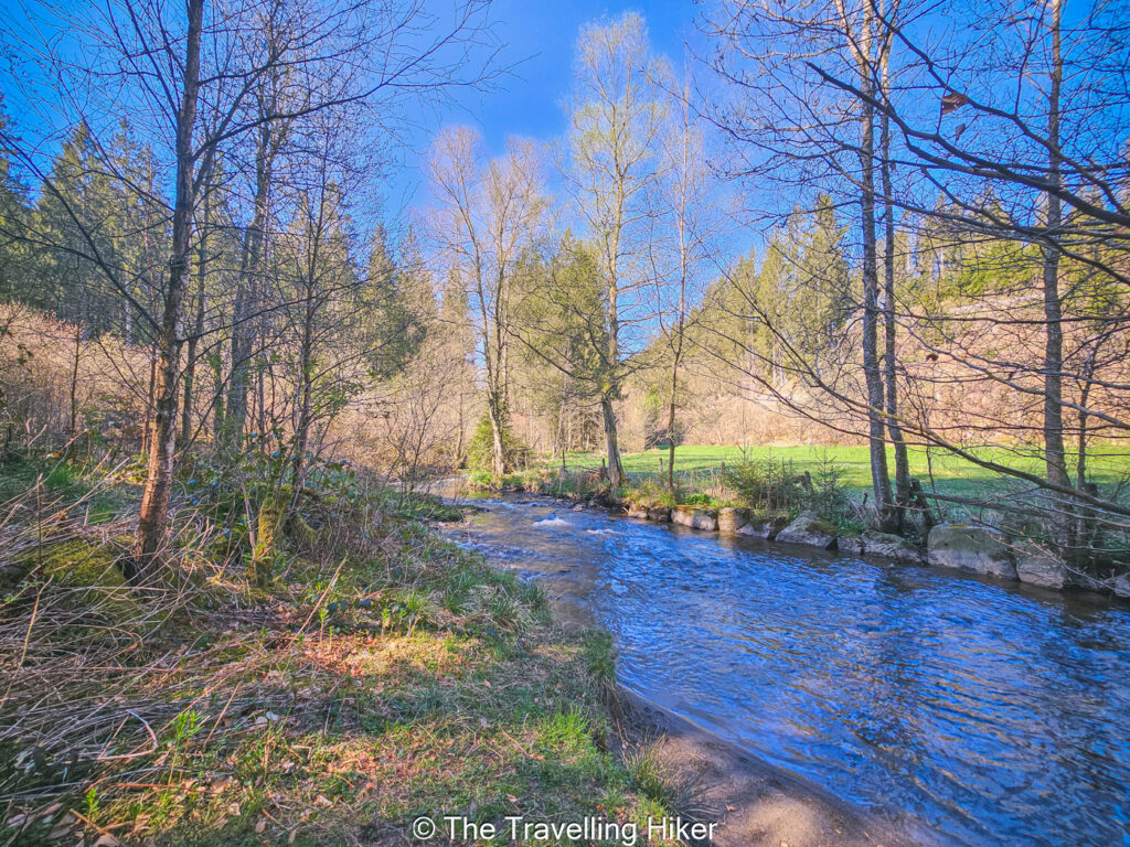
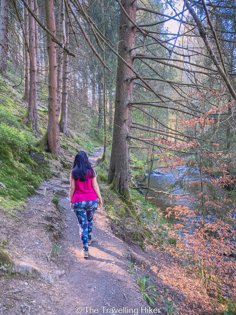
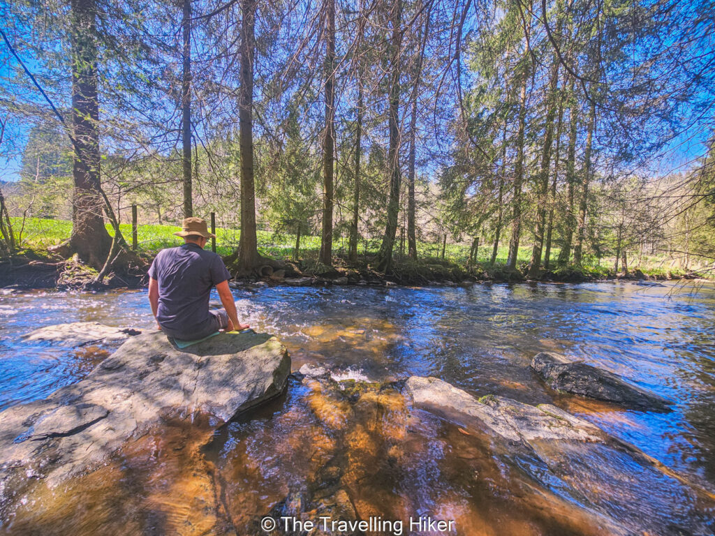
Walking next to the Perlenbach and Fuhrtsbach Rivers
The first part of the hike is very peaceful and pleasant, hearing only the gentle water flow, the birds chirping and your steps. You will be walking along the Perlenbach and Furhtsbach Rivers, that run along the Belgian and German borders.
Since it is right next to the river and mostly under the shade of the trees of the area, the trail is quite muddy at some parts. Make sure to bring some waterproofs boots unless you want your feet to get wet.
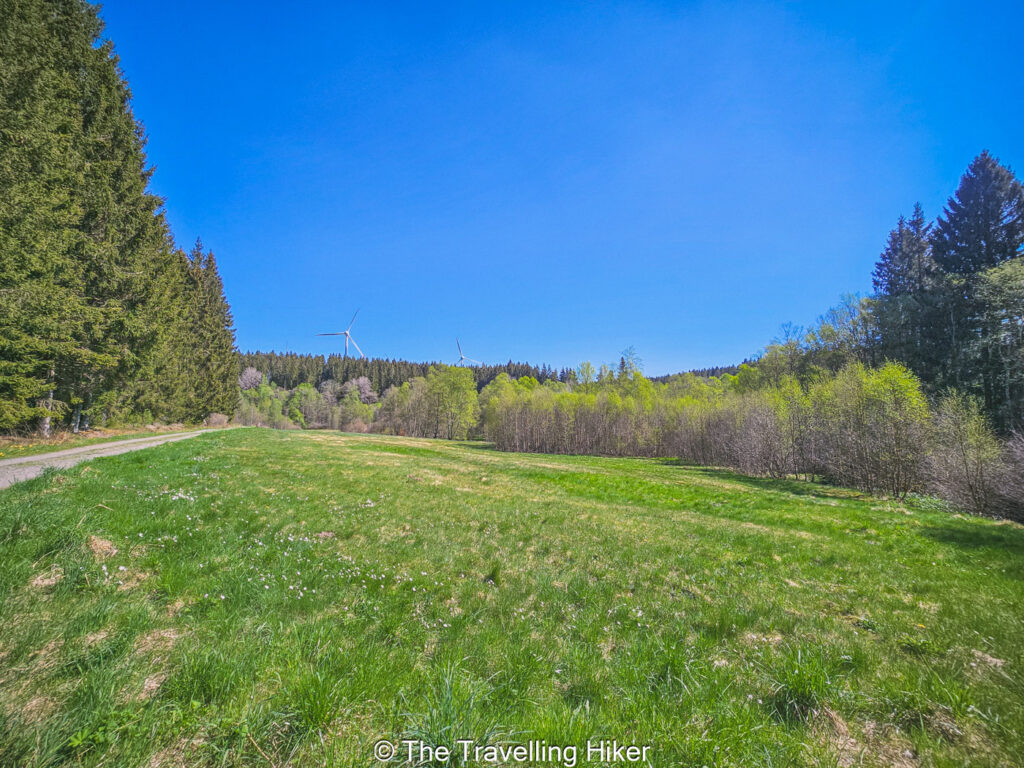
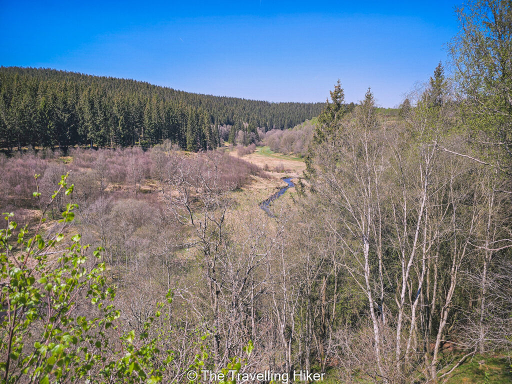
The Daffodil Fields
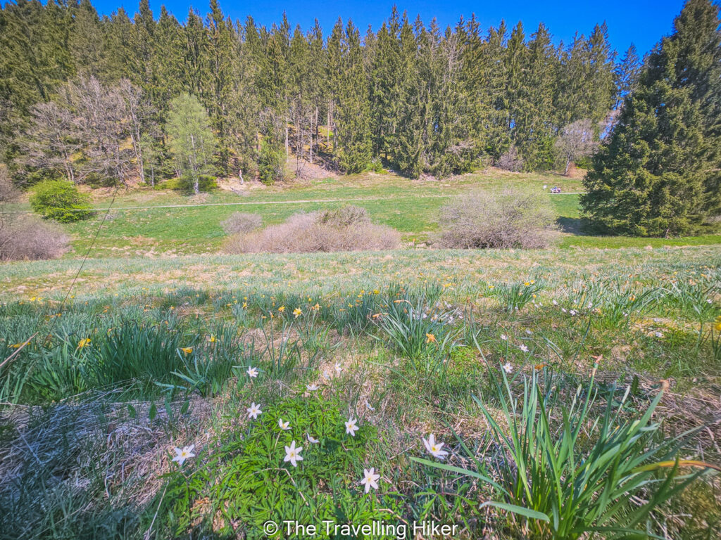
At some point you will leave the rivers behind you and enter an area with plenty of green fields. If you visit this hike in spring (mostly April) these fields are covered with wild yellow daffodils. Making it look like a yellow carpet.
I only did this hike in early May so most of the daffodils were already gone. However, there were a few fields that still had some daffodils on them and was truly magical. I will definitely come back again next year to see it in full bloom!
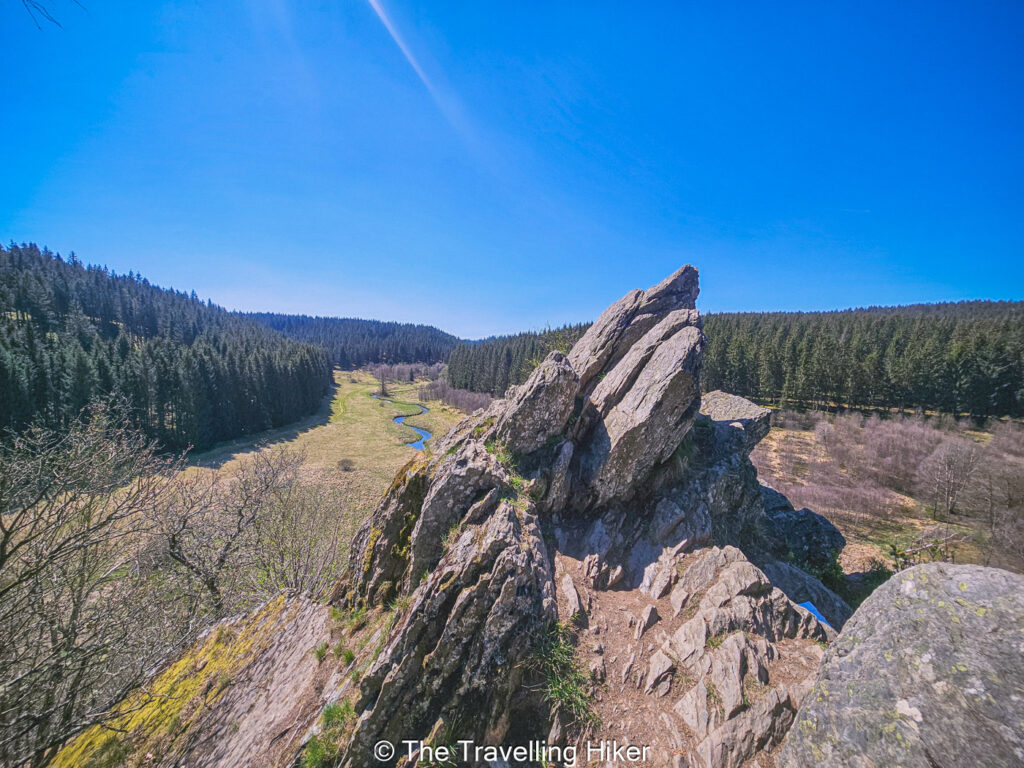
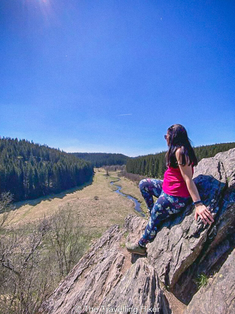
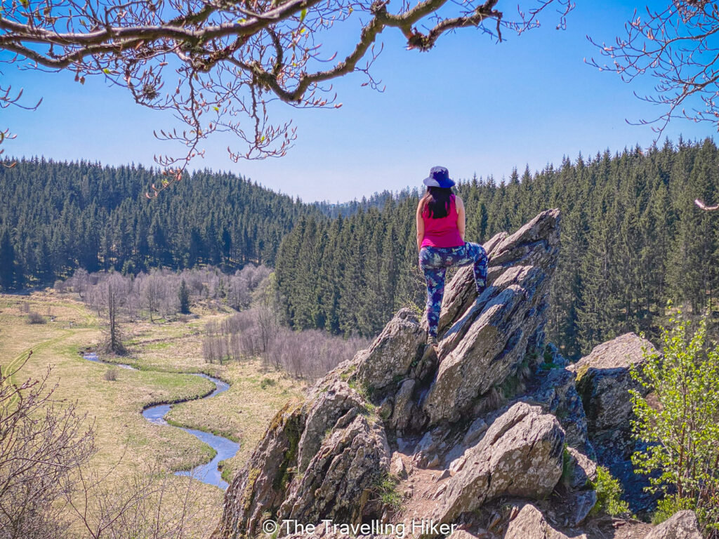
Bieley Rock
As you keep walking along the trail, at some point you will cross the border and enter Belgium again. Keep following the trail and you will reach a trail on your left that goes gently uphill towards Bieley Rock (Bieleyfelsen).
This trail will guide you to the stunning lookout point from the top of the rock. From up there, you will get stunning views of Olef valley at your feet. I loved this vantage point! It is so impressive to see the valley at your feet with the small creek making its way along the valley.
Important: This part of the trail can sometimes be closed due to military activity in the area. Check if the area is open before you start you hike here. The website is in German, but it is possible to translate it.
Return to the Parking Lot
Once you are done admiring the views, it is time to return to the main trail and start your return to the parking lot. The hikes goes through some more daffodil fields where you can stop again and enjoy the beautiful views.
Eventually, you will reach the Perlenbach river where you started the trail and reach the parking lot. In our case, since it was such a nice and wonderful spring day, we decided to take of our shoes and wet our feet in the river to cool down. It was the perfect way to end our hike!
OTHER THINGS TO DO NEARBY
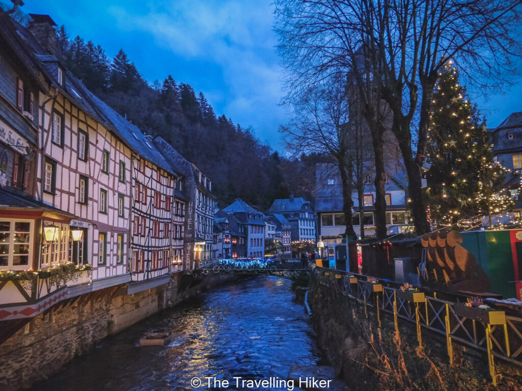
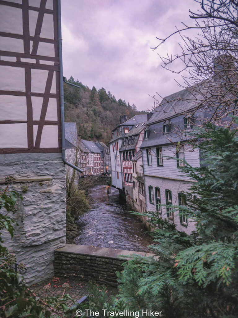
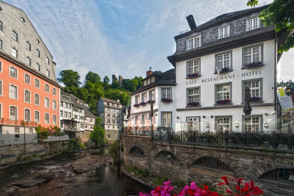
After you hike, if you still have some time, you can head to the beautiful town of Monschau. This is a picture-perfect German town that looks like it’s been taken from a fairytale. With its half-timbered houses, cobbled streets, and the scenic Rur River winding through the center, it’s the kind of place where you’ll want to slow down and soak it all in. Just wander through the charming streets and pop into one of its cozy cafés. This cute little town will steal your heart!
ACCOMMODATION NEAR THE TRAIL
Want to stay overnight and enjoy this area for a bit longer? Then Monschau is the best option for you. In the town you will find many different accommodation options. I recommend Horchen Hotel, located in the city center and right next to the Rur River. It is the perfect place to relax after a day of hiking.
HOW TO USE THIS MAP: Click the star next to the map title to add this map to your google maps account. To view it on your phone while traveling, open Google Maps, click on the menu button and go to “Your Places”, click on Maps and you’ll see this map in your list.
HIKE SUMMARY AND INFOGRAPHIC
No time to read the full blog post? Here’s an infographic I’ve created with the most important information about this hike.
And that’s it for this week’s blog. I hope you liked it and found it useful. Let me know what you think in the comments!
Happy hiking!
DISCLAIMER: Did you know? This blog uses affiliate partnerships. When you click and book or make a purchase through one of my blog posts, I may receive a small commission (at no extra cost to you). Thank you for supporting The Travelling Hiker!