THE BEAUTIFUL DJUPALONSSANDUR BEACH TO DRITVIK COVE HIKE
January 8, 2023
The Djupalonssandur Beach to Dritvik Cove Hike is a must-do hike within the Snaefellsnes Peninsula. Along this hike, you will be able to enjoy beautiful small lagoons, black lava pebbled beaches, and even the remains of a shipwreck! If any of this sounds interesting, keep reading to find out everything about Djupalonssandur and Dritvik.
TABLE OF CONTENTS
DJUPALONSSANDUR & DRITVIK
DJUPALONSSANDUR, THE BLACK LAVA PEARL BEACH
Here are some interesting facts about this beach:
The name Djupalonssandur comes from two small lagoons called Djúpulón that translate into English as The Deep Lagoons. Folklore believed that these lagoons were abysmal. However, despite their name, the lagoons have been measured and they are about 5 meters deep.
The path that leads to Djupalonssandur is called Nautastígur (the path of the bull).
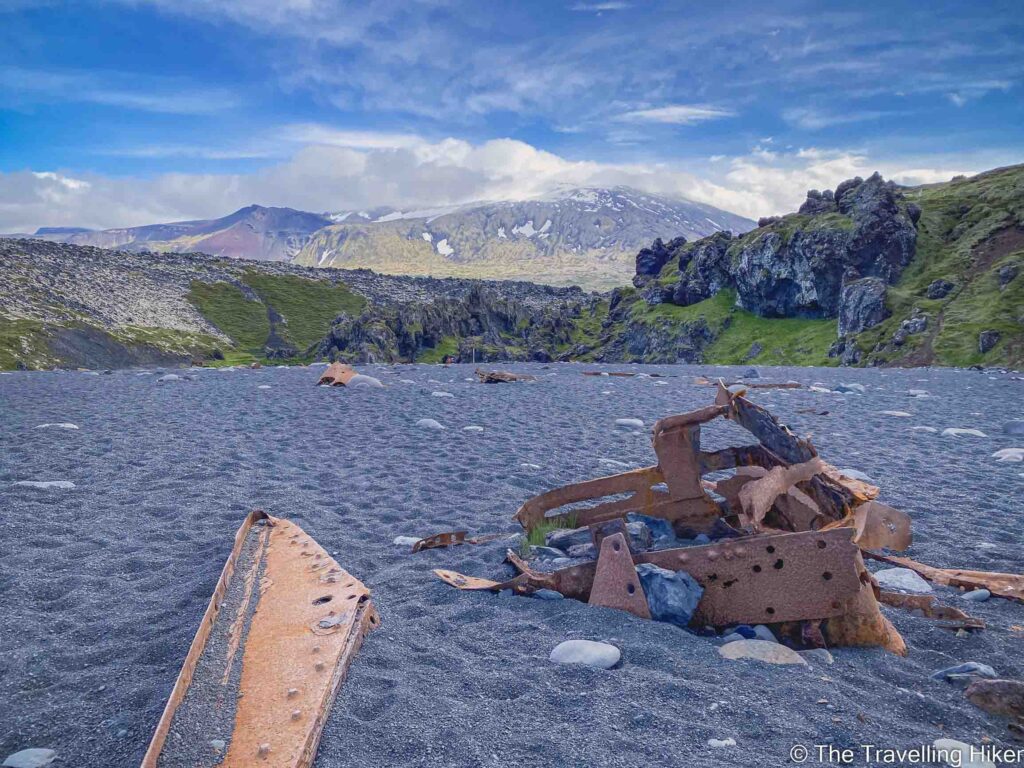
In Djupalonssandur you will be able to see the remains of the shipwreck of a British trawler, the Epine GY7. This ship wrecked near Dritvik cove on 13th March 1948. Only 5 men survived and fourteen men lost their lives. The remaining parts of the ship are left on the beach as a tribute to these men.
On the beach of Djupalonssandur, you will also find 4 big stones of different sizes and weights. From bigger to smaller you have Fullsterkur or strong (154kg), Halfsterkur or half-strong (100kg), Halfdraettingur or half as good (54kg) and Amlòdi or lightweight (23kg). It is said that these stones were used to test whether fishermen were strong enough to go on rowing boats that departed from Dritvik. If the fisherman was not able to lift at least the Halfdraettingur stone until its waist it was not allowed on the boats.
DRITVIK COVE
From Djupalonssandur you can hike to Dritvik Cove, which was a big seasonal fishing station in Iceland in the 16th century. Between 40 to 60 fishing boats would sail off from this beach with around 200 to 600 fishermen. The fishing season was between April to mid May.
PRACTICAL INFORMATION ABOUT THE HIKE
GETTING TO DJUPALONSSANDUR
Djupalonssandur is located at the western end of the Snaefellsnes peninsula.
The best and easiest way to reach the trailhead is by renting a car and driving there yourself, especially if you want to hike in the area. You just have to drive along Utnesvegur until you reach a deviation towards 572 Dritvikurvegur. At the end of this road, you will find the Djupalonssandur Parking Lot (exact location on the map at the end of this blog).
Driving times to reach Djupalonssandur will depend on where you are driving from:
From Reykjavik, it will take you approximately 2 hours and 40 minutes.
From Grundafjordur, it takes approximately 40 minutes to reach it.
💡 If driving is not your thing and you just want to do a carefree visit to the Snaefellsnes peninsula, you can just join a Day Tour To Snaefellsnes. Many of them include Djupalonssandur in their itinerary.
EQUIPMENT NEEDED
Though the Djupalonssandur Beach to Dritvik Cove Hike is relatively easy and well-marked, Icelandic conditions can be unpredictable, so it’s smart to come prepared. Here are the essentials you should bring with you.
Waterproof Hiking Boots. The path is uneven and can be slippery, especially after rain. Solid ankle support and good grip are key.
Hat & Gloves. Even in the summer, the wind off the ocean can be biting. Lightweight but warm options are perfect.
Snacks or a Light Lunch. It’s a short hike (approximately 1 hour and 30 minutes round trip), but a thermos of coffee or a sandwich with a view of the sea is hard to beat. If you do bring some snacks, always pack your trash and leave the place as you found it.
Phone or Camera. You’ll want photos of the lava formations and shipwreck remnants.
Map or GPS App (like AllTrails). The trail is pretty straightforward, but it never hurts to have a backup.
HIKING FROM DJUPALONSSANDUR BEACH TO DRITVIK COVE
HIKE STATS
Trail Start/End – Djupalonssandur Beach Parking
Distance – 3,4 km
Elevation Gain – 55 m
Level – Easy
Route Type – Circular Route
Estimated Time Needed – 1 hour and 30 minutes. This includes plenty of time to stop for a picnic, relax, and enjoy the scenery.
Best Time To Visit – June to September will grant you the best weather conditions to complete this hike.
HIKE MAP
I always use the AllTrails App during my hikes. The app has a GPX map that can help you stay on the right trail during your hikes. For this hike, we followed the Djupalonssandur – Dritvik Hike.
DJUPALONSSANDUR beach to DRITVIK cove HIKE - sTEP BY STEP GUIDE
Djupalonssandur Beach and the lagoons
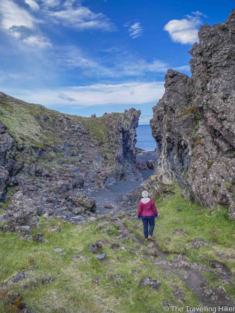
We parked our car at the Djupalonssandur parking lot and started following the Nautastígur path that led towards the beach. The trail soon split into two and we followed the left trail knowing that we would return through the other one.
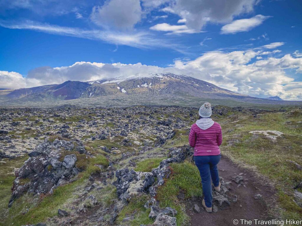
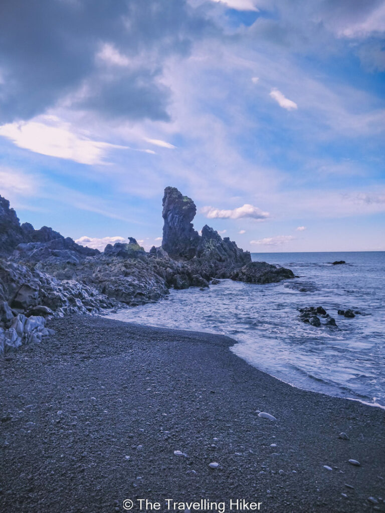
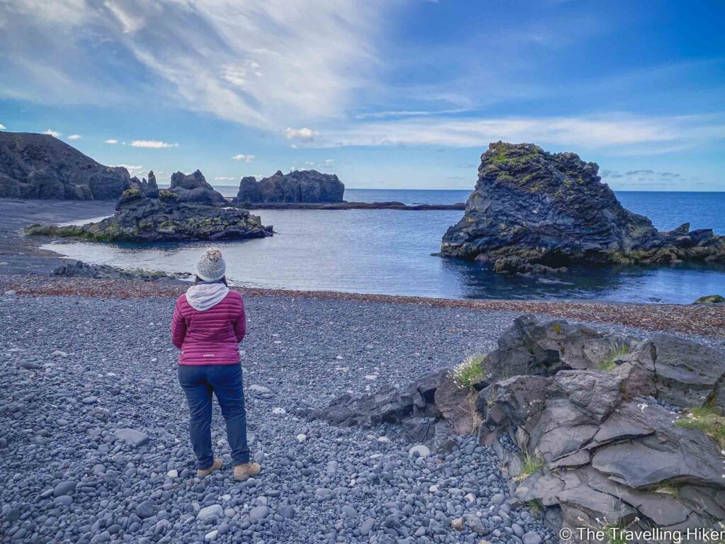
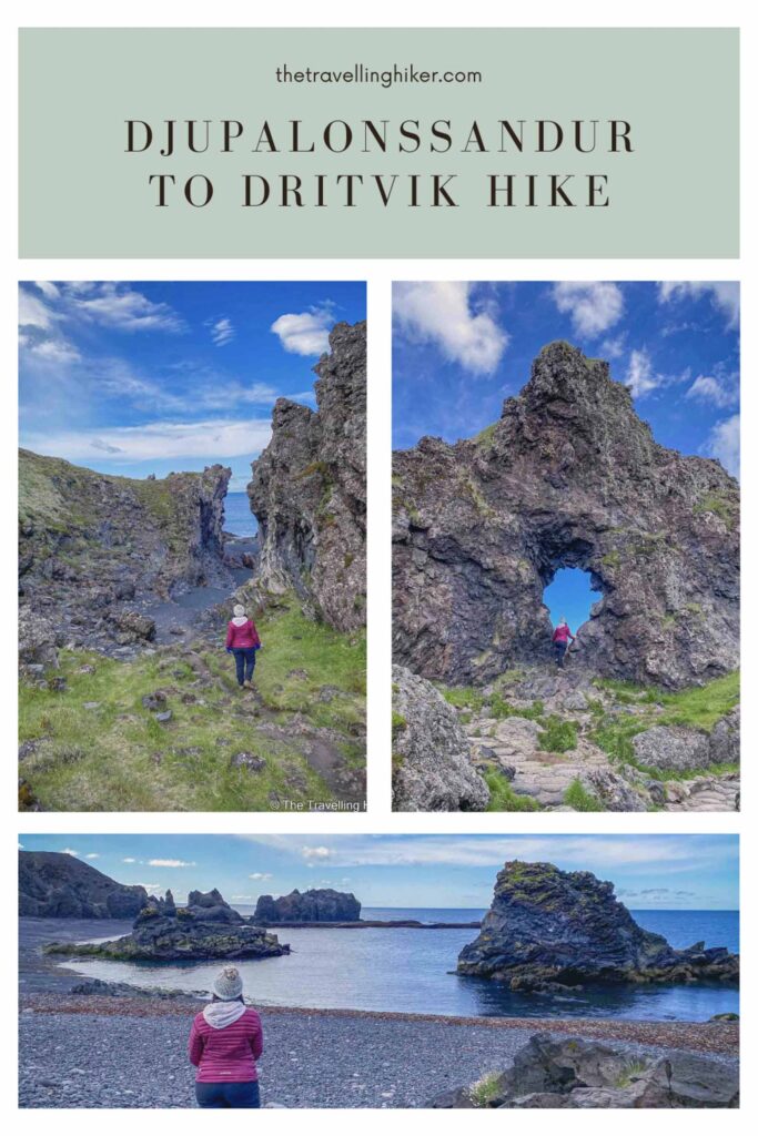
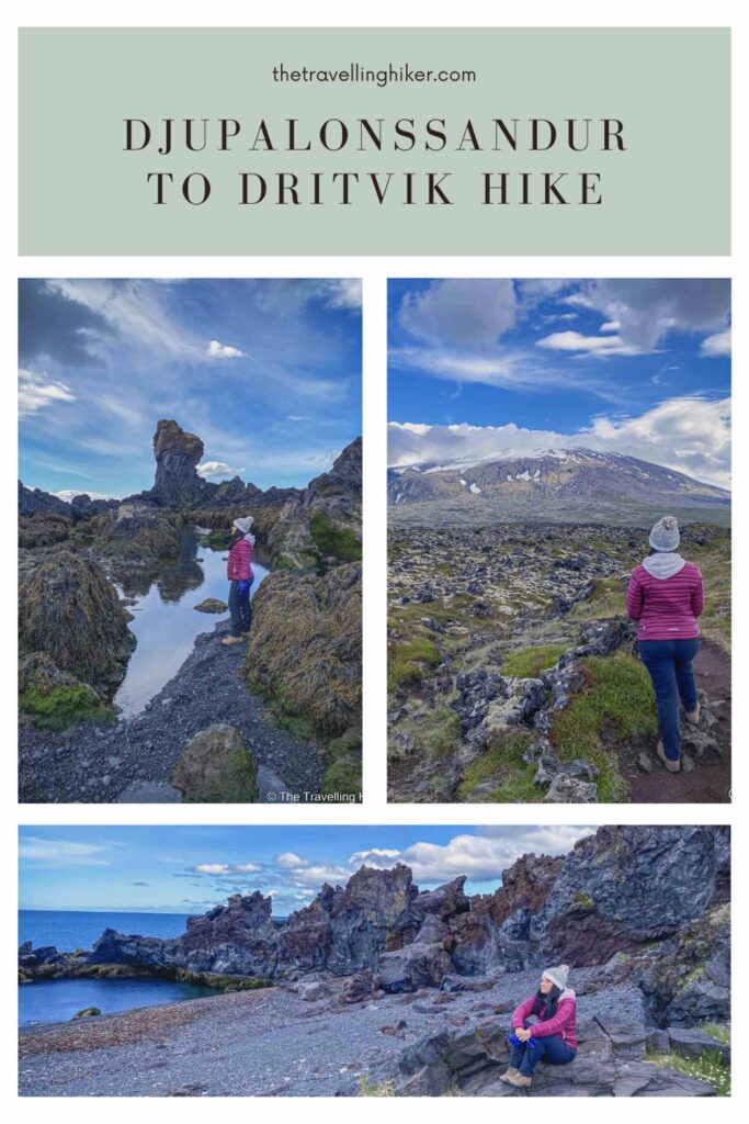
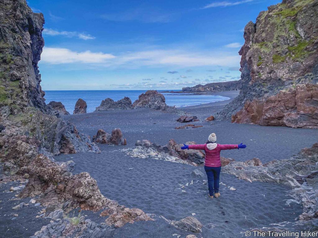
After a few hundred meters we arrived at the beautiful Djupalonssandur beach. As we approached it, we could see it appear behind the lava rock formations and were amazed by its beauty. It is a half-moon-shaped beach and the contrast of the black lava pebbles with the blue of the sea was something else. There were a few people on the beach but you could barely see them.
We spent some time admiring the beach, the lagoons and taking some pictures of it.
Hiking to Dritvik Cove
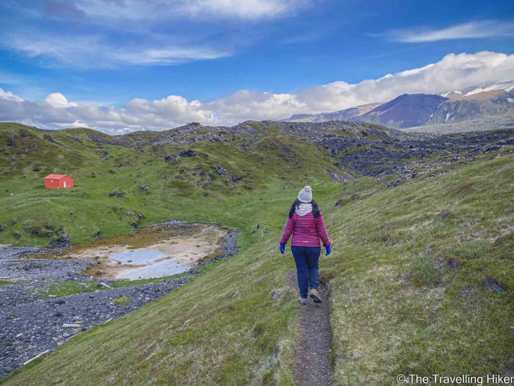
Once we had enjoyed some time at the beach, we began our hike towards to Dritvik Cove. The trail to Dritvik cove begins on the left-hand side of the beach (exact location on the map above). The trail is very easy and it took us approximately 20 minutes to reach Dritvik Cove. The views are also fantastic with the sea on your left and the Snaefellsjökull glacier on your right.
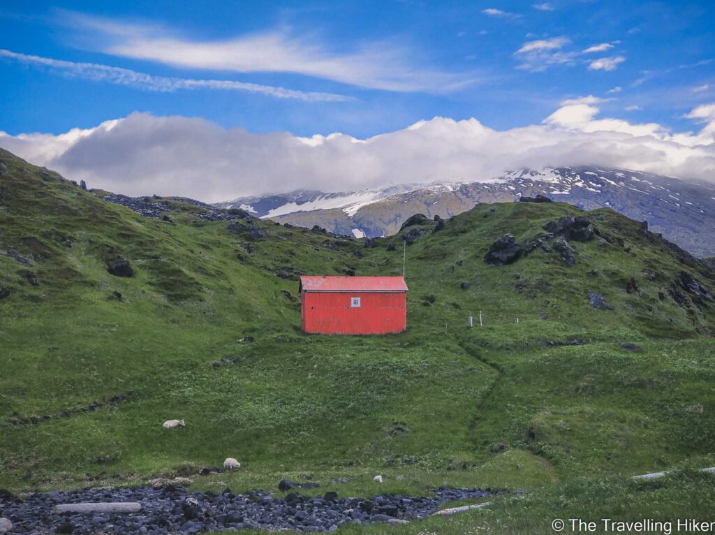
When we were arriving at Dritvik Cove, we saw that next to the red hut there were three sheep eating peacefully (a mom and its two little lambs). We approached them slowly in order not to scare them away. In the beginning, the mother was really aware of us getting close but soon she realized we were not harmful.
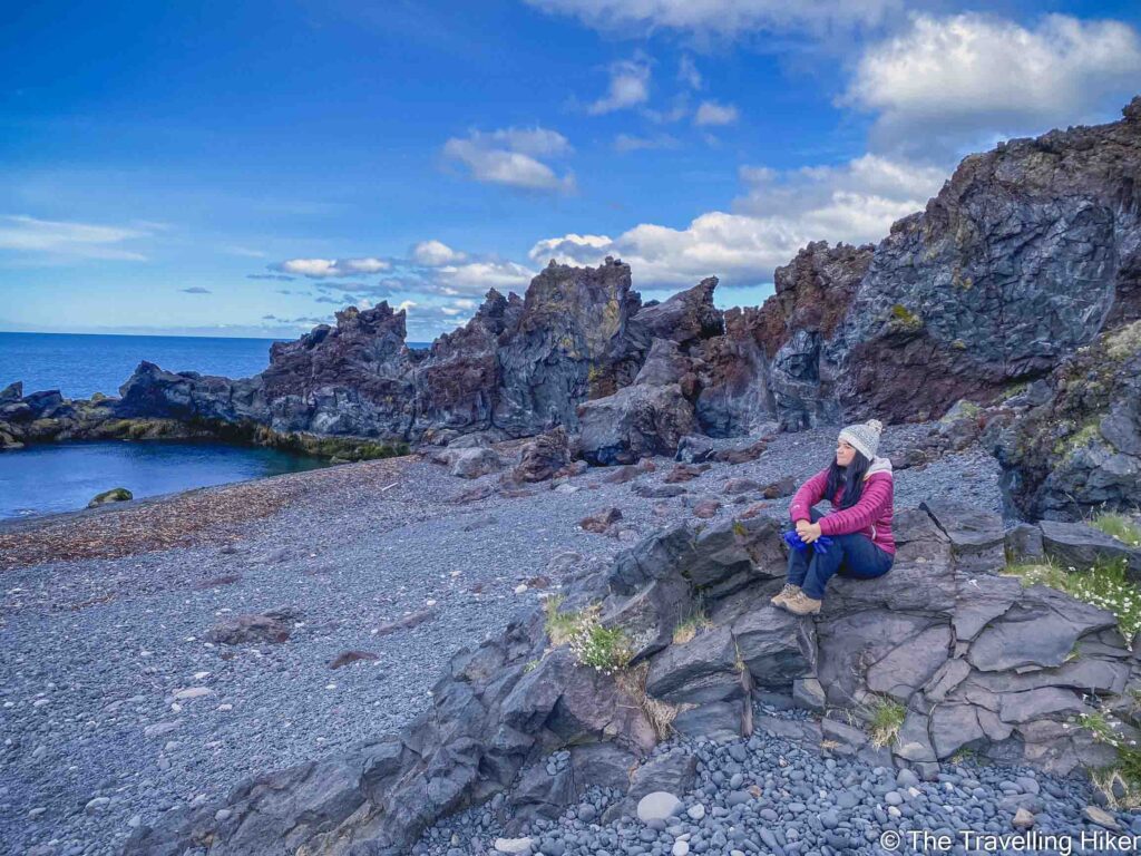
Dritvik Cove
At Dritvik Cove, we spent some time getting photos and videos of the sheep up close. It was the first time during our two weeks in the country that we had been able to get this close to them. We had of course seen plenty of them from the car but whenever we tried to get closer to them, they usually ran away.
We also enjoyed the beach as well. Dritvik Cove was smaller than Djupalonssandur but had nothing to envy in beauty. We were there completely alone which made it very peaceful and special.
Return to Djupalonssandur, the shipwreck and lifting stones
When we returned to Djupalonssandur beach, we took some time to see a few things we had skipped before. We saw the remainings of the Epine GY7 shipwreck spread around the beach. Important: These pieces are there as a tribute to the British men that died in that shipwreck, so please do not touch them or take them with you.
We also checked the lifting stones that fishermen needed to lift to prove they were capable of being oarsmen on the rowing fishing boats departing from Dritvik. David tested to pick up the stones and managed to lift the Halfdraettingur.
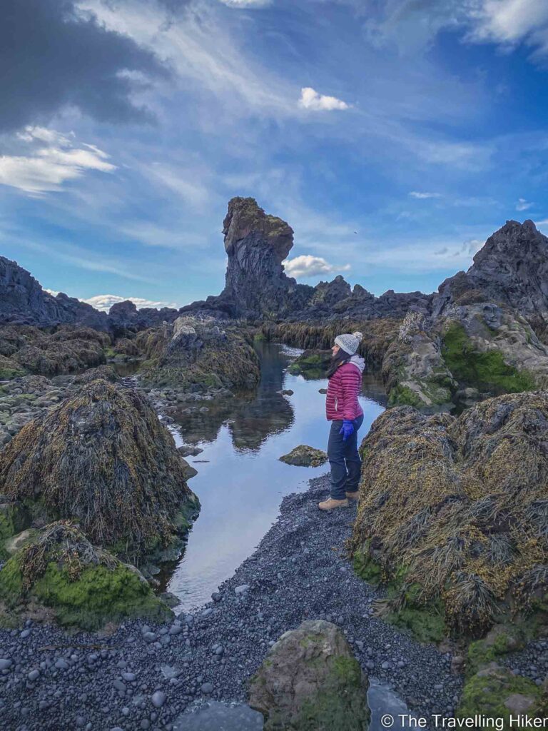
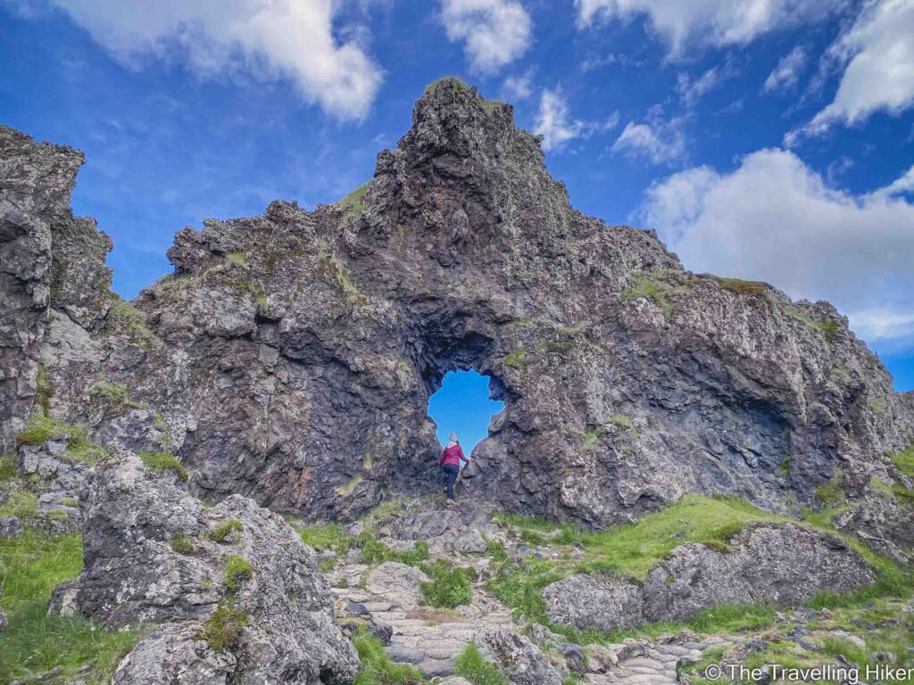
We completed our hike with Gatklettur, a rock formation with a hole in it from which you can observe the Snaefellsjokull Glacier.
ACCOMMODATION IN THE SNAEFELLSNES PENINSULA
The Snaefellsnes Peninsula is not that big so no matter how many nights you’ve planned to stay, you can choose one location and make it your base. Here are some suggestions for different kinds of budgets.
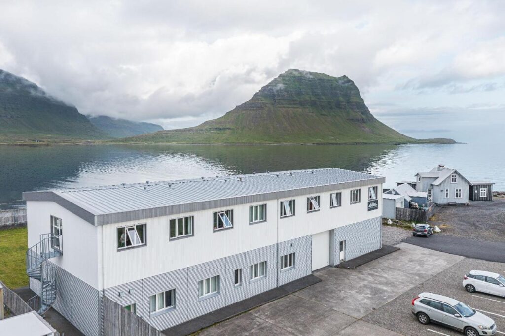
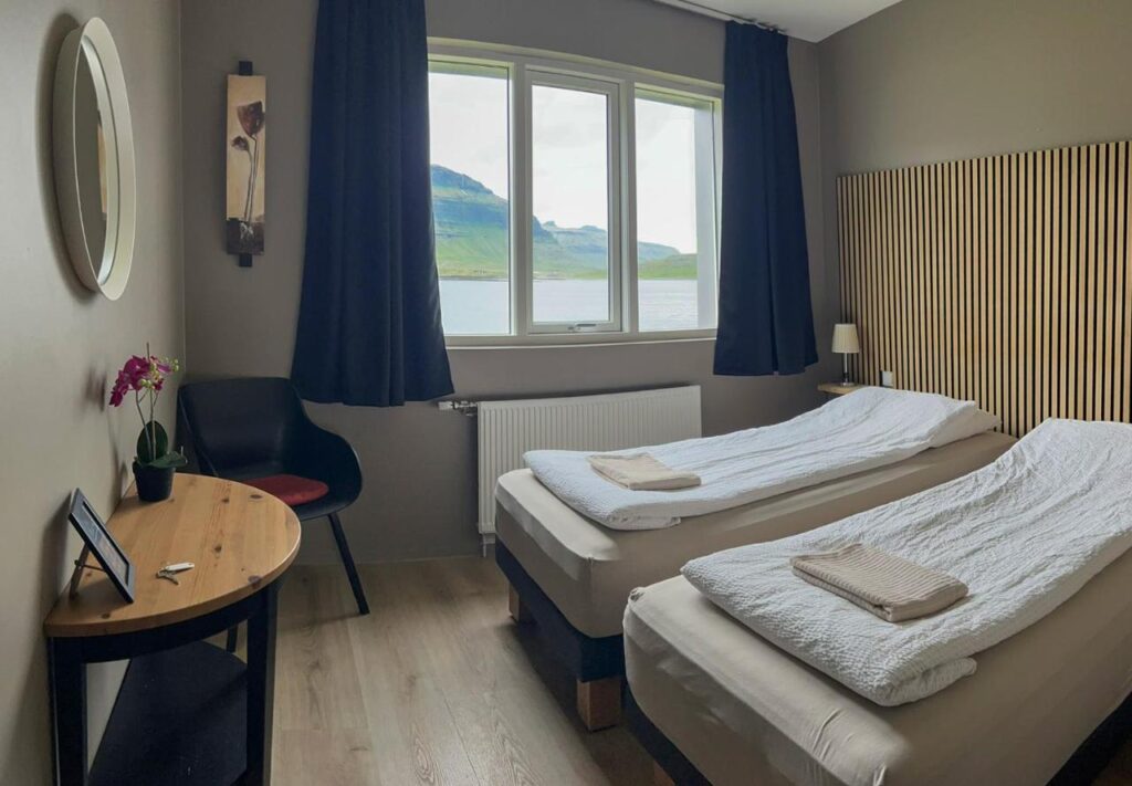
Stod Guesthouse and Apartments
Simple but comfortable guesthouse in Grundafjordur which is the perfect option if you want to save some money in accommodation. The guesthouse has a shared kitchen available with everything you may need to prepare your meals. We stayed here for two nights during our visit to the Snaefellsnes Peninsula and we were happy with it.
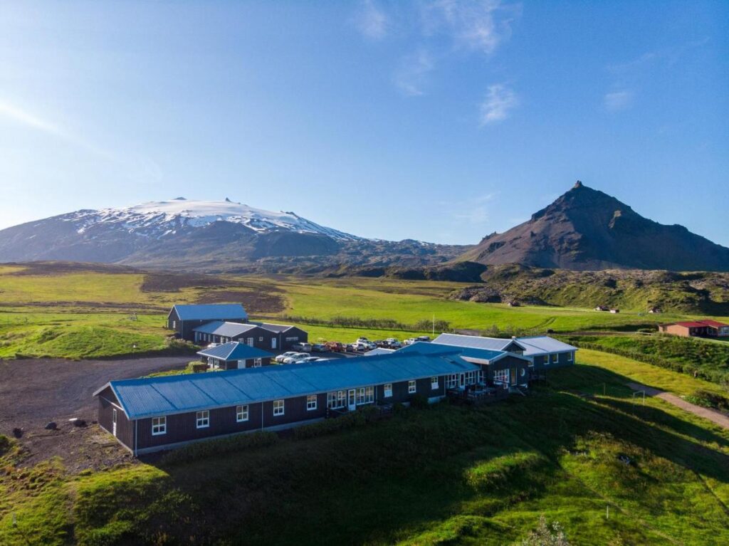
If you have some extra budget and want to stay in a more fancy place, then you should consider staying in Fosshotel Hellnar. You will be able to wake up with beautiful views over the Arnastapi Cliffs.
HOW TO USE THIS MAP: Click the star next to the map title to add this map to your google maps account. To view it on your phone while traveling, open Google Maps, click on the menu button and go to “Your Places”, click on Maps and you’ll see this map in your list.
I hope you liked my blog about the Djupalonssandur Beach to Dritvik Cove Hike blog. Let me know what you thought in the comments.
DISCLAIMER: This post contains affiliate links. Clicking and buying from them will be at no additional cost to you but I will get a small commission.