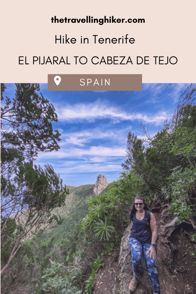
EL PIJARAL HIKE TO CABEZA DE TEJO VIEWPOINT: A HIDDEN GEM IN TENERIFE’S ANAGA MOUNTAINS
July 6, 2025
Hidden deep within the lush green folds of Tenerife’s Anaga Rural Park lies a hiking trail that feels like stepping into another world. The El Pijaral hike to Cabeza de Tejo viewpoint is a permit-only route through one of the island’s last untouched laurel forests, leading to sweeping views over the dramatic northern coastline.
If you’re looking for serenity, wild nature, and a rewarding viewpoint at the end, this trail belongs at the top of your Tenerife hiking list. Keep reading to get all the information you need to know before attempting to complete this hike.
TABLE OF CONTENTS
EL PIJARAL NATURAL RESERVE - WHY IS IT SO SPECIAL?
El Pijaral Natural Reserve is not just any forest, it’s part of a rare ecosystem known as laurisilva, or laurel forest, found only in a handful of places in the world. This prehistoric, misty forest is rich with ferns, moss-draped trees, and endemic plants like the Canary laurel and the Pijaral fern (from which the area gets ts name).
Because it’s so ecologically sensitive, and in order to preserve it, the trail is limited to just 45 hikers per day, making it one of Tenerife’s best-kept secrets.
Important: If you do get a permit and visit this Natural Reserve, please practice the leave no trace 7 principles. Let’s all contribute to protecting our beautiful planet.
PRACTICAL INFORMATION ABOUT THE HIKE
HOW DO YOU REACH THE TRAILHEAD?
The trailhead to this hike is not easy to reach, it is located quite far within the Anaga Mountains but it is so worth it! You can reach this trail both by driving yourself or with the island’s public transport.
🚗By Car
The easiest way to reach the trailhead is by car. You will have a lot more flexibility with your schedule and you will be able to optimize your visits for the day. However, you should be comfortable with driving through narrow mountain roads. You should also make sure that your car has enough horse power as some times the roads are quite steep.
The exact location of the parking next to the trailhead is located on the map at the end of this blog. Just follow the directions of your GPS to reach it. The driving times will vary depending on your starting point.
From Santa Cruz de Tenerife it will take approximately 45 minutes.
From Puerto de la Cruz, it will take apparoximately 1h and 10 minutes.
🅿 Parking – The parking lot for this trail is quite small. However, since the number of visitors per day is limited, this should not be a problem. We arrived there at 10 in the morning and there were still a few spots left. In addition, there is a second parking lot a few hundred meters down the road which is also quite small.
If you don’t feel comfortable driving, it is also possible to reach this hike with TITSA, the island’s public transport. It will just take longer to reach the trailhead.
The bus lines 947 which departs from Santa Cruz de Tenerife, has a stop only a few meters away from the trailhead. However, take into consideration the bus time schedules to ensure you can return back to the city.
HOW TO GET A PERMIT TO HIKE WITHIN EL PIJARAL NATURAL RESERVE?
A permit is required to hike within El Pijaral Natural Reserve, and you must request it online in advance. The permit is completely free but there is no on-the-spot requests. Here is how you can get one:
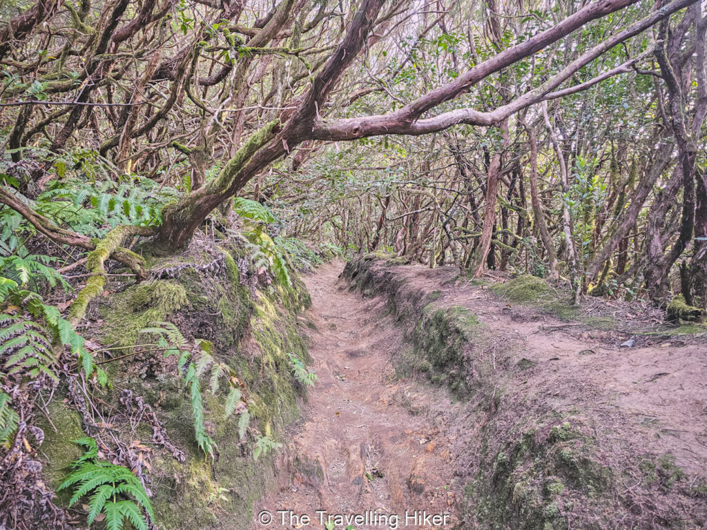
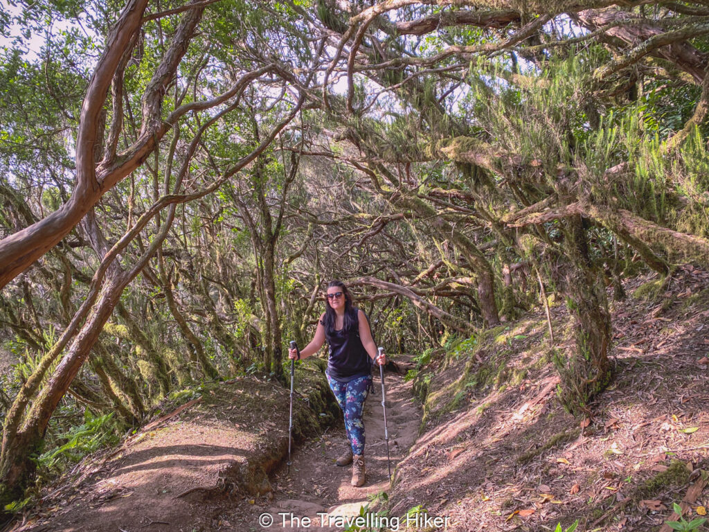
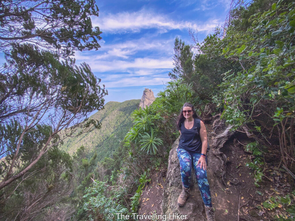
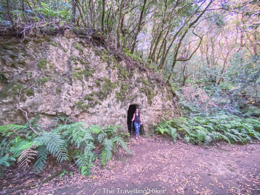
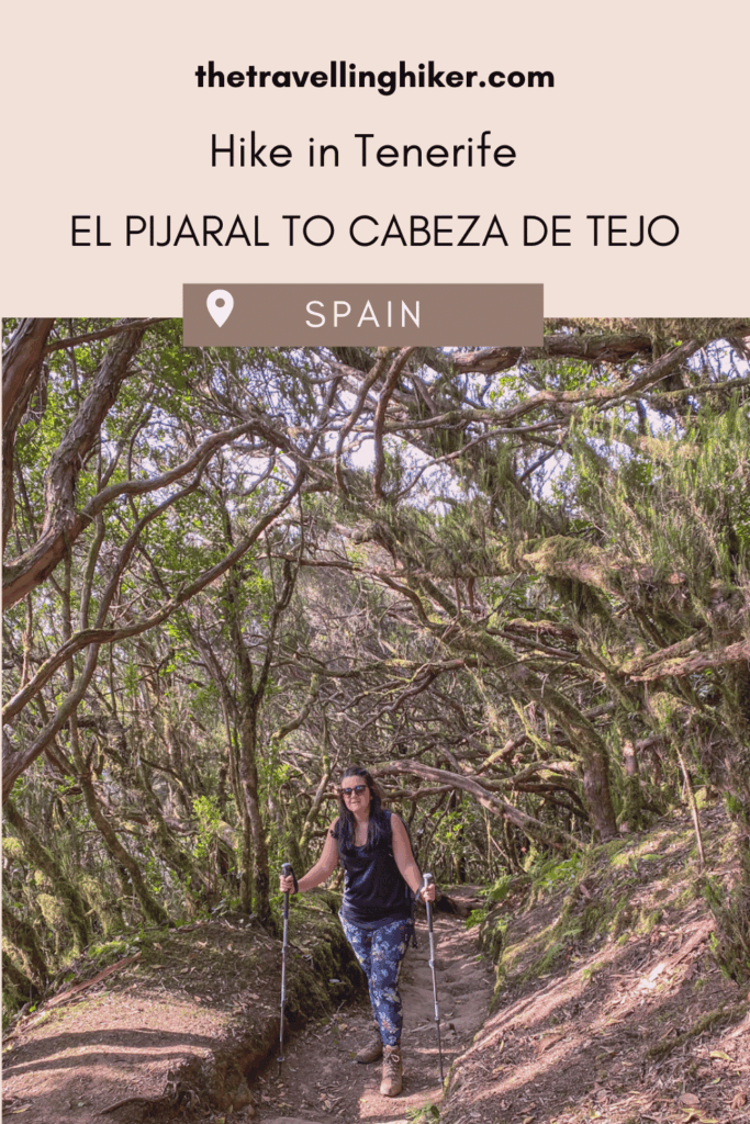
From the parking lot, you will immediately enter the Pijaral Natural Reseve and the laurel forest. The path is narrow giving the impression that you are walking throuhg a tunnel of vegetation. You will be surrounded by moss-covered laurel trees and ferns. The tree density is quite thick and they will arch above you, not allowing you to see what is outside.
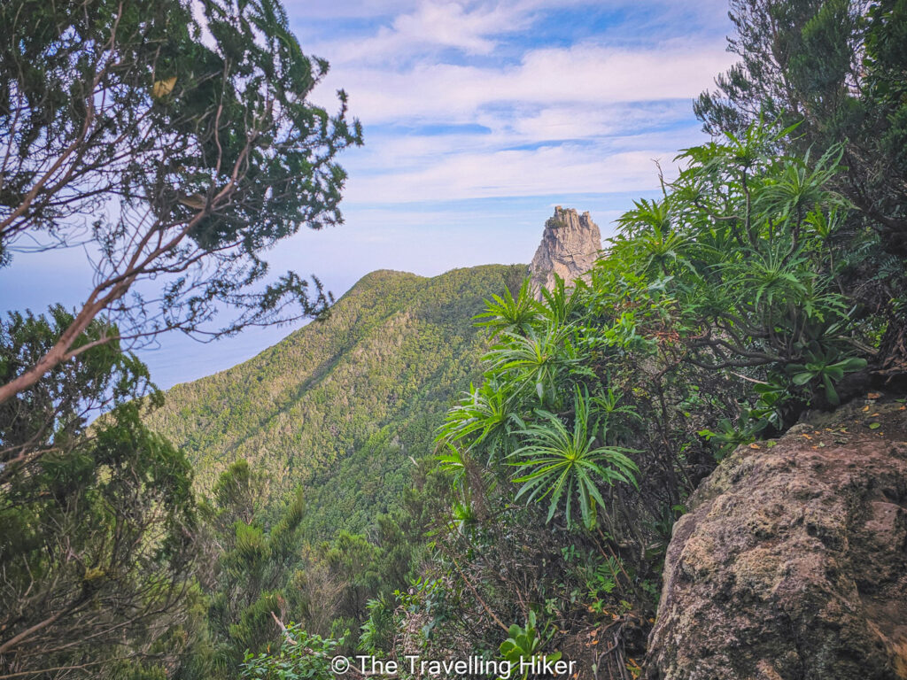
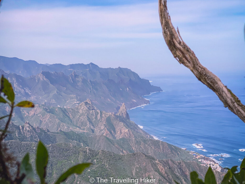
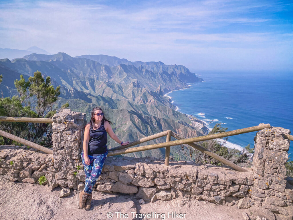
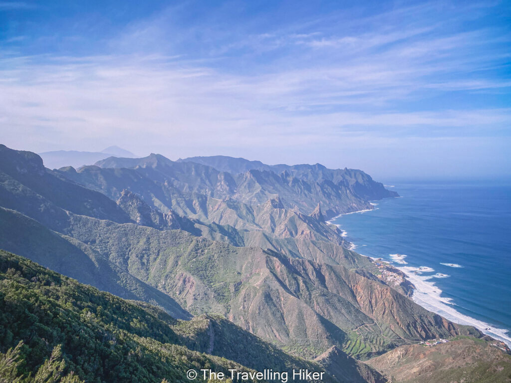
From time to time, the trees will open up giving you a glimpse into the beautiful northern coastline of Tenerife and Roque Anambro in the distance.
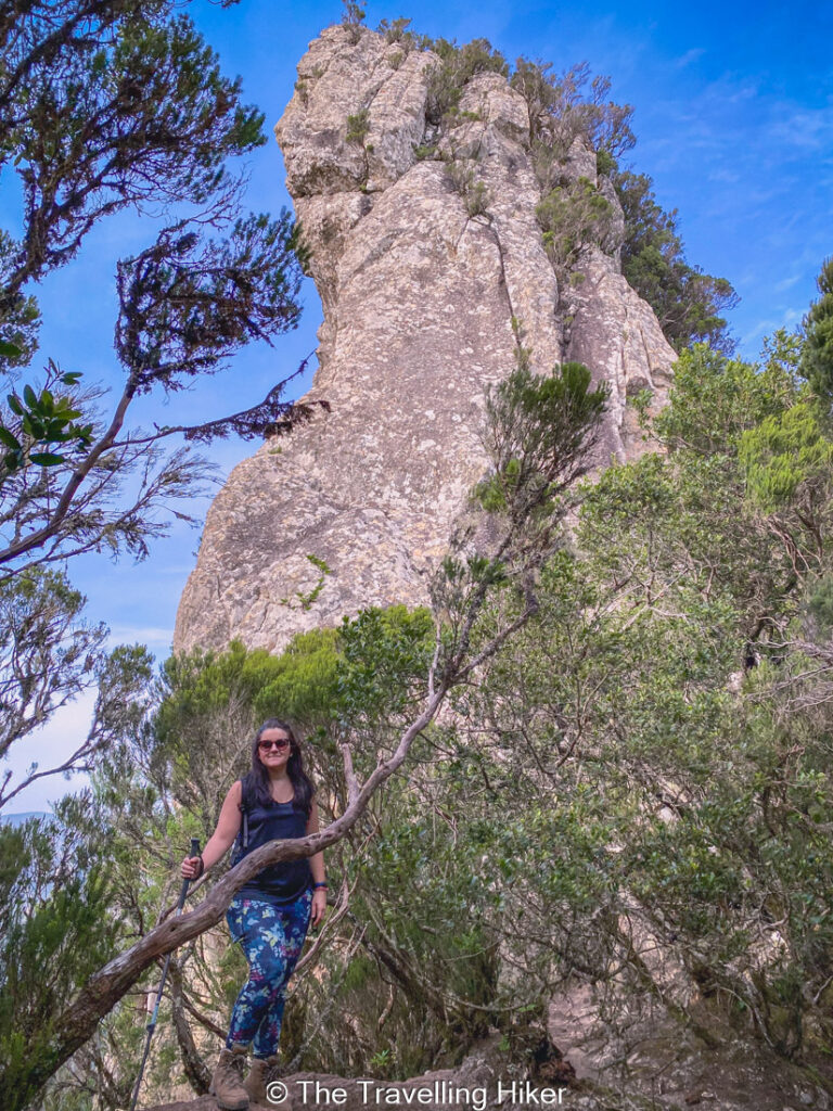
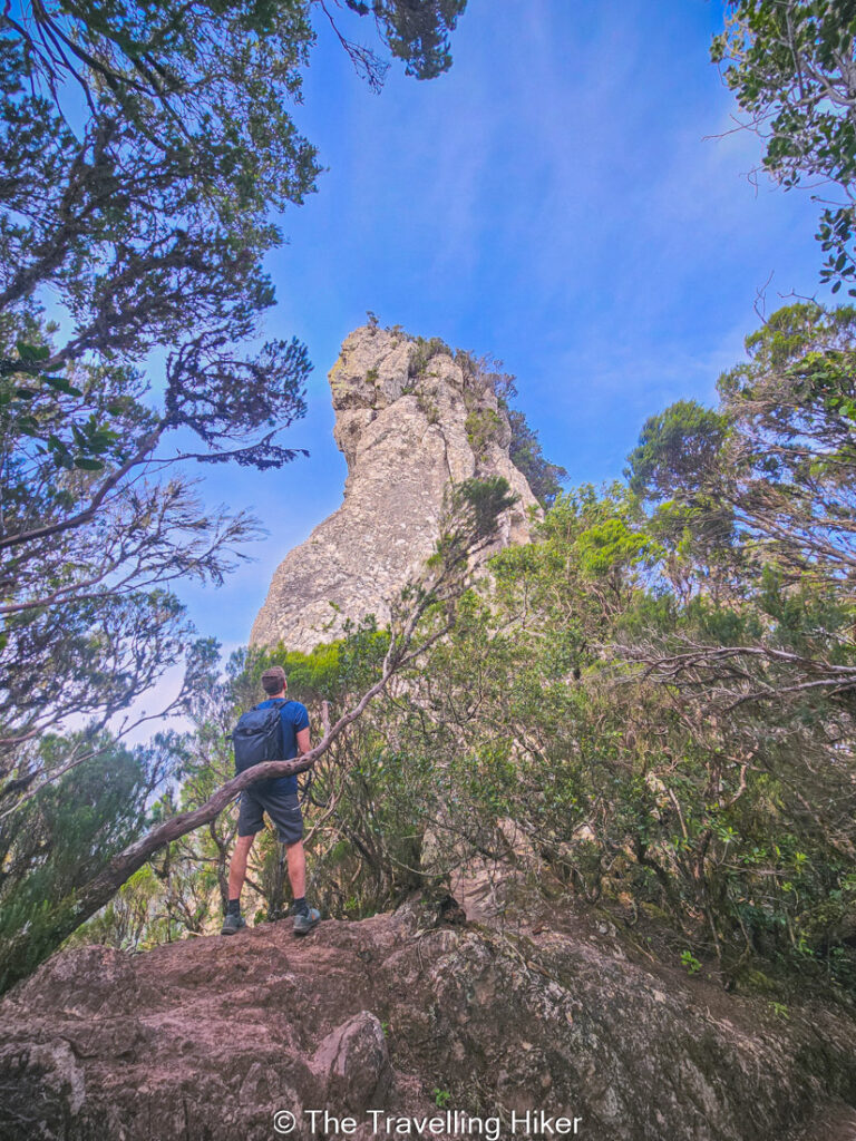
Cabeza del Tejo Viewpoint
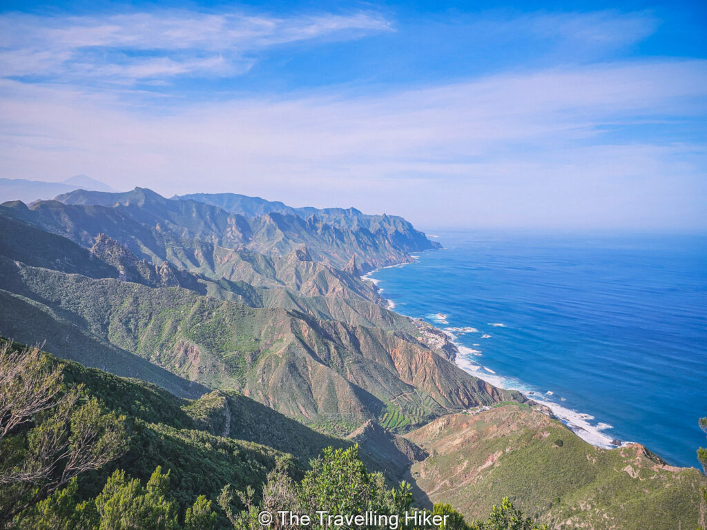
After around 3 km, you will reach Cabeza de Tejo, a rocky ledge offering dramatic views over the Roques de Anaga, the rugged Atlantic coastline, and even Mount Teide on a clear day.
Take a break here, it’s your reward. The silence, the air, and the views will stay with you long after your trip is finished. This viewpoint, makes the perfect spot for a picnic.
Returning to the parking lot
Once you’re done admiring the views, it’s time to continue the trail back to the parking lot. This part of the trail is wider and less impressive than the outbound part. However, from time to time, you will find small caves carved in the rocks. Once you reach the second parking lot, you will again enter the laurel forest for the last leg of the trail.
OTHER THINGS TO DO NEARBY
Here are some ideas of things you can do in the Anaga Rural Park to complete your day.
Extend your hike to Cruz del Draguillo and Chamorga. Do you feel like hiking some more? From Cabeza de Tejo Viewpoint, you can continue hiking all the way to Cruz del Draguillo and Chamorga. However, keep in mind that this will make the hike more challenging due to the elevation gain.
Check out the different viewpoints in Anaga Rural Park. The road that brings you to this trail is a beautiful scenic road with plenty of viewpoints along the way. Take your time and stop as many times as you want to enjoy the breathtaking views.
ACCOMMODATION NEAR THE HIKE
This hike is located deep within the Anaga Rural Park so there is not that much accommodation nearby. In my opinion, the best areas to stay if you’re planning to do this hike are either Santa Cruz de Tenerife or San Cristobal de La Laguna. Here is one recommendation that I would choose for these two places.
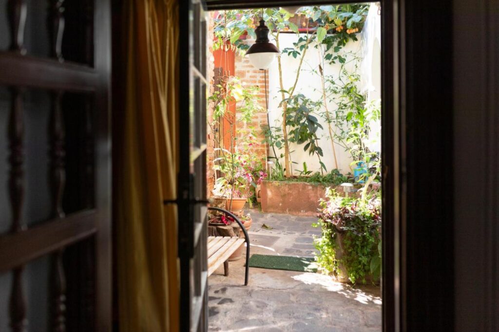
La Asomada del Gato
Charming and rustic hotel located in the center of San Cristobal de la Laguna, next to Anaga Rural Park. All rooms have a balcony that opens into a central courtyard in Canarian style.
Modern and comfortable hotel located in a prime location in Santa Cruz de Tenerife. The hotel has exceptional facilities that include a rooftop pool and parking. There no better way to rest and unwind after a day of hiking.
HOW TO USE THIS MAP: Click the star next to the map title to add this map to your google maps account. To view it on your phone while traveling, open Google Maps, click on the menu button and go to “Your Places”, click on Maps and you’ll see this map in your list.
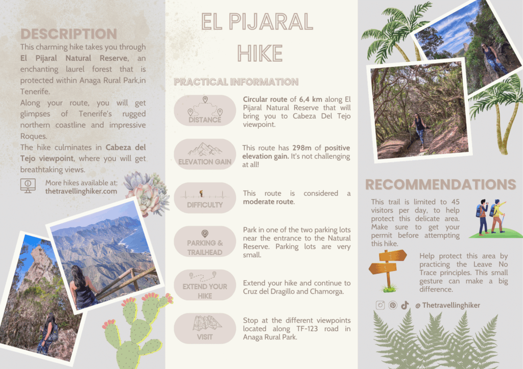
HIKE SUMMARY AND INFOGRAPHIC
And that’s it for this week’s blog. I hope you liked it and found it useful. Let me know what you think in the comments!
Happy hiking!
DISCLAIMER: Did you know? This blog uses affiliate partnerships. When you click and book or make a purchase through one of my blog posts, I may receive a small commission (at no extra cost to you). Thank you for supporting The Travelling Hiker!