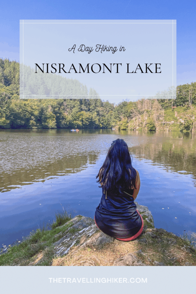
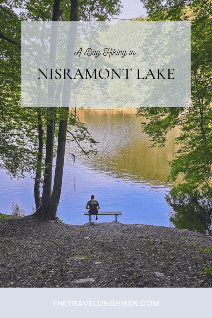
HIKING AROUND NISRAMONT LAKE – A SCENIC LOOP IN THE BELGIAN ARDENNES
July 19, 2025
If you’re looking for an unforgettable day hike in the heart of nature, hiking around Nisramont Lake in the Belgian Ardennes delivers breathtaking views, dense forest trails, river crossings, and true wilderness. Located in the Two Ourthes Natural Park, this circular trail is one of the most rewarding hikes in the region. A hidden gem for outdoor lovers seeking tranquility and adventure.
TABLE OF CONTENTS
LAKE NISRAMONT & THE TWO OURTHES NATIONAL PARK
Located near La Roche-en-Ardenne, Nisramont Lake was created by a dam where the Eastern and Western Ourthe rivers merge. This peaceful reservoir is surrounded by lush hills and forms part of the protected Parc Naturel des Deux Ourthes, a haven for hikers, wildlife, and nature conservation.
The surrounding park stretches across 76,000 hectares of forest, river valleys, and rock outcrops, perfect for hiking, photography, and birdwatching.
PRACTICAL INFORMATION ABOUT THE HIKE
HOW TO GET THERE?
The trailhead for this hike is located at the Nisramont Dam. Just search “Parking Barrage de Nisramont” in your GPS and follow the directions. It should take approximately 1 hour and 30 minutes to reach it from Brussels.
🅿️Parking: There is a big parking next to the dam so finding a parking spot should not be too complicated.
EQUIPMENT NEEDED
Even though this hike is not technically difficult, it does have some strenous uphills and downhills. The following equipment will make your hike easier.
Sturdy hiking boots. Shoes with a good grip are your best option in this hike, and if they are waterproof, even better! The trail can get muddy after a few rainy days.
Day backpack, to carry your water and snacks.
Water & Snacks. Make sure to bring plenty of water as there are no refills or cafés on the trail. We did this hike on a really warm sunny day and we run a bit short on water by the end of the hike.
Trekking poles (optional but helpful). Your knees will thank you for them.
Map or GPS app. The trail is marked but a GPS App like AllTrails, is always very handy.
Camera or smartphone, to capture all the beautiful sights.
BEST TIME TO DO THIS HIKE
The best time of the year to do this hike si between mid-spring to early autumn (April through October).This will increase your chances of good weather.
Avoid doing this hike after heavy reain, as some riverside sections can overflow, or get muddy and slippery.
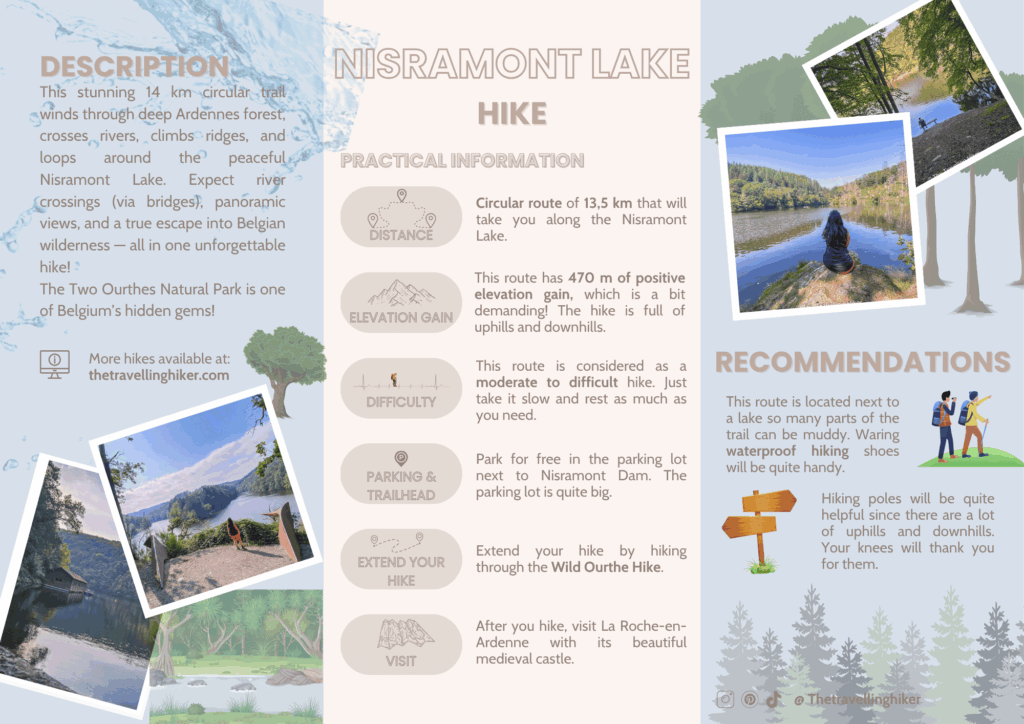
NISRAMONT LAKE LOOP TRAIL - TWO OURTHES NATURAL PARK
HIKE STATS
Trail Start/End – Nisramont Dam (Barrage de Nisramont)
Distance – 13 km
Elevation Gain – 470 m
Level – Moderate to Difficult
Route Type – Circular Route
Estimated Time Needed – 6 to 7 hours. This includes plenty of time to stop for a picnic, relax, and enjoy the scenery.
Best Time To Visit – Between April and October. However, I would recommend a sunny day to enjoy as much as possible.
HIKE MAP
I always use the AllTrails App during my hikes. The app has a GPX map that can help you stay on the right trail during your hikes. For this hike, we followed the Nisramont Lake Loop Trail.
HIKING AROUND NISRAMONT LAKE - STEP BY STEP GUIDE
Hiking until the first viewpoint: Avolare
From the parking lot, you will leave the Ourthe behind you, and you will begin directly with a steep uphill. There are some stairs to help you gain the altitud difference and you will be surrounded by mostly trees. But don’t worry, the uphill only goes for approximately 1 km. The trees will open up, showing you the river in the distance.
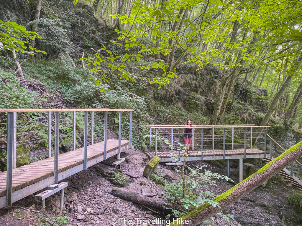
At this point, the trail will begin to descend until you reach the water level again. Along the trail, you will find some additional stairs and bridges to help with your progress.
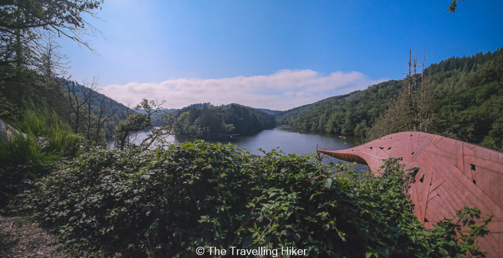
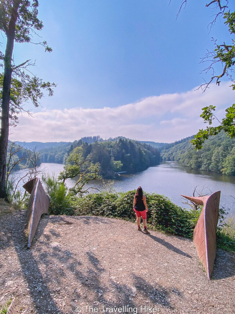
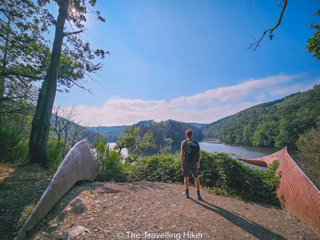
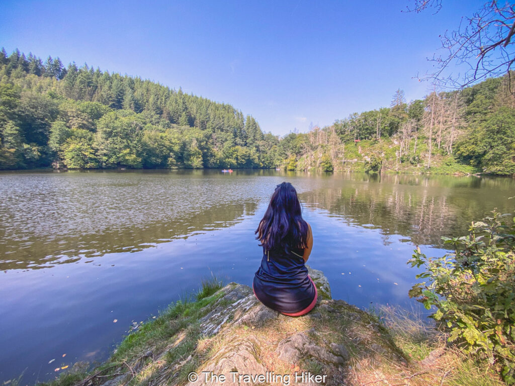
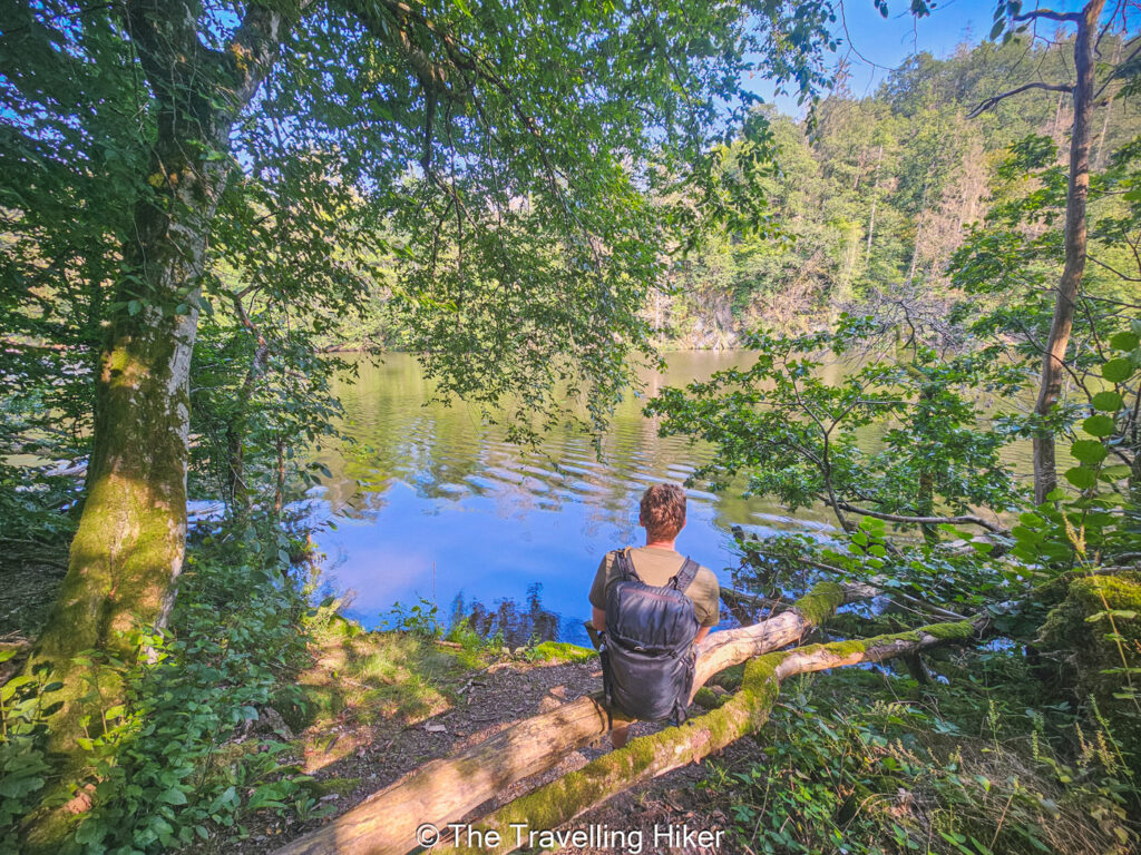
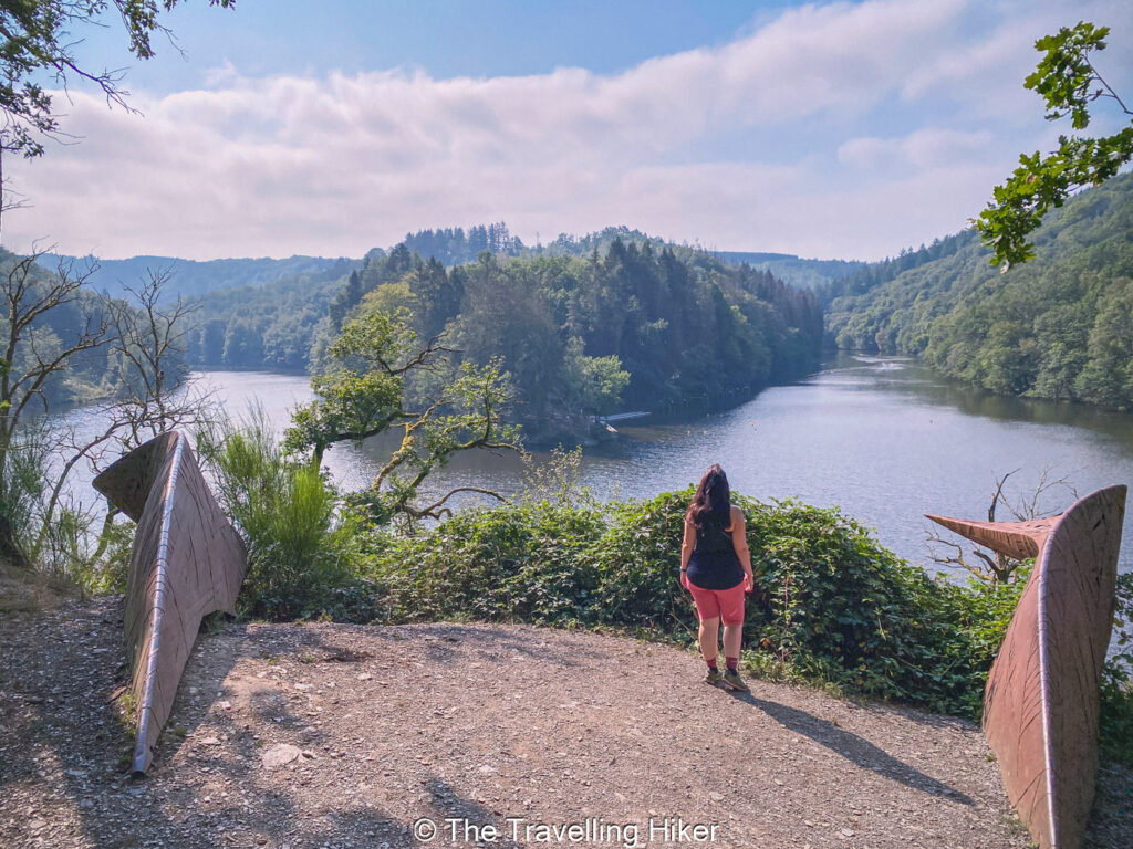
From here, the trail just follows the river with some uphills and downhills along the way, until you reach a viewpoint which offers stunning views of the point where the Ourthe splits into the Eastern and Western Ourthe. At this viewpoint, you will also find the art installation Avolare, which represents two wings that flow in different directions in a similar way to both branches of the Ourthe. This viewpoint is just fantastic, it was without a doubt my favorite part of this hike.
The Eastern Ourthe
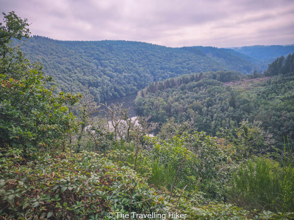
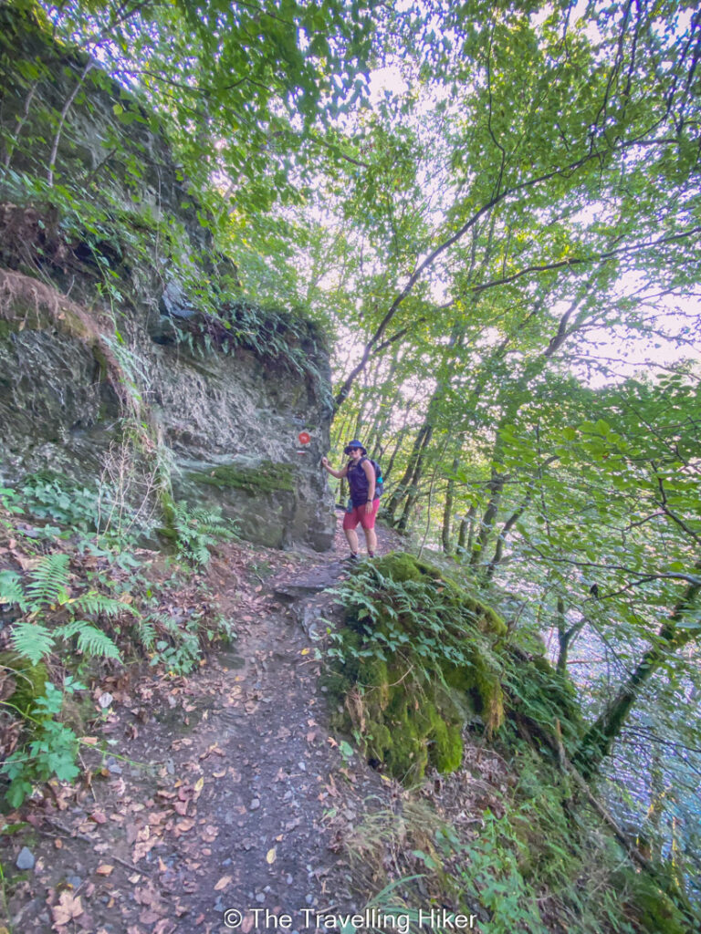
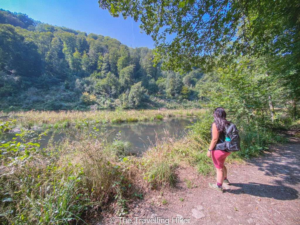
From Avolare viewpoint, the trail descends again until water level, and you hike along the eastern branch of the Ourthe. You will pass through dense forested areas, and next to some open fields, while the Ourthe remains on your right side.
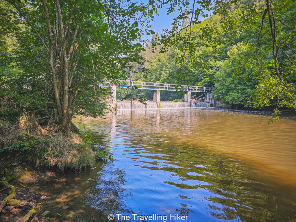
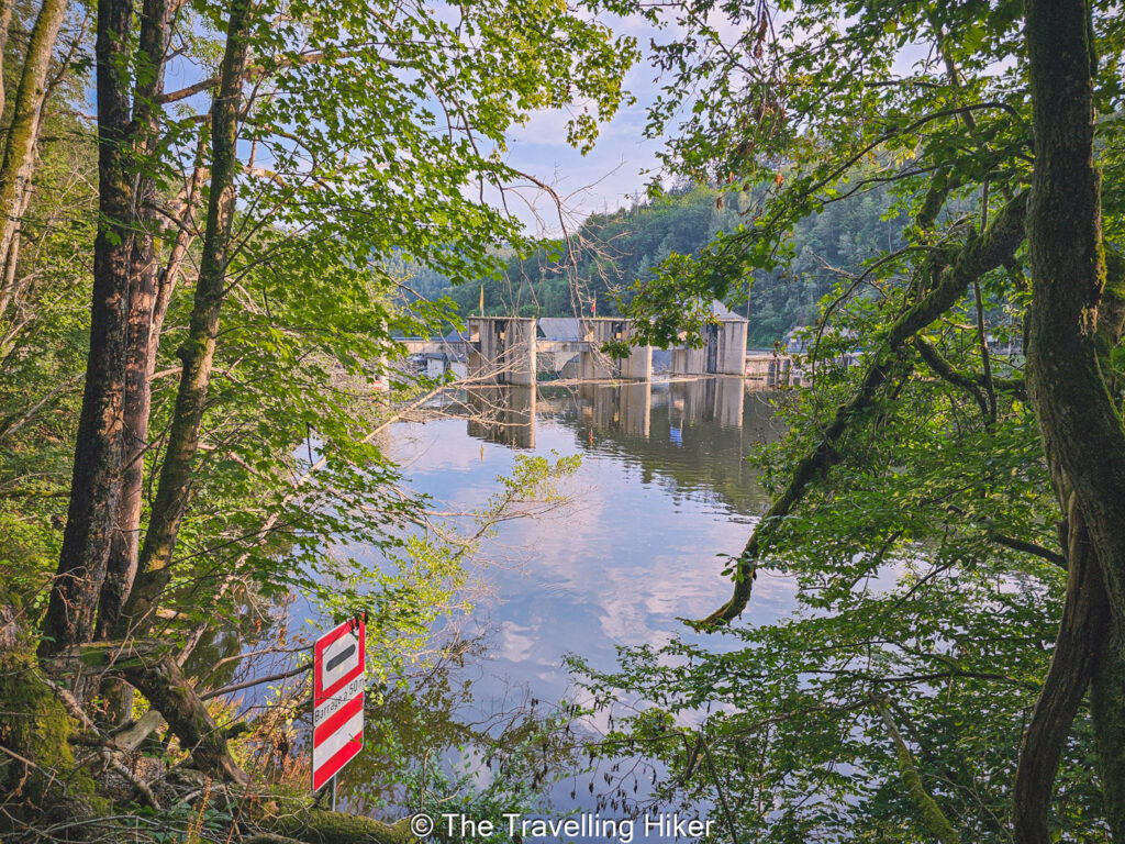
You will follow this trail until you reach a smaller dam with a bridge over it. It is time to cross the eastern branch of the Ourthe, and retrace your steps on the other side of the river.
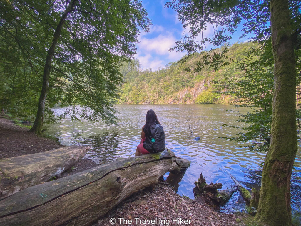
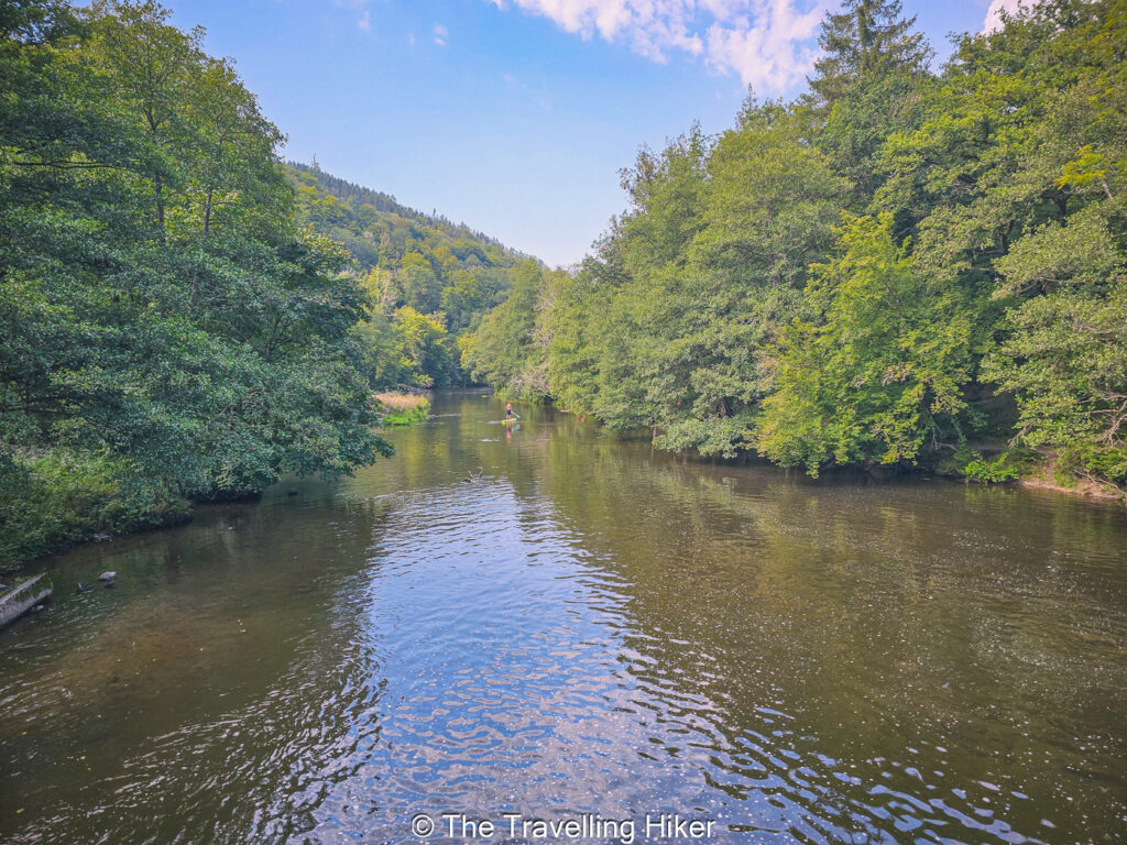
On this side of the river, follow the trail until you reach the point where the two Ourthes split. This is another amazing photo spot, and a great place to have a picnic lunch.
If you look carefully in between the trees, you should see the Avolare viewpoint in front of you.
The Western Ourthe
After a nice relaxing lunch, it is time to walk next to the water and along the Western Ourthe. Again, you will follow the river until you reach another small dam with a crossing over it.
Reaching Nisramont Dam
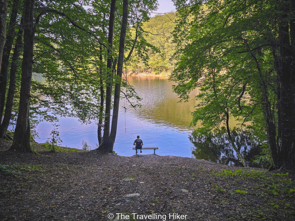
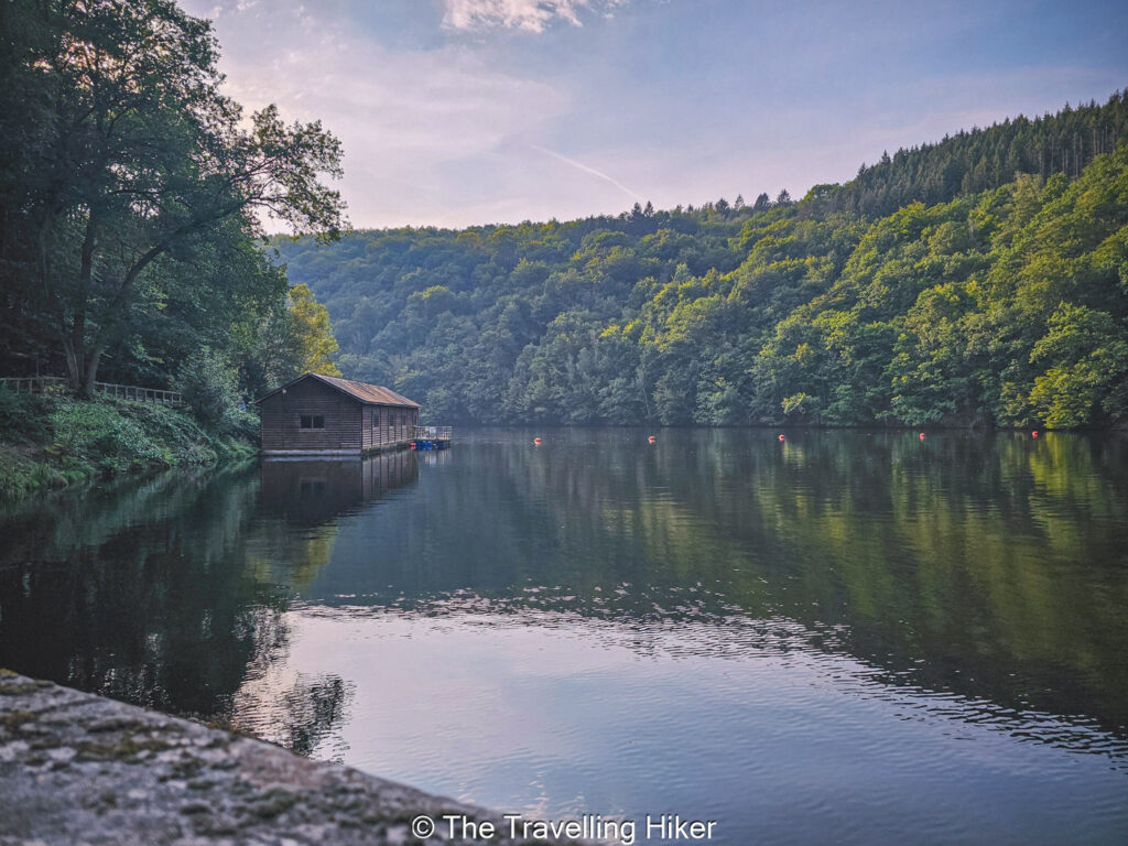
Once you’ve crossed the second Ourthe, all that is left to do is follow the trail back to Nisramont Dam. This part of the trail is pretty with several benches and spots to sit next to the water and enjoy the views.
Once you reach the dam, you just have to cross it, enjoy the views of the lake one last time, and you’ve finished the hike.
Good to know: The last 2 kilometers become a bit tedious because you can already see the dam in the distance but it is still a far away.
OTHER THINGS TO DO NEAR NISRAMONT LAKE
After you hike, consider exploring:
La Roche-en-Ardenne: A charming town with a medieval castle, cafés, and great local food.
Kayaking or Paddleboarding; In the warmer months, water activities are allowed in certain areas of the lake.
Hike The Wild Ourthe: If you still have some energy left, you can hike The Wild Ourthe Trail, another breathtaking trail within the Two Ourhtes Natural Park.
ACCOMMODATION NEAR NISRAMONT LAKE
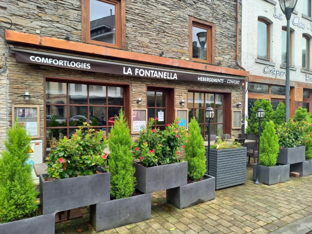
Want to stay overnight? Then I would recommend staying in La Roche-en-Ardenne. I would recommend Hebergement Comfort La Fontanella. This hotel is located in a historic building just 3 minutes walking from the Feudal Castle.
HOW TO USE THIS MAP: Click the star next to the map title to add this map to your google maps account. To view it on your phone while traveling, open Google Maps, click on the menu button and go to “Your Places”, click on Maps and you’ll see this map in your list.
HIKE SUMMARY AND INFOGRAPHIC
No time to read the full blog post? Here’s an infographic I’ve created with the most important information about this hike.
And that’s it for my blog about Nisramont Lakes. I hope you liked it and found it useful. Let me know what you think in the comments!
Happy hiking!
DISCLAIMER: Did you know? This blog uses affiliate partnerships. When you click and book or make a purchase through one of my blog posts, I may receive a small commission (at no extra cost to you). Thank you for supporting The Travelling Hiker!