HIKING IN BERDORF, LUXEMBOURG – MULLERTHAL B2 TRAIL
February 19, 2023
Hiking inBerdorf, Luxembourg, was my favorite part of our long weekend in Luxembourg. It was only supposed to be a short morning hike before we had to drive back to Belgium, but its beauty surprised us. It was also a super fun hike to do because it was full of canyons and caves that you can explore.
If you are planning a trip to the Grand Duchy of Luxembourg and you want to spend a day discovering the Mullerthal region, then I recommend you include this hike in your itinerary. Do you want to know more? Then keep reading to find out everything you need to know about Berdorf.
TABLE OF CONTENTS
THE MULLERTHAL REGION & BERDORF
The Mullerthal region, also known as Luxembourg’s “Little Switzerland”, is considered to be a paradise for hiking lovers.
In particular, the Mullerthal Trail is a 112 km long trail that offers forests and rivers combined with impressive canyons. Due to its length, it has been divided into several local hiking paths. You can find all the different possibilities on the Mullerthal website.
BERDORF - MULLERTHAL LOCAL B2 TRAIL
Berdorf is one of the most tourist areas in Luxembourg. It is located on a “plateau” overlooking the valleys of Black Ernz, the Sure, and the Aesbach.
In particular, the B2 Local Trail has many highlights along the hike such as:
The viewpoint of the Berdorfer Castle;
Parcours de Jean Siebertz or Siweschleff: A narrow canyon labyrinth that is quite fun to go through;
Teufelsinsel: Another set of canyons and narrow passages that will make you feel like an explorer;
Raiberhiel Cave: A cave that you enter through the bottom entrance and have to climb through several ladders to exit it.
PRACTICAL INFORMATION ABOUT THE HIKE
HOW TO GET TO THE MULLERTHAL TRAIL B2?
The easiest way to get to the beginning of the Mullerthal Trail B2 will be by driving a car. From Luxembourg City, you will have to drive the E29 direction Echternach until Bech. From there, you just have to follow CR137 road until you reach the parking lot (exact location at the map at the end of this blog).
Distance: 35km
Driving Time: 31 minutes
If you don’t have a car, you can also reach the trailhead by public buses but you will have to take several buses.
WHAT EQUIPMENT DO YOU NEED TO HIKE THIS TRAIL?
This trail is not particularly difficult so there’s no specific equipment that is needed. Nevertheless, the following might come in handy.
Sturdy hiking shoes
Backpack with snacks and plenty of water, especially if you’re doing the hike on a super warm day as we did.
HIKING IN BERDORF - MULLERTHAL TRAIL B2
HIKE STATS
Trail Start/End – Parking near Camping Martbusch (location in the map at the end of this blog).
Distance – 6,3 km
Elevation Gain – 214 m
Level – Easy
Route Type – Loop trail
Estimated Time Needed – 3 hours (including plenty of time to stop for photos). Remember to stay within the marked trails.
Best Time To Visit – From May to October to ensure the best possible weather.
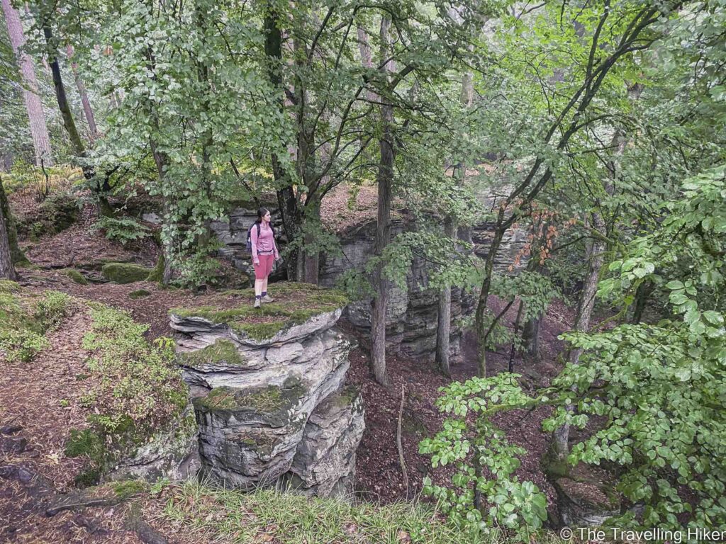
The first part of the trail was relatively easy. The trail begins at the top of a “plateau” so the first kilometer was a constant descent while you border the rock formations that you will later explore.
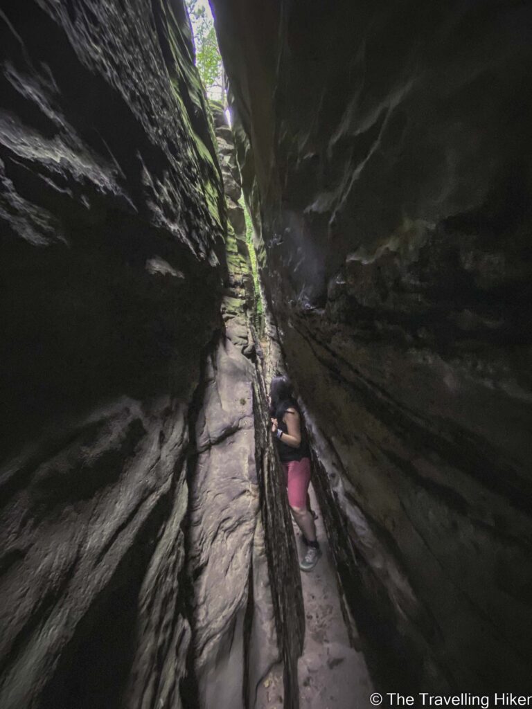
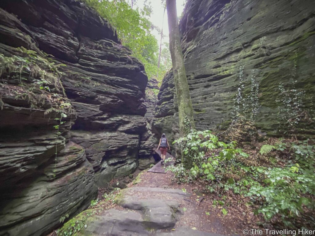
Once we had completed the descent, we reached the first highlight of the hike, Siweschleff, which translates into English as “seven gorges”. It is a rock labyrinth with narrow canyons that are approximately 30 cm wide and up to 20 meters high. Going through these canyons was a lot of fun. We felt like little kids again exploring the different canyons and trying to fit through the most narrow ones.
Good to know: Some of the gorges are really narrow. I had a hard time fitting through one of them. I you are claustrophobic or don’t deal well with tight places, you might want to avoid the narrowest gorges.
Once we were done exploring the labyrinth, we took the small path on the right which took us to the top part of this canyon maze. From there, we were able to admire the views of the area.
Exploring Wanterbaach
We continued along the trail and the next highlight we reached was Wanterbaach. These are other canyons and rock formations similar to the previous ones but a bit wider. We also spent some time exploring this area and climbing to the top of the rock formations to enjoy the gorges from above.
Good to know: Next to this area, there is also a rock climbing zone for those who like this sport.
Rauberhohle Cave
DISCLAIMER: Did you know? This blog uses affiliate partnerships. When you click and book or make a purchase through one of my blog posts, I may receive a small commission (at no extra cost to you). Thank you for supporting The Travelling Hiker!
During the last part of the hike, we entered Rauberhohle Cave. The entry to the cave was very low and we had to almost walk on our knees. However, after this first part, the height was ok and it was possible to stand up again.
To exit the cave, you will have to climb through some stairs and ladders. These were not difficult at all (many kids were climbing them). However, if you are afraid of heights they might be scary since you will be able to see the fall.
Once you are out of the cave, you can choose to explore the view from the plateau or continue the hike.
At this point of our hike, it started raining quite hard and we got a bit lost. Directions for the hike in this area are not very good.
When we managed to find the way to the trail with the GPS, we noticed we had skipped approximately 2 km of the hike. However, since it was raining a lot, we decided to return to the car and finish the hike for the day.
WHERE TO STAY IN LUXEMBOURG?
For a long weekend in Luxembourg, the best thing is to sleep in Luxembourg city and move around from there. This will allow you to explore the country without too much driving time and have plenty of places to have dinner in the evening.
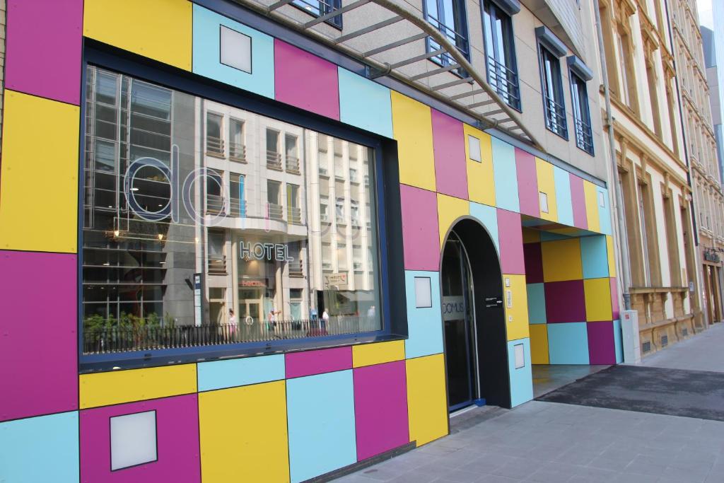
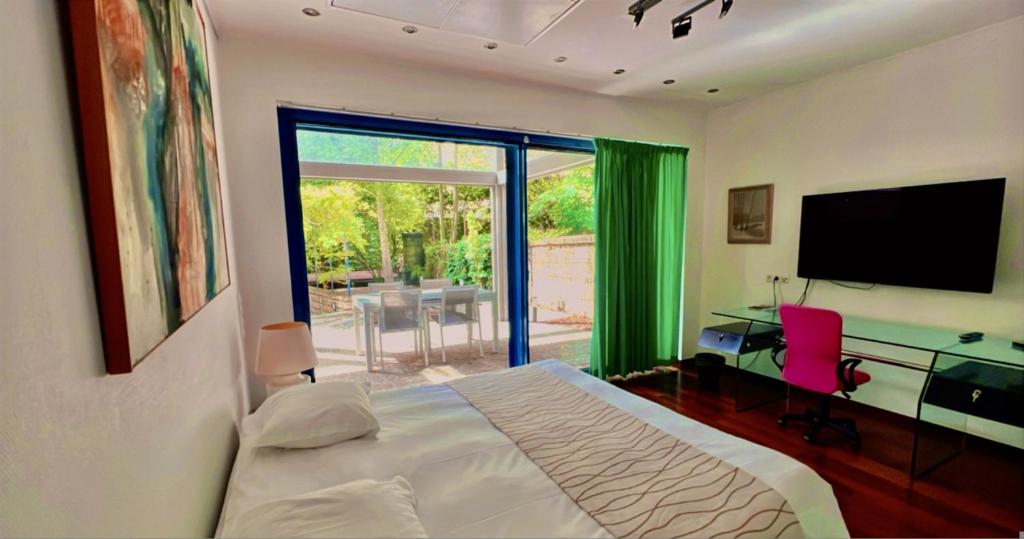
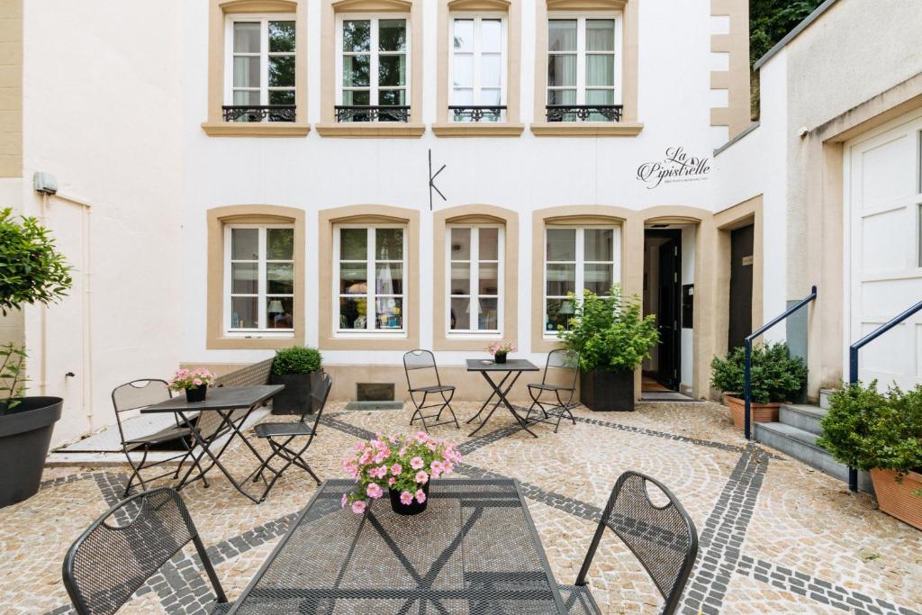
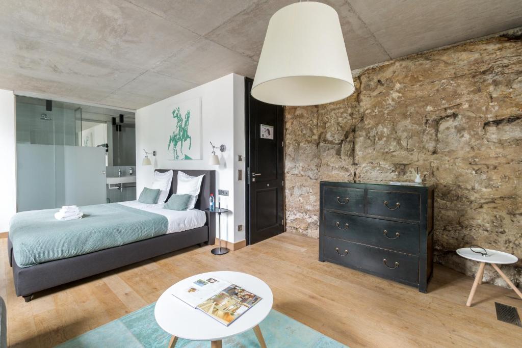
Domus Hotel
Domus Hotel has a primer location in central Luxembourg. This hotel has modern and comfortable rooms that even have a kitchenet in case you want to safe some money and cook your own meals.
If you are staying a bit longer and visiting the Mullerthal region for a few days, then you can book a night in the camping next to the beginning of the trail, Camping Martbusch. This camping offers small bungalows or pods for you to spend the night.
MAP WITH ALL LOCATIONS
HOW TO USE THIS MAP: Click the star next to the map title to add this map to your google maps account. To view it on your phone while traveling, open Google Maps, click on the menu button and go to “Your Places”, click on Maps and you’ll see this map in your list.
I hope you liked my blog about Hiking in Berdorf, Luxembourg. Let me know what you thought in the comments.
DISCLAIMER: This post contains affiliate links. Clicking and buying from them will be at no additional cost to you but I will get a small commission.