One of the main things to do in the Lake Myvatn area is to visit the Dimmuborgir Lava Fields and Caves. This area, full of rocky formations covered in moss and full of caves, is the perfect location for a short hike! Do you want to know more about it? In this guide, I will share with you all the necessary information to spend a wonderful time hiking in Dimmuborgir lava fields.
TABLE OF CONTENTS
DIMMUBORGIR
Dimmuborgir (in English Dark Fortress) are unique lava formations formed about 2300 years ago during an eruption of the Þrengslaborgir and Lúdentsborgir craters. The site is full of volcanic caves and unusually shaped rock formations that make it resemble an old village.
DIMMUBORGIR ACCORDING TO ICELANDIC FOLKLORE
In Icelandic culture, lava caves were the places where trolls would live. Particularly, in Dimmuborgir, it was the home to the Yule Lads or “Icelandic Santa Clauses”. However, these were not like the American Santa Claus, the Yule Lads would go out on the thirteen days before Christmas and terrorize Icelanders.
In modern years, the Yule Lads have been “Americanised” and are known more as mischievous tricksters. Before Christmas, they go out and steal skyr but also bring children gifts.
PRACTICAL INFORMATION ABOUT THE HIKE
GETTING TO DIMMUBORGIR
Dimmuborgir Lava Fields are located next to Lake Myvatn in the northern part of Iceland.
The best way to reach them is by renting a car and driving there yourself. Driving times will vary depending on where you are coming from.
From Akureyri, it is approximately 1 hour and 15 minutes drive to reach Dimmuborgir.
From Reykjahlid, the main village near Myvatn, it is only a 10 minute drive.
If driving is not your thing, you can always join a guided tour that includes Dimmuborgir in its itinerary. For example, this tour departing from Akureyri.
eQUIPMENT NEEDED
You don’t need specific equipment for this hike. However, the following might become handy.
Hiking shoes: You will be walking in between lava rocks, so good hiking shoes will be very useful.
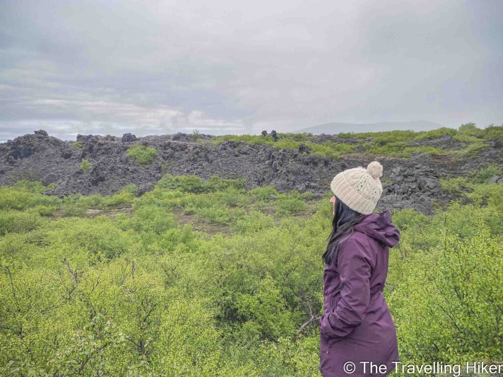
Different layers: During this hike, you will be in an exposed area, so it is recommended to wear different layers to adjust to the changing weather. As you can see from my photos, during the hike, we experienced warm weather and really cold wind.
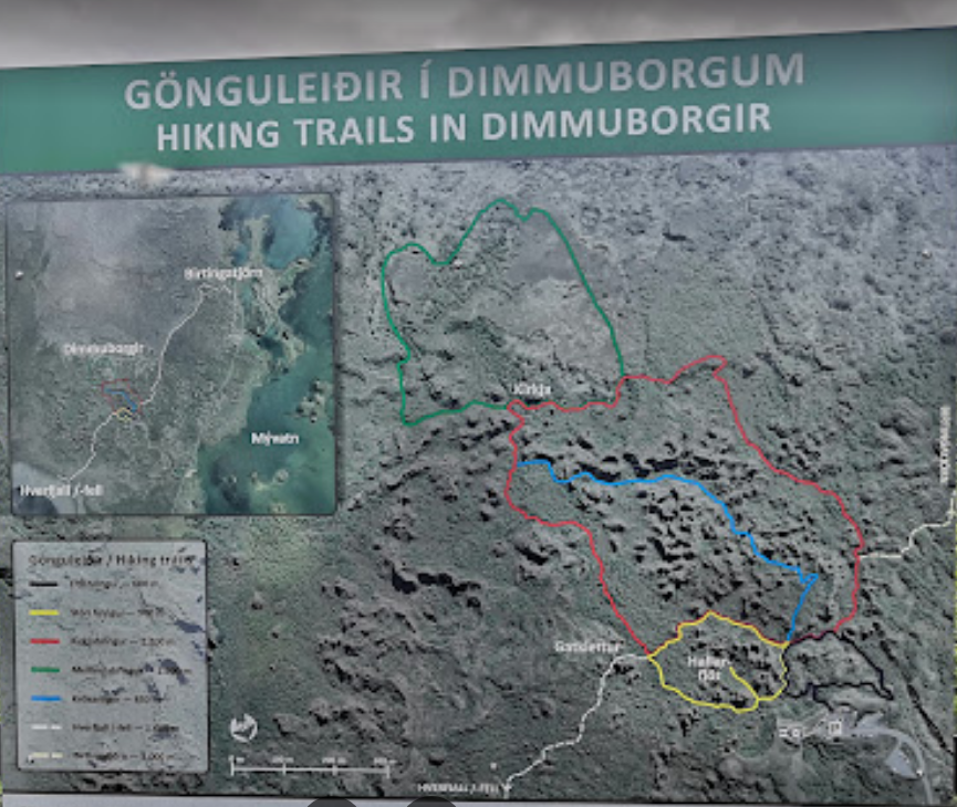
DIMMUBORGIR WALKING ROUTES
There are different walking paths in Dimmuborgir:
Litli Hringur or black trail (600 meters).
Stori Hringur or yellow trail (900 meters). This path takes you the Hallarflöt and the Yule Lads cave.
Kirkjuhringur or red trail (2200 meters). This path takes you to the Kirkja (church), one of the main sites in Dimmuborgir.
Mellandahringur or green trail (1000 meters). This trail is right behind the Kirkja and takes you to some sandy lava fields.
Krokastigur or blue trail (850 meters). This trail is marked as difficult.
HVERFJALL CRATER HIKE
HIKE STATS
Trail Start/End – Dimmuborgir Parking Lot (exact location at the end of this blog)
Distance – 4,5 km
Elevation Gain – 80 m
Level – Easy
Route Type – Circular Route
Estimated Time Needed – 2 hours (including plenty of time to stop for photos). Remember to stay within the marked trails.
Best Time To Visit – July to September to ensure the best weather conditions.
HIKE MAP
I always use the AllTrails App during my hikes. The app has a GPX map that can help you stay on the right trail during your hikes. For this hike, we followed the Dimmuborgir: Kirkjuhringur – Mellanahringur Trail. which is a combination of the yellow, red, and greem trails.
MY EXPERIENCE HIKING IN DIMMUBORGIR LAVA FIELDS - STEP BY STEP GUIDE
Yellow Trail and Yule Lads Cave
We arrived at Dimmuborgir at the same time as a big guided tour. Since they were heading directly to Hallarflöt and the Kirkja, we decided to do the hike clockwise to avoid the big crowds.
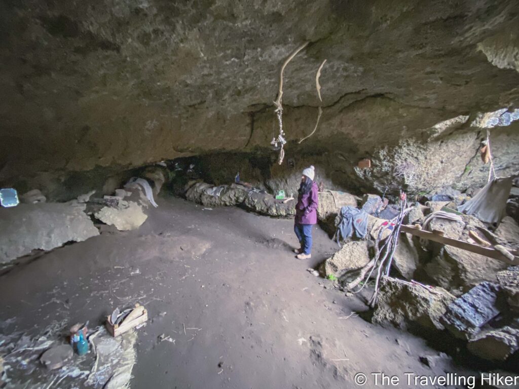
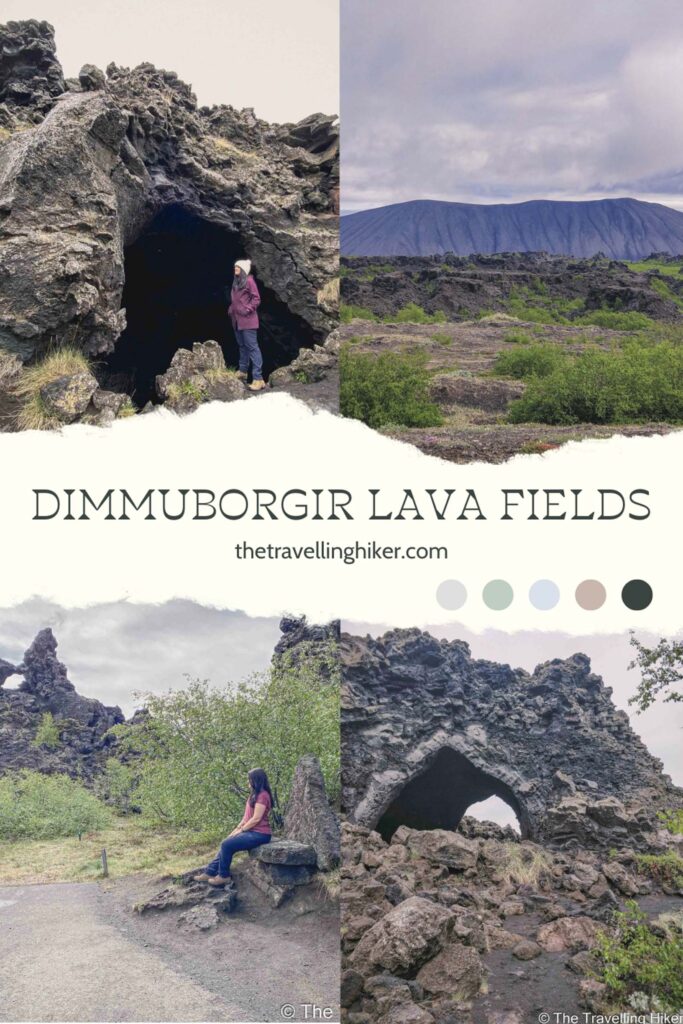
The first thing we encountered was teh Yule Lads cave. This cave was not so special but it was staged to resemble what it would be like to live here.
From there, you could also have an aerial view of the impressive Dimmuborgir fields with Hverfjall crater in the background.
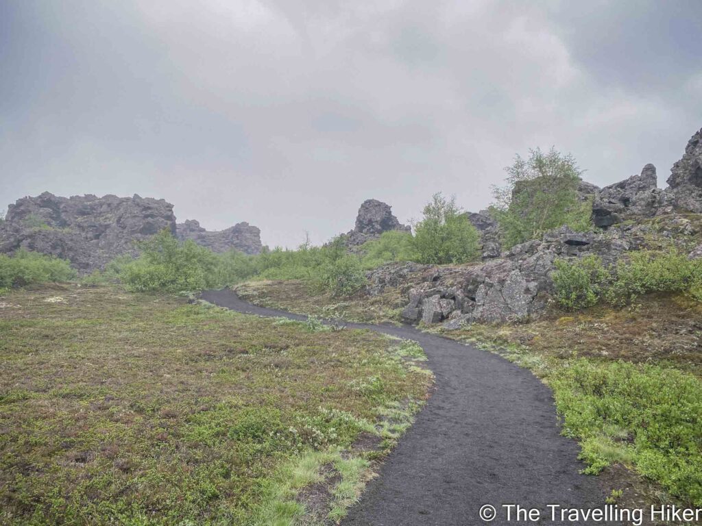
Walking the red route until the Kirkja
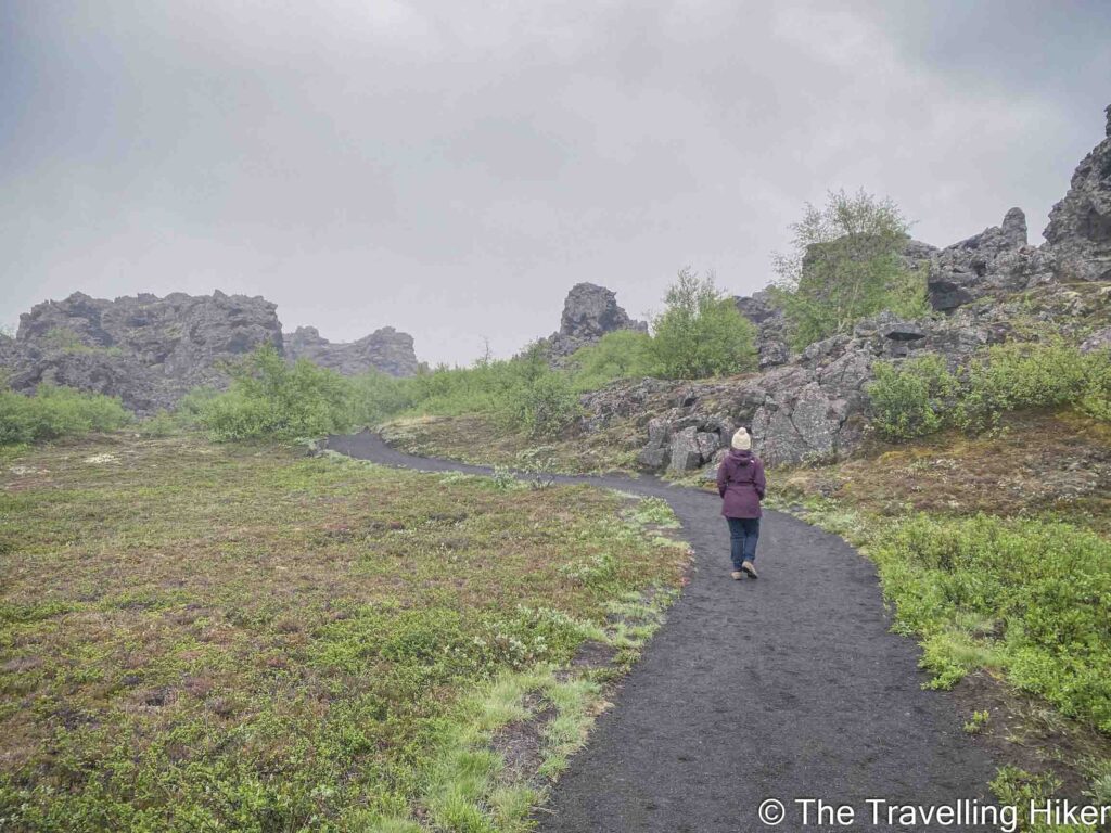
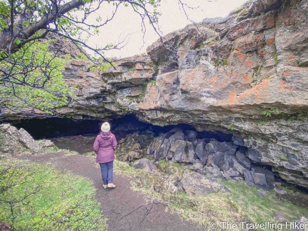
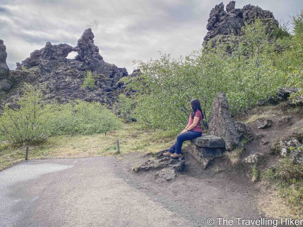
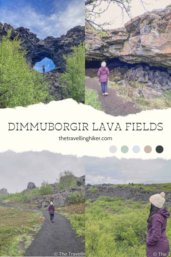
After the cave, we kept following the red path through Dimmuborgir. This part of the trail (in my opinion) is a bit monotonous until you reach the Kirkja cave. It is just walking along endless lava covered in moss.
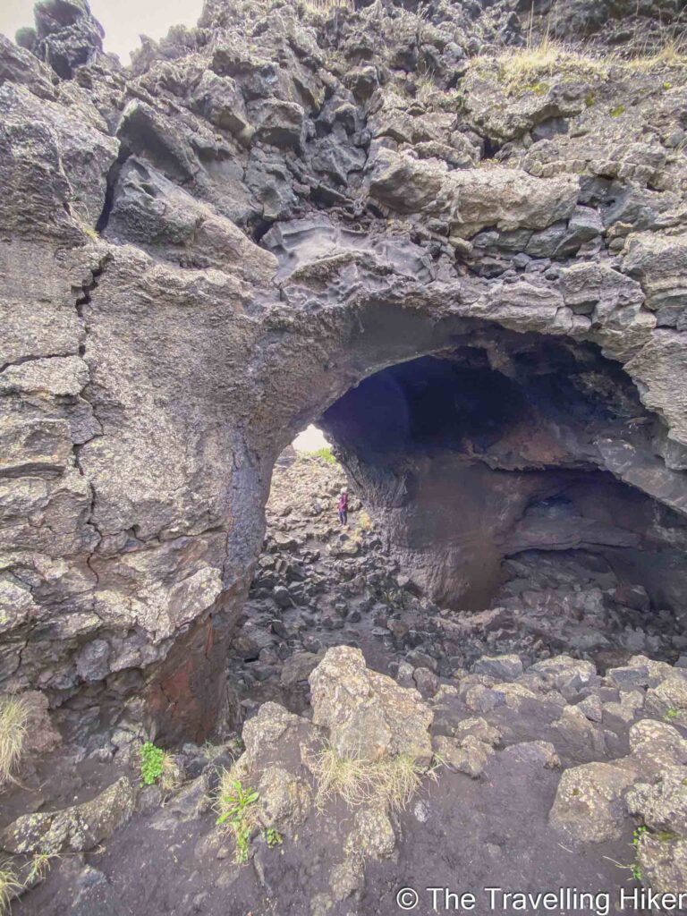
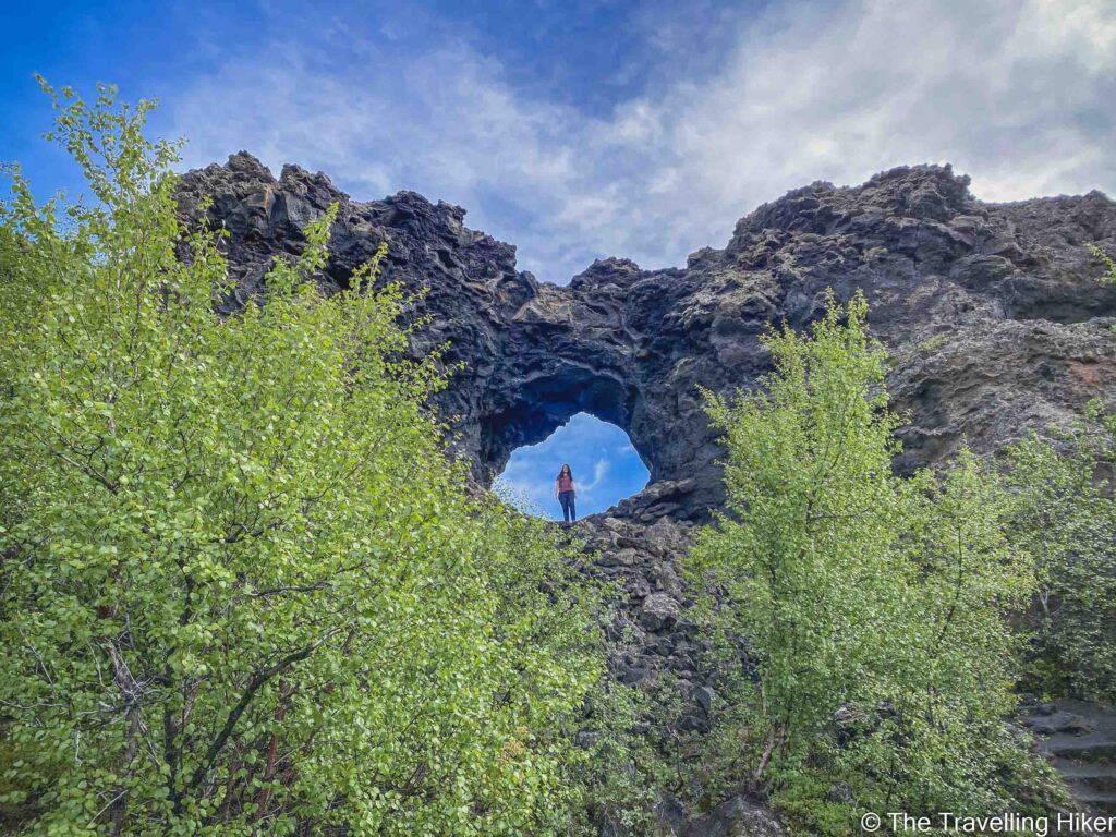
However, once you reach the Kirkja or Dimmuborgir Church cave, the area is impressive. The Kirkja was named like this because of its shape. It is open on two ends and has a dome-like shape.
Sandy Lava Fields along the Green Route
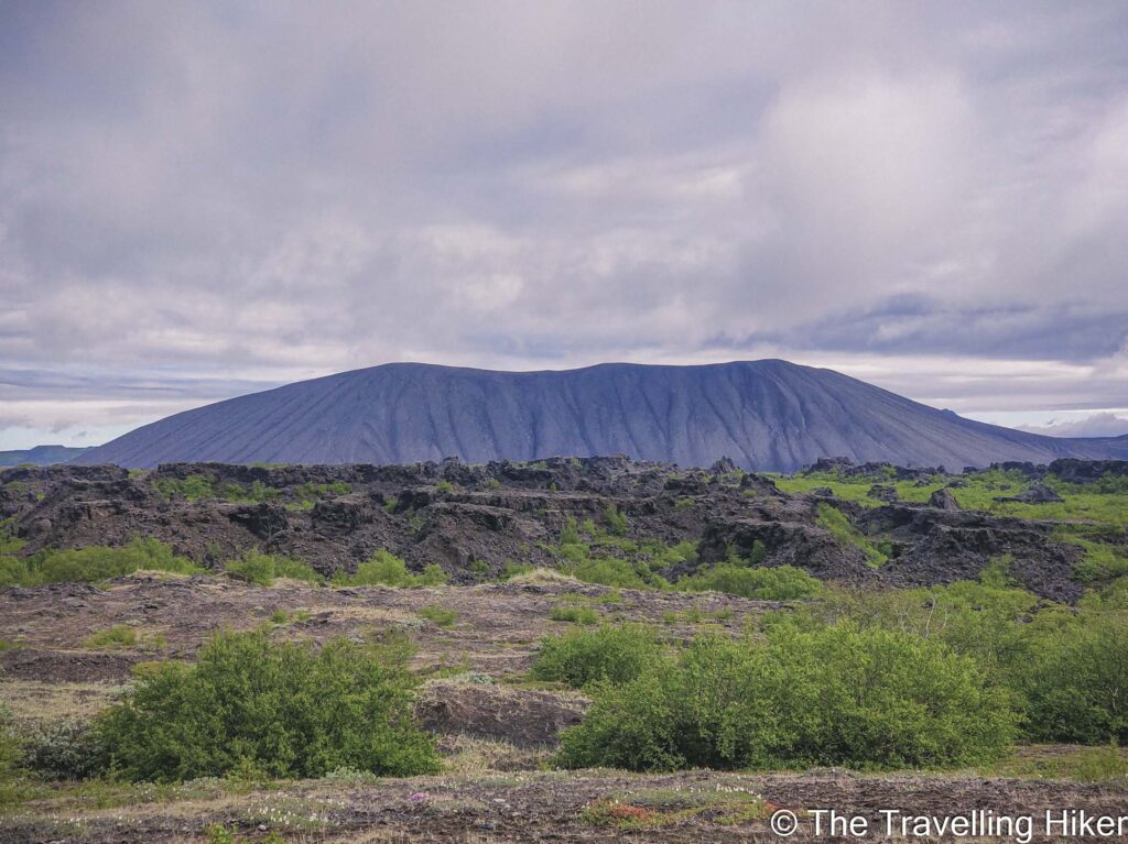
Right before reaching the Kirkja Cave, the green trail will begin. This trail goes a little further south of Dimmuborgir where the lava fields are covered in sand and moss.
From here, you can get a really nice view of the Hverfjall Crater next to Dimmuborgir. However, it is the only remarkable part of this Green Circle so if you have limited time, you can skip this part of the hike and just follow the red trail.
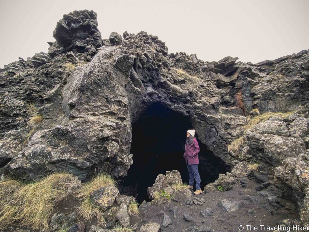
Rock Caves and Arches along the Red Trail
Once we were done with the green trail, we returned to the red trail to do what was my favorite part of Dimmuborgir. This area was full of rocky formations and caves of different shapes. We kept stopping along the way to admire them and see if it was possible to enter the caves.
Hallarflöt
The last part of the trail was on the yellow loop where we saw the Hallarflöt rocky formations. This is one of the other main sites in Dimmuborgir.
ACCOMMODATION IN MYVATN
There are many things to see and visit around Lake Myvatn. To be able to enjoy this beautiful region in the North of Iceland, I recommend spending a minimum of one night here. Here are some hotel and guesthouse recommendations.
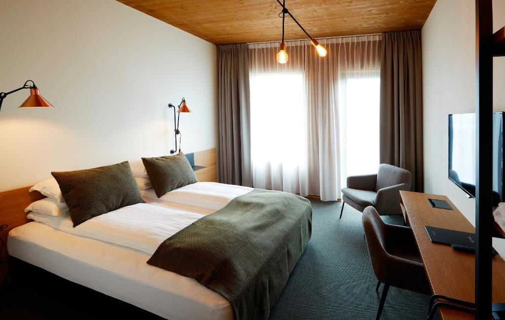
Skútustadir Guesthouse (€€)
Skútustadir Guesthouse is family-owned guesthouse set on a farm by the southern shore of Lake Mývatn. Rooms are cleaned and comfortable and you can choose between rooms with a private or shared bathrooms. They also offer a shared kitchen where you can cook your own meals and save some extra morney.
We stayed 2 nights here and we had a fantastic time there. The staff here was super helpful and friendly.
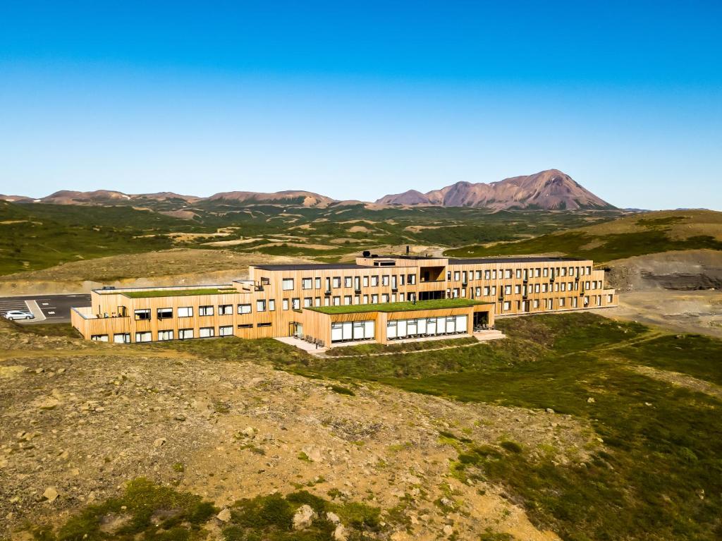
If you’re looking for a more traditional hotel experience, then I recommend you stay at Fosshotel Myvatn. All rooms are super comfortable and have every amenity that you might think of.
HOW TO USE THIS MAP: Click the star next to the map title to add this map to your google maps account. To view it on your phone while traveling, open Google Maps, click on the menu button and go to “Your Places”, click on Maps and you’ll see this map in your list.
DISCLAIMER: This post contains affiliate links. Clicking and buying from them will be at no additional cost to you but I will get a small commission.