When planning your next trip to the Grand Duchy of Luxembourg, you should consider adding a couple of extra days to visit the Mullerthal Region in the eastern part of the country. This region will surprise you with its dense forests, rivers and streams, and impressive rock formations. Are you interested in knowing more? Then keep reading my blog about hiking the Mullerthal Trail.
TABLE OF CONTENTS
THE MULLERTHAL TRAIL
The Mullerthal region, also known as Luxembourg’s “Little Switzerland”, is considered to be a paradise for hiking lovers.
In particular, the Mullerthal Trail is a 112km long trail that offers forests and rivers combined with impressive canyons. Due to its length, it has been divided into several local hiking paths. You can find all the different possibilities on the Mullerthal website.
W7 - MULLERTHAL HIKING TRAIL
The W7 hiking path is a relatively new trail with the following main highlights.
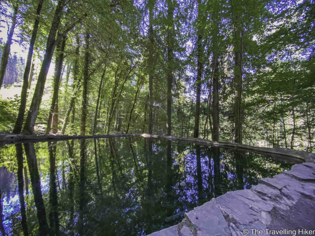
Kalktuffquell: Travertine water source within the Black Ernz Valley. Cristal clear calcareous water flows down from a natural pool into the rocks.
Schiessentumpel: A waterfall with three water streams located under a beautiful stone bridge.
Mellerdal Stairway: A recently built modern stairway over the cliffs.
PRACTICAL INFORMATION ABOUT THE HIKE
HOW TO GET TO THE MULLERTHAL TRAIL W7?
The easiest way to get to the beginning of the Mullerthal Trail W7 will be by driving a car. From Luxembourg City, you will have to drive the E29 direction Echternach until Bech. From there, you just have to follow CR137 road until you reach the parking lot (see map).
Distance: 30km
Driving Time: 31 minutes
If you don’t have a car, you can also reach the trailhead by public buses but you will have to take several buses.
WHAT EQUIPMENT DO YOU NEED TO HIKE THIS TRAIL?
This trail is not particularly difficult so there’s no specific equipment that is needed. Nevertheless, the following might come in handy:
Proper hiking shoes
Backpack with snacks and plenty of water, particularly if you’re doing the hike on a super warm day as we did.
Swimsuit and a light towel: On a warm summer day, plenty of people were swimming near the waterfall.
HIKING THE MULLERTHAL TRAIL - W7 TRAIL
HIKE STATS
Trail Start/End – Mullerthal Parking Lot (location in the map at the end of this blog).
Distance – 11,27 km
Elevation Gain – 321 m
Level – Easy to Moderate
Route Type – Loop trail
Estimated Time Needed – 5 hours (including plenty of time to rest and even wet your feet near the waterfall).
Best Time To Visit – From May to October to ensure the best possible weather.
HIKE MAP
I always use the AllTrails App during my hikes. The app has a GPX map that can help you stay on the right trail during your hikes. For this hike, we followed the Mullerthal Trail W7.
MY EXPERIENCE HIKING THE MULLERTHAL TRAIL W7
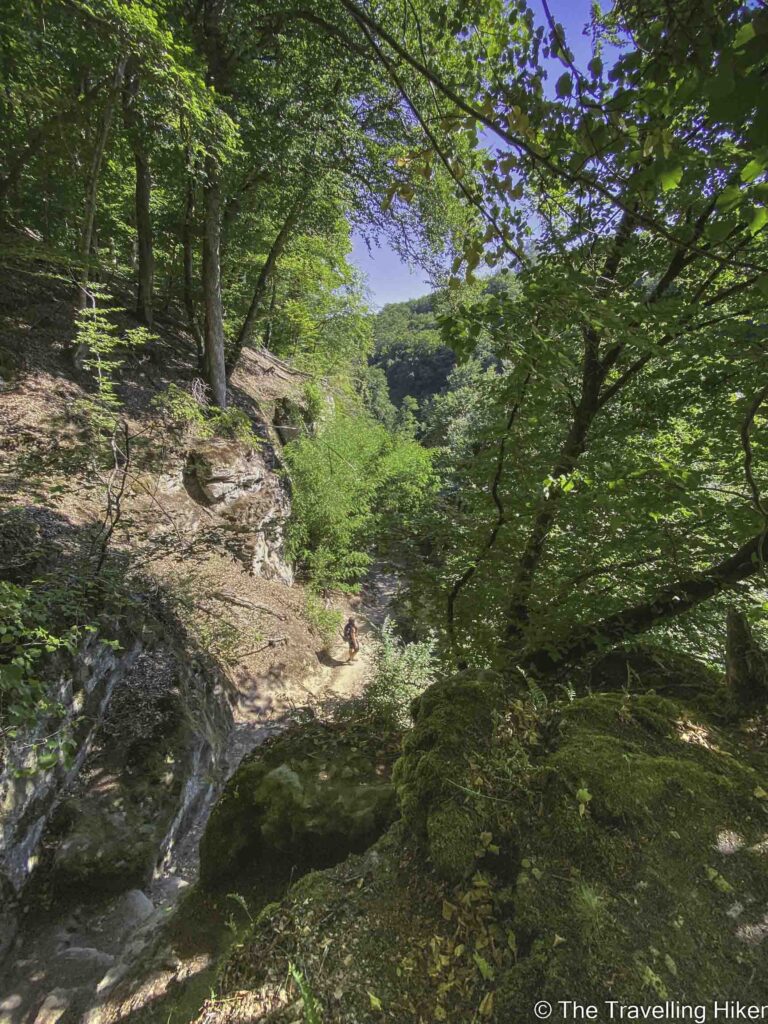
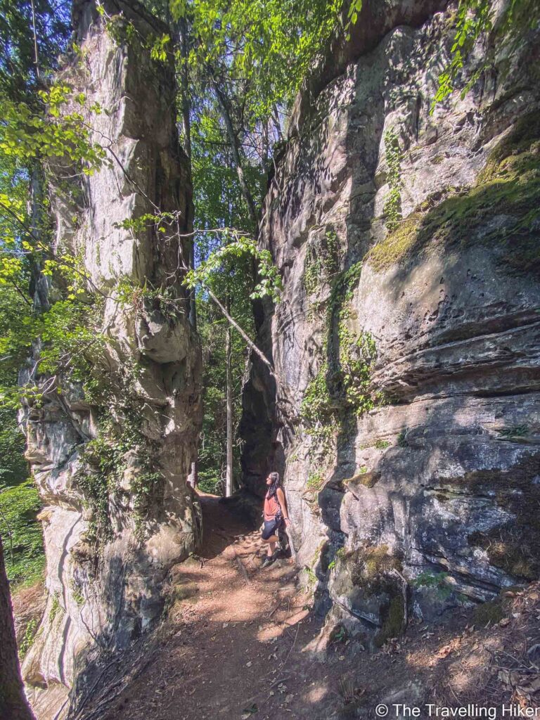
Hiking between high rock formations
After parking our car in the parking lot next to the trailhead we began our hike. The trail immediately started to go uphill until we reached a small wood pavilion overlooking the valley. Once we had completed the hike, we would know that this was the most difficult part of the trail.
From there, we started our descent surrounded by lush green trees and huge rocky formations. It felt like we were not in Luxembourg and I started to understand why this region is called Little Switzerland.
Reaching Kalktuffquell
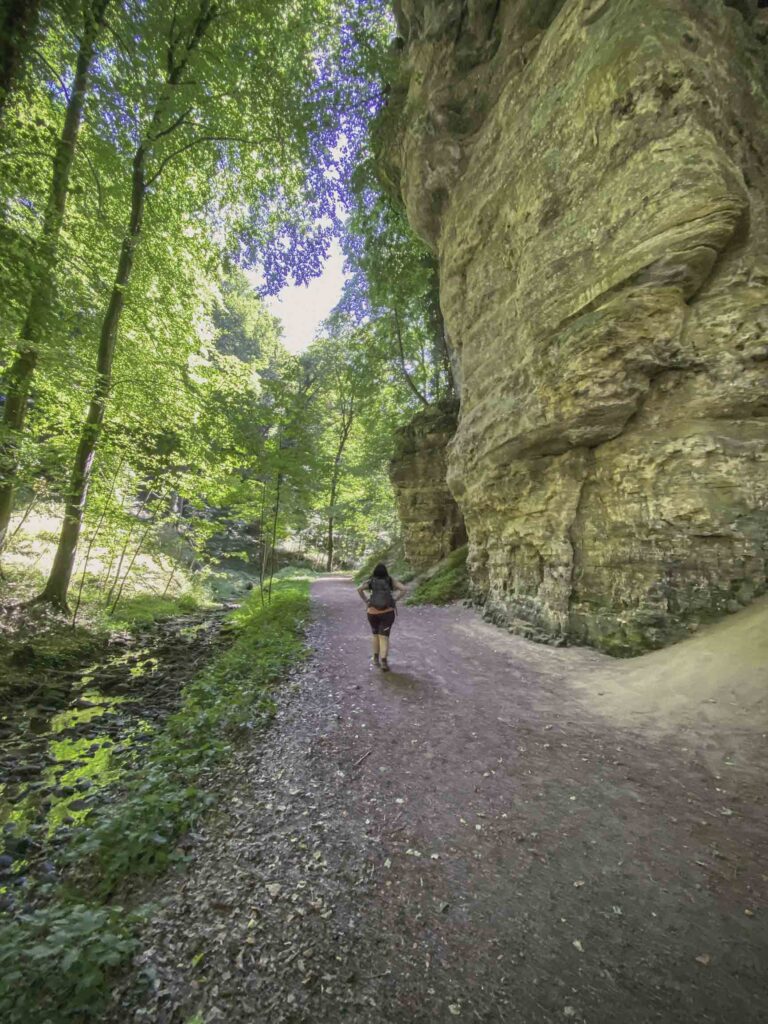
After a few kilometers, the scenery changed from rocky to just trees and a small stream flowing next to us. There were not many people walking around us so it was quite peaceful.
Soon enough we arrived at a clear water rock pool. It was quite warm, so we decided to wet our feet, cool down, and relax on its border. This water pool had a tube that fed water into a canalization over a rock formation creating a thin waterfall similar to a veil that fell into a second pool.
The Schiessentumpel Waterfall
After this point, the rest of the hike was a peaceful quiet walk around trees and rocky formations. Toward the end of the hike, we reached the Mellerdal Stairway, a wooden passerelle and stairway hanging from the rocks.
The last highlight of this hike was the Schiessentumpel waterfall, a three-stream small waterfall with a beautiful rock bridge over it. It was the perfect spot for a dip in the water and cool down from the summer heat. Unfortunately, we had forgotten to bring our swimsuits so we just took off our shoes and wet our feet in the cool water. It was the perfect ending to this hike.
WHERE TO STAY IN LUXEMBOURG?
For a long weekend in Luxembourg, the best thing is to sleep in Luxembourg city and move around from there. This will allow you to explore the country without too much driving time and have plenty of places to have dinner in the evening.
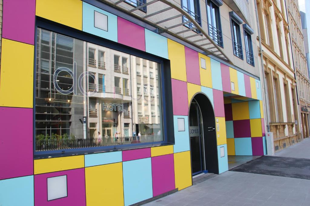
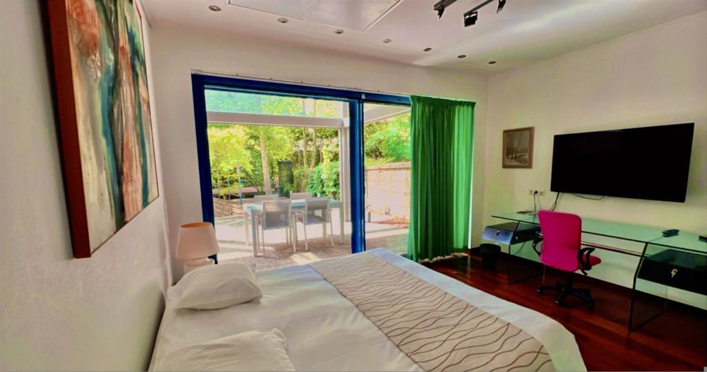
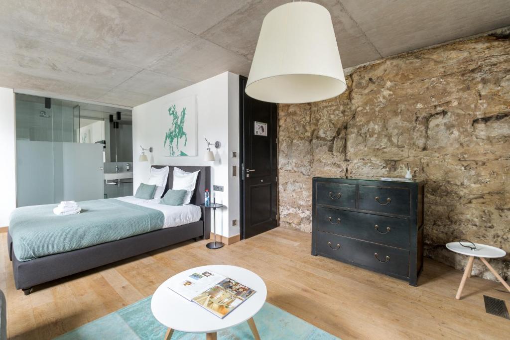
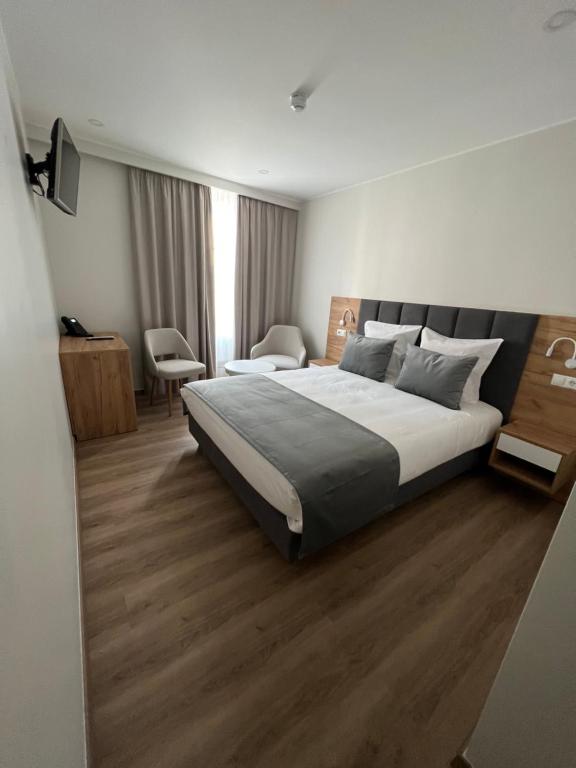
Domus Hotel
Domus Hotel has a primer location in central Luxembourg. This hotel has modern and comfortable rooms that even have a kitchenet in case you want to safe some money and cook your own meals.
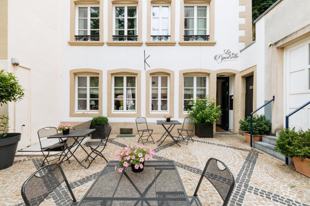
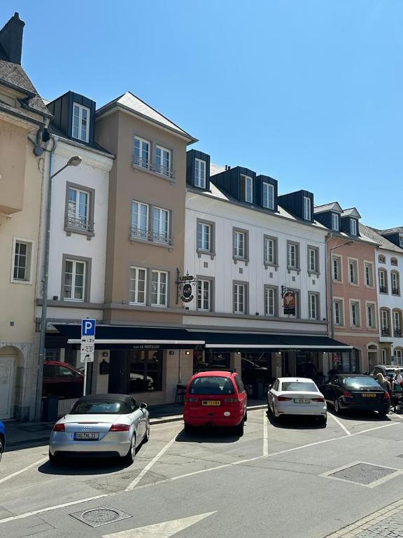
If you’re staying a bit longer in Luxembourg and visiting the Mullerthal region for a few days, then you can book a hotel in Echternach like for example Le Postillon, a small family owned boutique hotel.
HOW TO USE THIS MAP: Click the star next to the map title to add this map to your google maps account. To view it on your phone while traveling, open Google Maps, click on the menu button and go to “Your Places”, click on Maps and you’ll see this map in your list.
I hope you liked my blog about Hiking the Mullerthal Trail. Let me know what you thought in the comments.
DISCLAIMER: This post contains affiliate links. Clicking and buying from them will be at no additional cost to you but I will get a small commission.