If you‘re dreaming of dramatic volcanic landscapes, lush laurel forests, and sweeping ocean views, you’re in for a treat. Some of the best hikes in Tenerife offer all that and more. This Canary Island is a paradise for outdoor lovers, with trails that wind through ancient calderas, climb to Spain’s highest peak, and meander through quaint villages that feel like time forgot them. It doesn’t matter your fitness level, Tenerife has a trail with your name on it.
What makes hiking in Tenerife so special is the sheer variety packed into one island. You can choose between hikes surrounded by pines on Mount Teide or hiking near a coastal mountain path. With year-round sunshine and a mix of well-maintained routes for all skill levels, it’s no wonder hikers from around the world choose Tenerife as a prime hiking destination. Let’s dive into some of the most unforgettable trails this island has to offer!
TABLE OF CONTENTS
TIPS AND RECOMMENDATIONS ABOUT HIKING IN TENERIFE
Before I give you my list of the best hikes in Tenerife, here is a friendly list of tips and recommendations to help you make the most of your hiking adventures in Tenerife.
Wear proper hiking shoes. Trails in Tenerife can be rocky, steep and uneven. Sturdy footwear will save your feet and your balance.
Layer you clothing. It might be warm byt the coast but cold in the mountains. Always bring a light jacket or extra layer just in case.
Pack plenty of water and snacks. Some hikes have no shops or facilities nearby.
Download offline maps. Some trails (especially in Anaga or Teno Rural Parks) have poor signals. Apps like AllTrails can help you stay on the right path.
Some hikes in Tenerife need permits. Make sure to book them well in advance!
Respect nature and stay on marked trails. Tenerife’s landscapes are fragile and protected. Stick to official routes to help preserve the natural beauty of the island.
Help protect nature by practicing the 7 Leave No Trace Principles: 1. Plan ahead; 2. Stay on the trail; 3. Pack out what you bring to the trail; 4. Properly dispose of waste;5. Leave areas as you found them; 6. Be considerate of other hikes and; 7. Do not approach or feed wildlife.
THE 7 BEST HIKES IN TENERIFE
When people think about Tenerife and the Canary Islands, the first thing that comes into mind is beach time and year-round summer weather. While this is an important part of Tenerife, the island is also an amazing hiking destination.
To help you navigate the post, I have organised the hikes based on distance. Let’s not wait anymore and jump into the 7 best hikes in Tenerife!
1. ROQUES DE GARCIA
DISTANCE: 3,4 km
ALTITUDE GAIN: 184 m
LEVEL: Easy to Moderate
ROUTE TYPE: Circular
TRAILHEAD/END:Parking near La Ruleta viewpoint
BEST TIME TO DO THE HIKE: The hike can be done all year long.
ESTIMATED TIME NEEDED: 2 to 3 hours (depending on your fitness level)
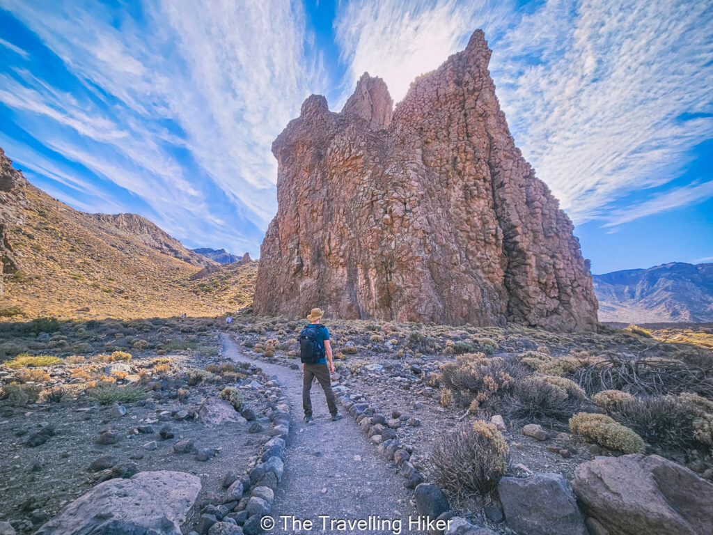
The Roques de García Hike is a classic hike in Tenerife and a must-do if you’re visiting Teide National Park. The loop is relatively easy, with only a steep uphill at the end of the hike, which makes it a very popular trail. But don’t worry, even though there is a lot of people here, most of them only stay at the first part of the trail and don’t complete the loop.
Along the trail, you will walk next to massive rock formations that rise dramatically from the volcanic plain, each with different shapes. The most famous one is Roque Chinchado, also known as “God’s Finger” but all of them are impressive. The trail gently winds through the Llano de Ucanca (Ucanca plain), giving you a close-up look at the different lava formations with the impressive Teide as a backdrop.
There is just one thing you should consider when hiking Roques de García. Even though it is not a long hike, you are stil hiking at high altitude (over 2.000 meters above sea level), so take it slow and drink plenty of water. Also consider bringing a hat to protect you from the sun and use plenty of sunscreen. There is barely any shadow along the trail!
2. EL PIJARAL NATURE RESERVe TO CABEZA DE TEJO VIEWPOINT
DISTANCE: 6,4 km
ALTITUDE GAIN: 293 m
LEVEL: Easy to Moderate
ROUTE TYPE: Circular
TRAILHEAD/END:Parking at El Pijaral Nature Reserve
BEST TIME TO DO THE HIKE: The hike can be done all year long.
ESTIMATED TIME NEEDED: 2 to 3 hours (depending on your fitness level)
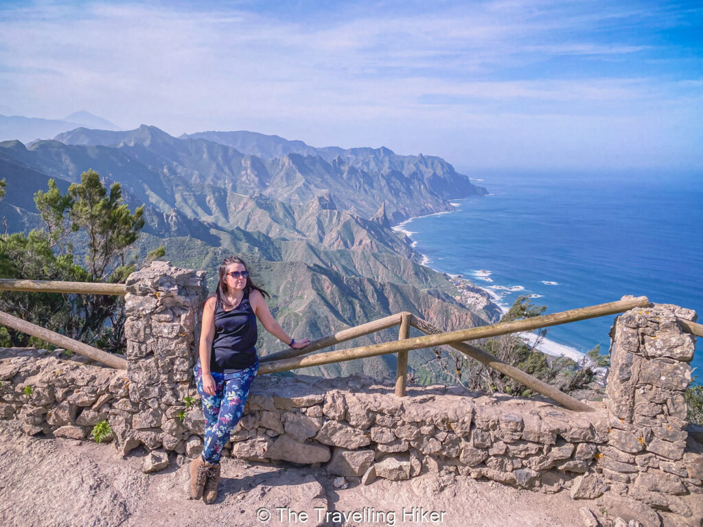
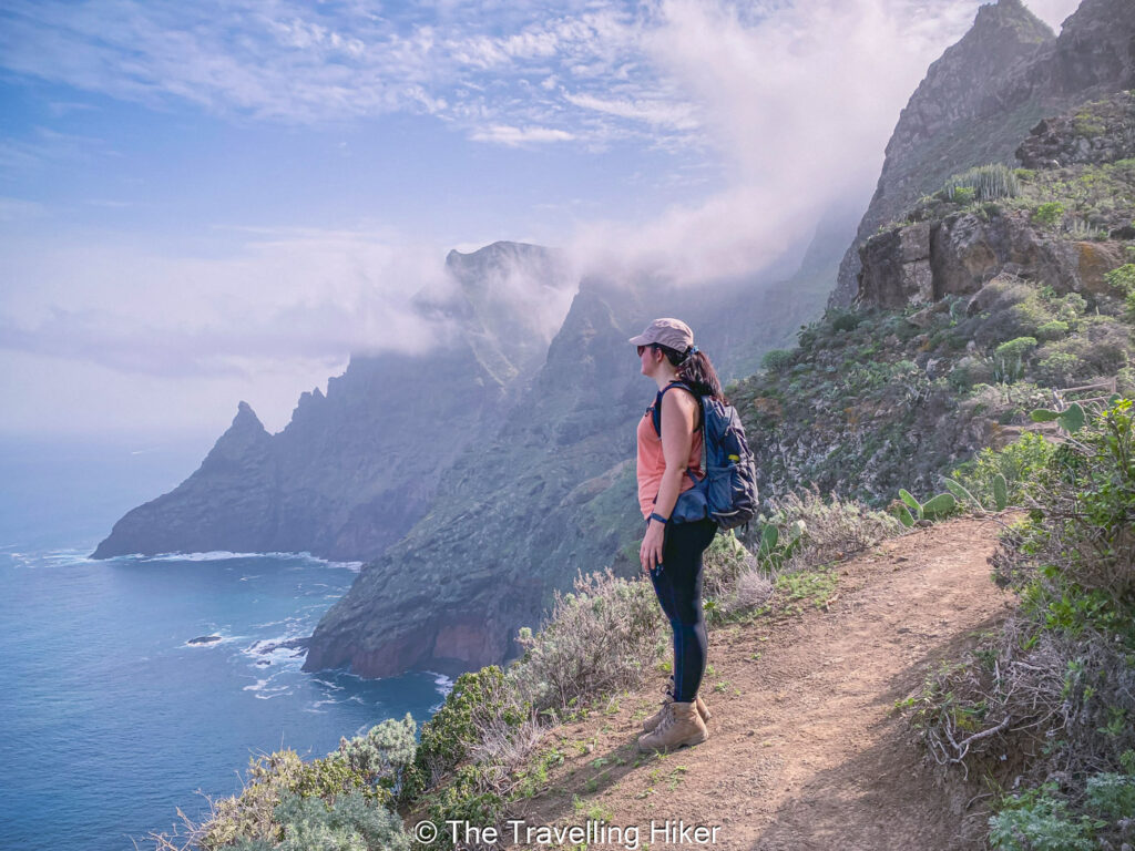
Tucked away in the lush northerneastern corner of Tenerife, the hike between El Pijaral and Cabeza de Tejo in Anaga Rural Park feels like stepping into a lost world. This area is part of a protected laurel forest so enchanting it’s nicknamed “The Enchanted Forest” (El Bosque Encantado) and it is easy to see why. From the moment you step onto the trail, you’re surrounded by thick, misty greenery, with moss-draped trees that look like they’ve been growing here forever.
The hike itself is not too difficult, with a few climbs and descents, but nothing too intense. The trail winds along the ridges and dips of the Anaga massif, offering constant changes in scenery. From dense tunnes to exposed viewpoints where the trees part just enough to reveal dramatic clifgs plunging into the Atlantic Ocean. One of the most jaw-dropping moments is when you reach Cabeza de Tejo, a natural lookout point with panoramic views over teh Anaga coastline, the Roques de Anaga, and sometimes even all the way to Mount Teide on a clear day.
Important: This is a protected area with limited daily access to preserve the delicate ecosystem, so you do need to apply for a free permit in advance to hike here.
BEST TIME TO DO THE HIKE: The hike can be done all year long.
ESTIMATED TIME NEEDED: 3 hours (depending on your fitness level)
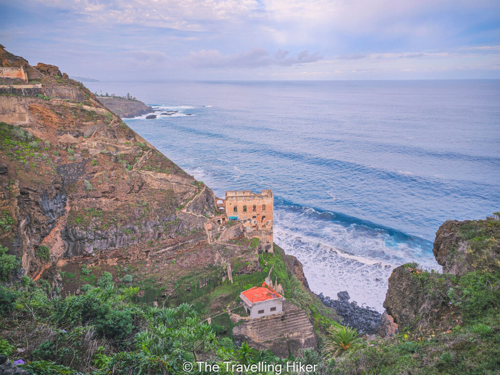
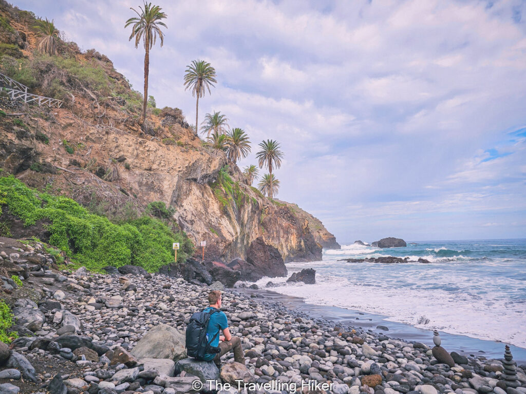
Rambla de Castro, located in Los Realejos town, is beautiful coastal trail that blends lush landscapes with cactus and palm trees with stunning ocean views. The hike starts near Mirador de los Roques and the path will take you along dramatic cliffs, vibrant palms groves and banana plantations. At the same time, you will feel the gentle sea breeze in your face and you will be captivated by the waves crashing into the cliffs.
Along the trail you will find several historical buildings such as La Gordejuela water elevator, an early 20th-century pumping station that was once the house to Tenerife’s first steam engine. Further along the trail, you will find Fortín de San Andres (St. Andrew’s Fort) which was used to protect the coast from pirates.
The hike culminates at Playa de Castro, where you can just relax until you feel like tracing back your steps. This hike will reward you with stunning scenery of Tenerife’s coast and will leave you wanting to explore more about the island.
BEST TIME TO DO THE HIKE: The hike can be done all year long.
ESTIMATED TIME NEEDED: 2 to 3 hours (depending on your fitness level)
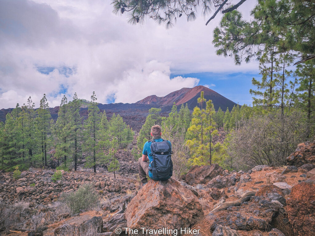
The Chinyero Volcano Hike (PR TF-43) is one of those trails in Tenerife that perfectly blends natural beauty, volcanic history, and peaceful forest vibes. Located near the village of Santiago del Teide, this loop trail takes you on a scenic journey around the site of the island’s most recent volcanic eruption in 1909. But don’t worry, it’s been quiet ever since!
As you circle the base of Chinyero Volcano, you’ll pass through a variety of terrains, from rough lava rocks to soft forest paths, with occasional glimpses of Mount Teide towering in the distance. On a clear day, the views are epic! What makes this hike special is the dramatic contrast between the black lava fields and the vibrant green of the surrounding Canarian pineforests.
In addition, this hike is so peaceful compared to other busier hikes in Teide National Park. If you are looking for a less touristy but still impressive hike, this is the one for you. Just make sure to bring water, sunscreen, and snacks to enjoy along the way as there is no facilities nearby.
BEST TIME TO DO THE HIKE: The hike can be done all year long.
ESTIMATED TIME NEEDED: 3 to 4 hours (depending on your fitness level)
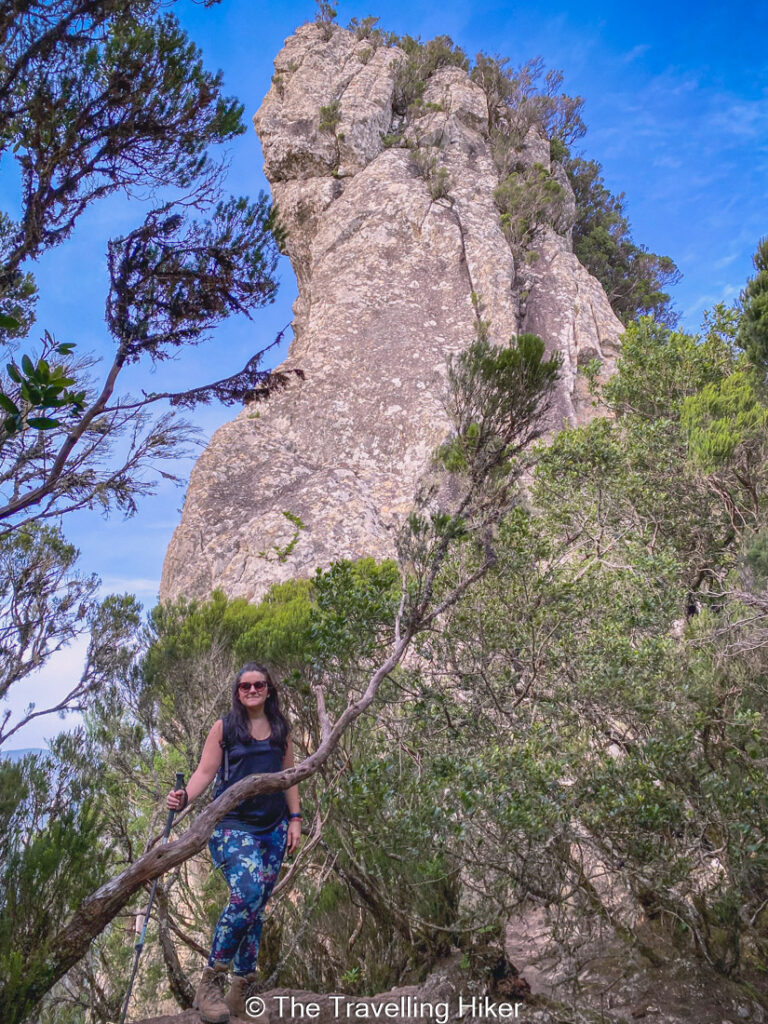
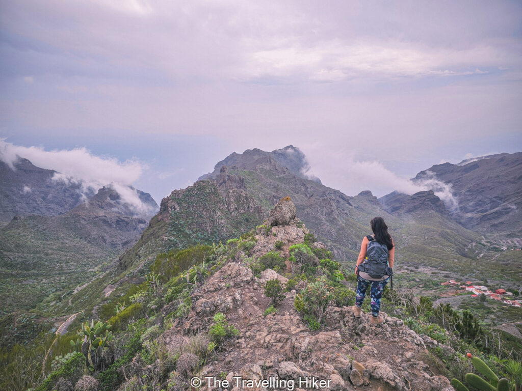
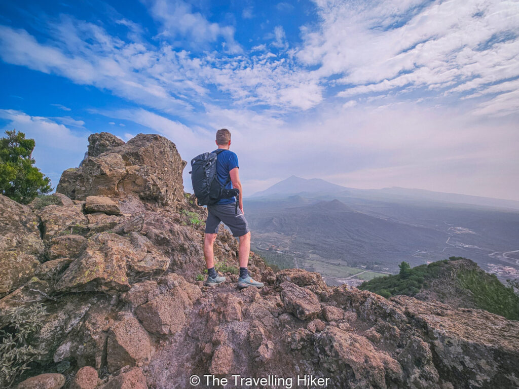
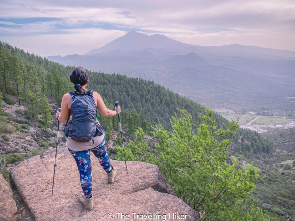
If you’re looking to experience one of Tenerife’s most stunning landscapes, the hike from Santiago del Teide to Masca Village is a must-do. This trail takes you right through the heart of the Teno Rural Park, a region known for its dramatic mountain scenery, charming rural vibes, and endless photo-worthy moments. Starting at the town Santiago del Teide, the path quickly gains elevation, rewarding you with sweeping views of the valley below and even glimpses of Mount Teide in the distance on a clear day.
The route itself is moderately challenging but totally manageable if you’re reasonably fit. There are some steep sections, a bit of rocky terrain, and narrow paths carved into the hillside, but it’s all part of the adventure. Along the way, you’ll pass through dense forests, open ridges, and ancient lava flows that give you a real sense of the island’s volcanic roots.
Reaching Masca Village feels like stepping into a hidden world. Tucked deep within a lush ravine, this tiny hamlet is bursting with character—stone cottages, terraced gardens, and jaw-dropping views in every direction. After hours on the trail, make sure to enjoy a cold cactus limonade before you take a local bus back to Santiago del Teide.
BEST TIME TO DO THE HIKE: The hike can be done all year long.
ESTIMATED TIME NEEDED: 4 to 5 hours (depending on your fitness level)
Located in Anaga Rural Park, in the northeast of the island, the hike from Punta del Hidalgo to Chimanada is an absolute gem for anyone craving wild beauty and a touch of history since the trail goes through an old linen route. The trail kick off near the coast at Punta del Hidalgo, where the Atlantic waves crash against volcanic rocks and set the mood for the adventure.
As you start to ascend through the Barranco del Río gorge, you’ll be treated with breathtaking views of the Anaga Mountains and the Atlantic coastline. The path is surrunded by plenty of cactus and aloe vera plants, and upon reaching the small village of Chimanada, the Aguaide Viewpoint offers impressive panoramic views. You will find yourself constantly stopping, not because you’re tired, but because you can’t believe how stunning it all is.
HOW TO USE THIS MAP: Click the star next to the map title to add this map to your google maps account. To view it on your phone while traveling, open Google Maps, click on the menu button and go to “Your Places”, click on Maps and you’ll see this map in your list.
MAP WITH THE 6 BEST HIKES IN TENERIFE
No time to read this blog? Here’s and infographic with the most important information.
And that’s it for this week’s blog. I hope you liked it and found it useful. Let me know what you think in the comments!
Happy hiking!
DISCLAIMER: Did you know? This blog uses affiliate partnerships. When you click and book or make a purchase through one of my blog posts, I may receive a small commission (at no extra cost to you). Thank you for supporting The Travelling Hiker!