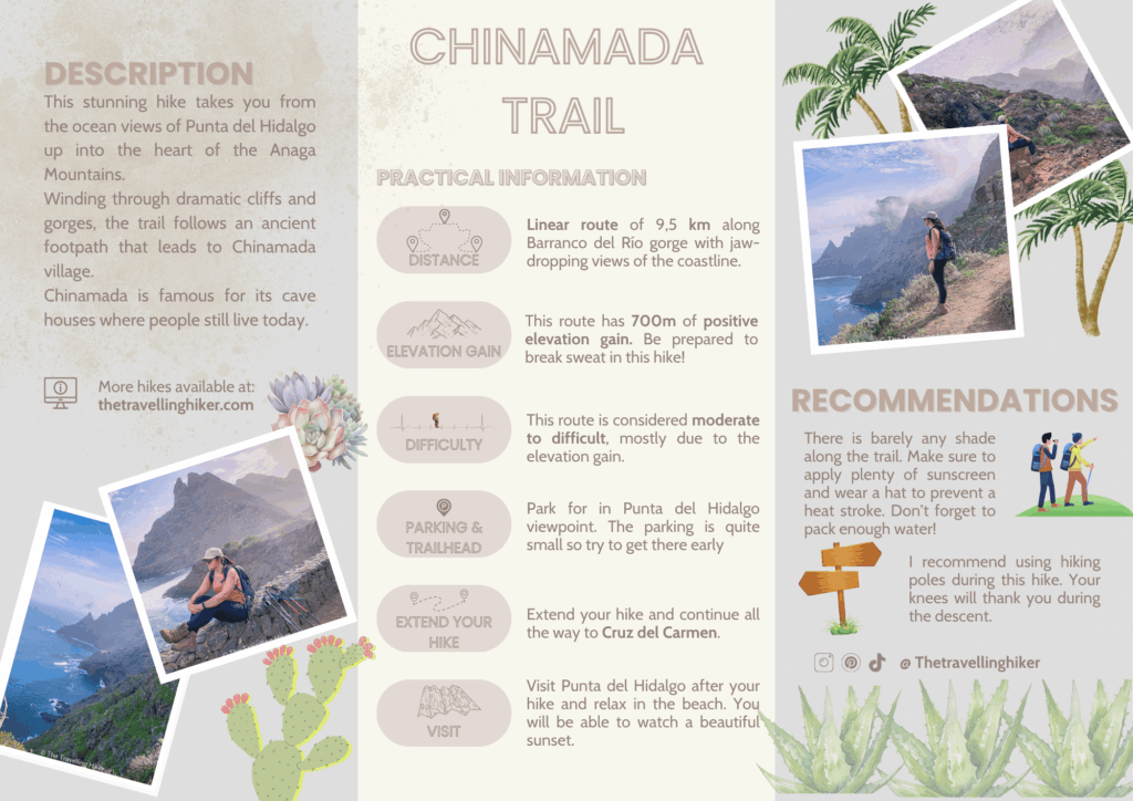
If you’re looking for a hike that combines dramatic coastal cliffs, remote villages, and sweeping ocean views, the Chinamada Trail, which goes from Punta del Hidalgo to Chinamada mountain village, should be at the top of your list. This unforgettable trail climbs from sea level through steep, rugged terrain into the heart of the Anaga Mountains.
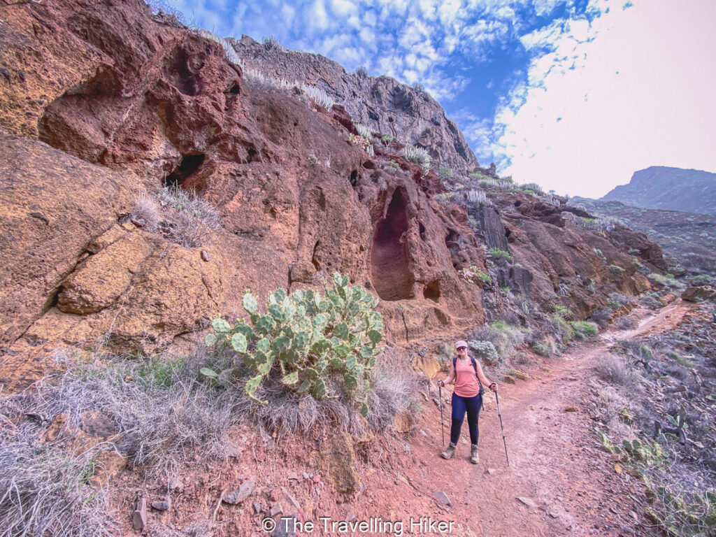
The trail follows the ancient paths that were once used by the indigenous Guanche people. As you reach toward the tiny hamlet of Chinamada, you’ll see the cave dwellings where people used to live. It’s a moderately challenging hike, but the effort is well worth it for the stunning landscapes and sense of adventure.
TABLE OF CONTENTS
INTERESTING FACTS ABOUT THE CHINAMADA TRAIL
Still hesitating about this trail? Here’s a short list of interesting facts about the Chinamada Trail in Tenerife.
It’s a coast to mountain peak hike. The trail starts at sea level in Punta del Hidalgo and climbs up to Chinamada, a tiny village where people still live in a traditional cave houses carved into volcanic rock.
The trail follows historic routes once used by locals and farmers to travel between villages before roads were built.
Along the trail, you’ll get sweeping views of the Atlantic Ocean, deep ravines, and green mountain ridges.
The trail takes you through Barranco del Río, the gorge where you will be hiking.
PRACTICAL INFORMATION ABOUT THE HIKE
HOW DO YOU REACH THE TRAILHEAD?
The trail start in Punta del Hidalgo, a small coastal town right at the beginning of Anaga Rural Park. Here are the best ways to reach the trailhead.
🚗By Car
The easiest way to reach the trailhead is by car. Just search in your GPS “Mirador Punta del Hidalgo” (Punta del Hidalgo Viewpoint) and follow its instructions.
🅿 Parking – Park your car in the small parking lot next to the viewpoint. It is a very small parking lot with maximum 10 parking spots. Aim to get there as early as possible to ensure you get a parking spot.
If you don’t feel comfortable driving, it is also possible to reach this hike with the island’s public transport. It will just take longer to reach the trailhead.
The bus lines 50 which departs from La Laguna, has a stop only a 100 m away from the trailhead.
EQUIPMENT NEEDED
The Chinamada Trail is a bit demanding so I recommend that you bring the following equipment to make it easier.
Sturdy hiking shoes. The trail is rocky and steep in places, so good grip is a must!
Hiking poles. If you’re not used to steep ascents and descents, polew can help take pressure off your knees.
Plenty of water. There are no fountains along the trail, and the climb can be sweaty.
Snack or a light picnic. You will be thankful to refuel with some energy bars, or a sandwich.
Sun protection. Don’t forget sunscreen, sunglasses, and a hat.
Map or GPS App. Even though the trail is well marked, having a hiking app that you can use offline is always a good idea. I always use the AllTrails App.
Camera or phone. Trust me, you’ll want to capture those epic views.
BEST TIME TO DO THIS HIKE
The best time to hike the Chinamada Trail is during the cooler, drier months which are generally from October to May. During this period, the temperatures are mild, the skies are clearer, and the trail is lush with greenery, especially after a bit of rain. You’ll get those postcard-worthy views of the coastline and dramatic cliffs without the summer heat bearing down on you. Plus, hiking during the off-peak tourist season means fewer crowds and a more peaceful, immersive experience in nature.
That said, the Anaga region has its own microclimate, so it’s smart to check the forecast before you go, especially in winter, when the higher elevations can be misty or drizzly. Summer (June to Septembe) is still doable, but it can get hot and dry, particularly near Punta del Hidalgo, so if you go then, start early in the morning and bring extra water.
THE AMAZING CHINAMADA TRAIL IN TENERIFE
HIKE STATS
Trail Start/End – Parking lot next to Mirador Punta del Hidalgo
Distance – 9,5 km
Elevation Gain – 700 m
Level – Moderate to Challenging
Route Type – Out & Back
Estimated Time Needed – 5 to 6 hours. You’ll have plenty of time to enjoy the views at the different viewpoints.
Best Time To Visit – Spring or Fall, to get the most favorable weather conditions and fewer crowds.
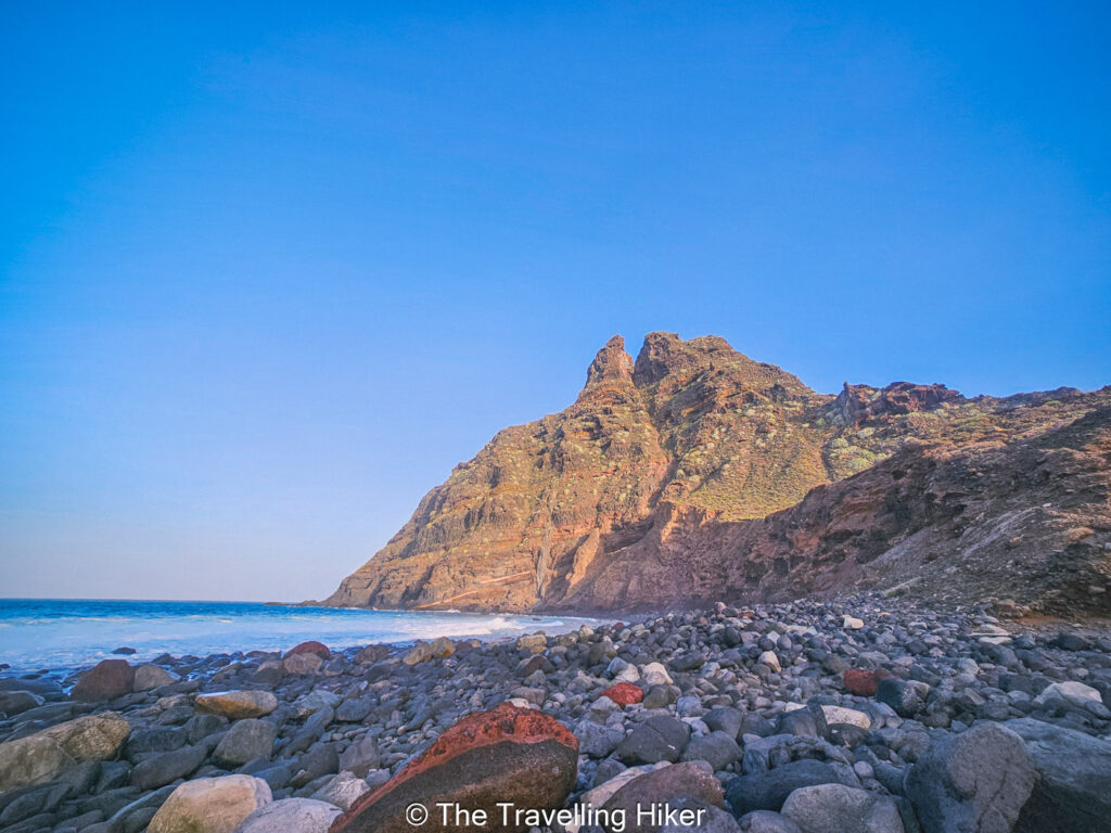
From the trailhead in Punta del Hidalgo, you’ll follow an upaved road down towards Playa de los Troches (Troches Beach). Though this part of the trail is nothing special, the views of beach and the first mountain peak (Roque Dos Hermanos) are impressive.
Once this road comes to an end, you’ll find a trail which will officially begin your hike through Barranco del Río. After a few meters, you’ll see on your left a second trail that will take you to Playa de los Troches, but you need to keep following the main trail towards the mountain peaks.
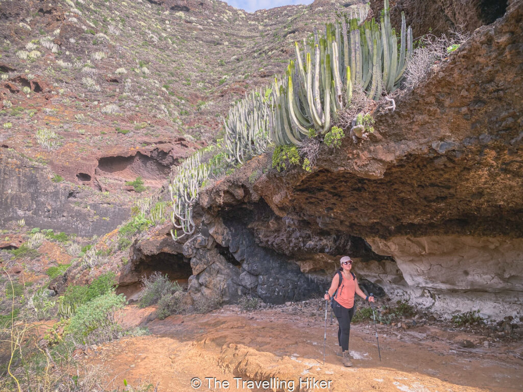
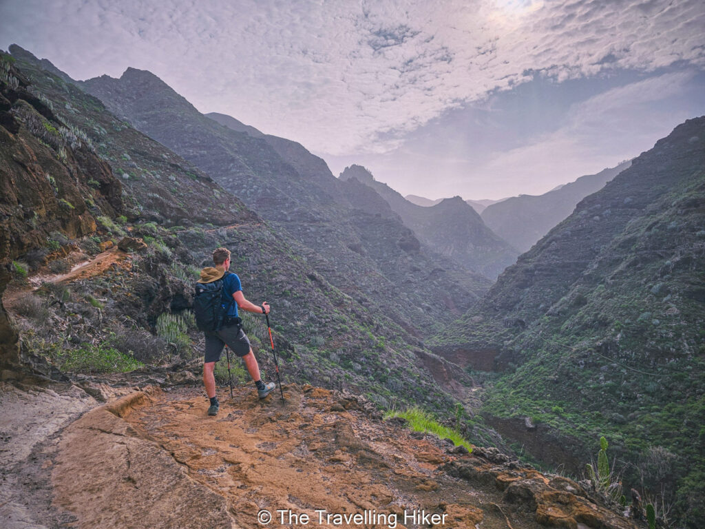
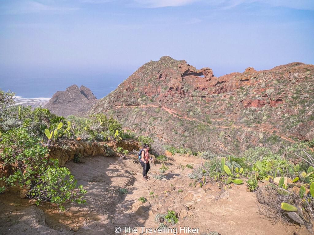
It’s time to begin your ascent into the Anaga Mountains through Barranco del Río. You’ll have the gorge on your right as you steeply ascend. This part is a quite demanding, especially since there is barely any shade but the breathtaking views in front of you will give you the energy to continue.
La Goleta Viewpoint
In this first part of the hike, you will be hiking through the inside of the gorge while steadily gaining elevation without any views of the coast. The ascent will be steep and you will most probably be sweating quite a bit.
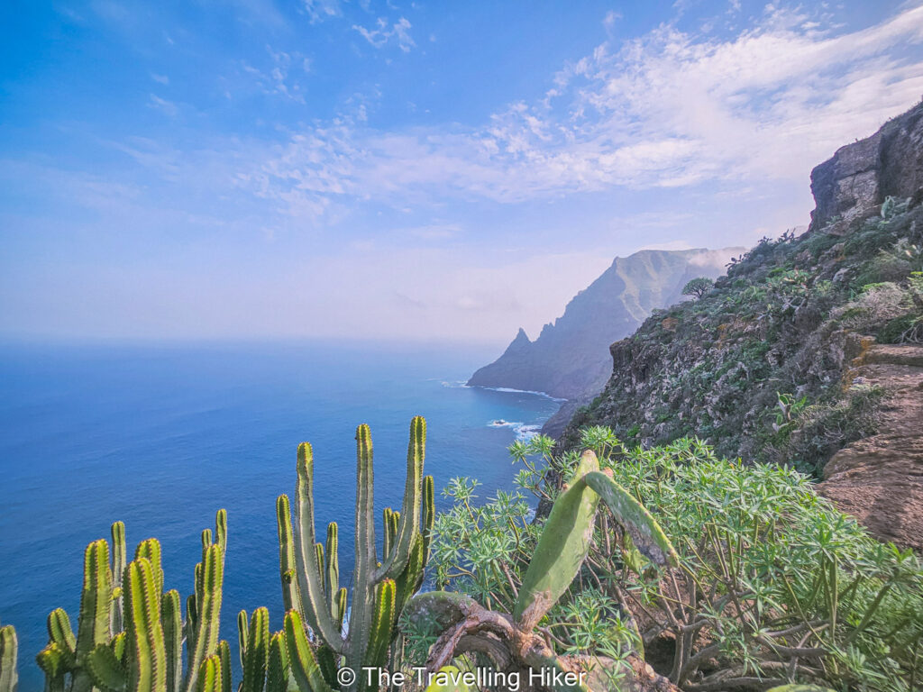
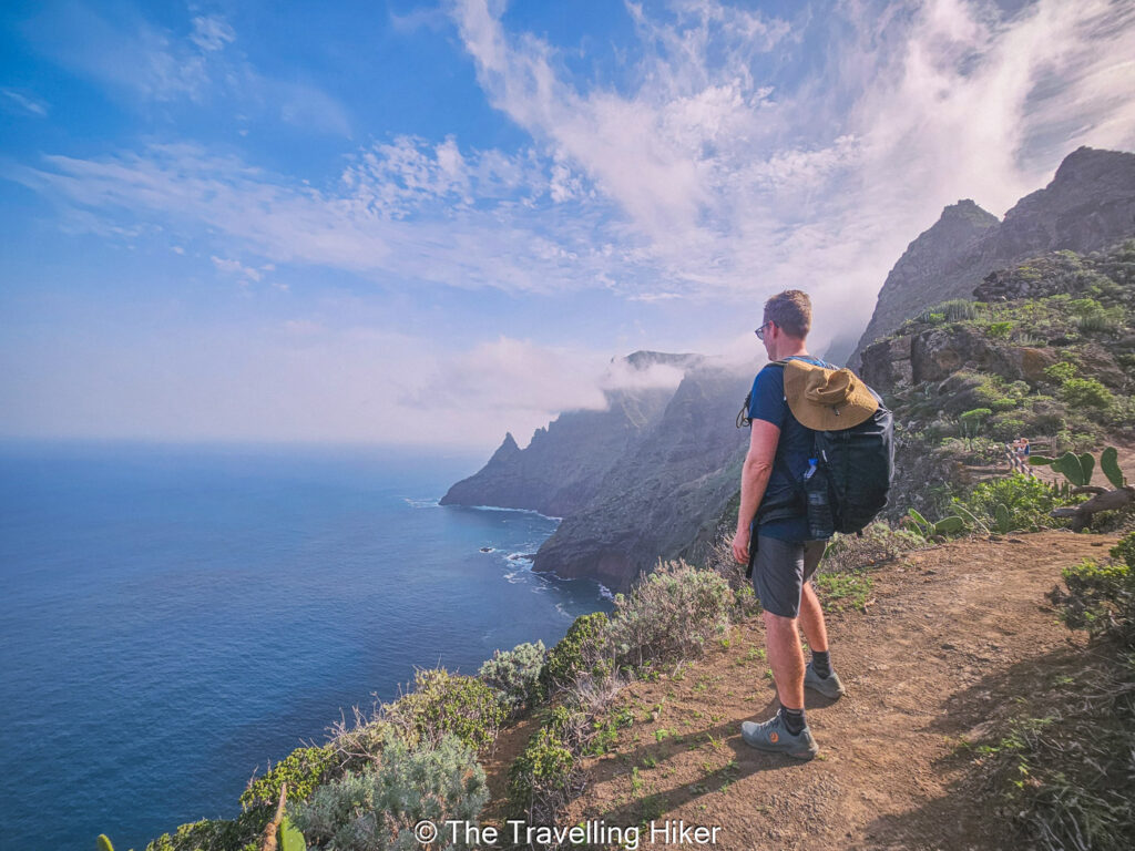
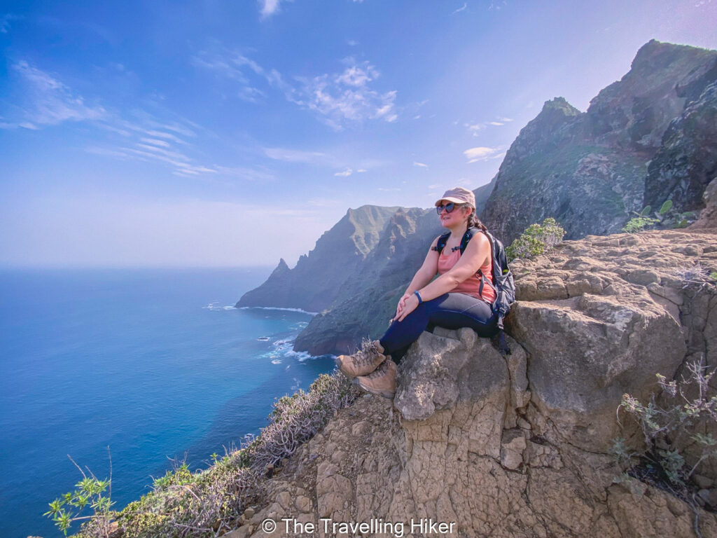
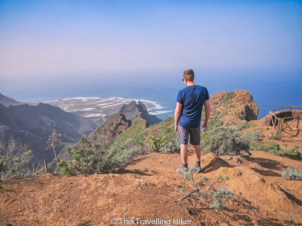
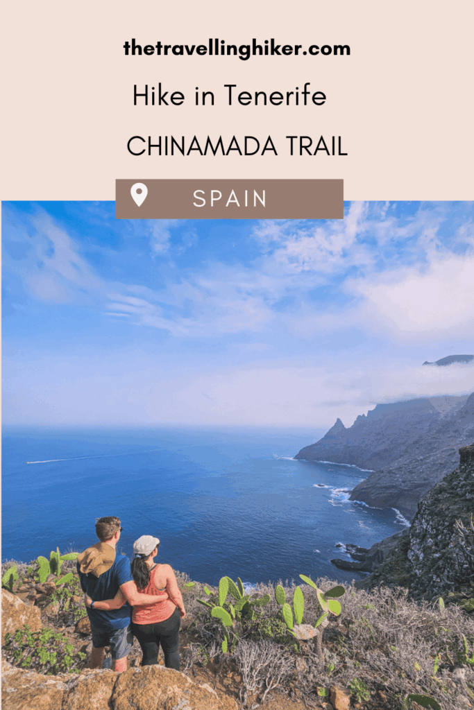
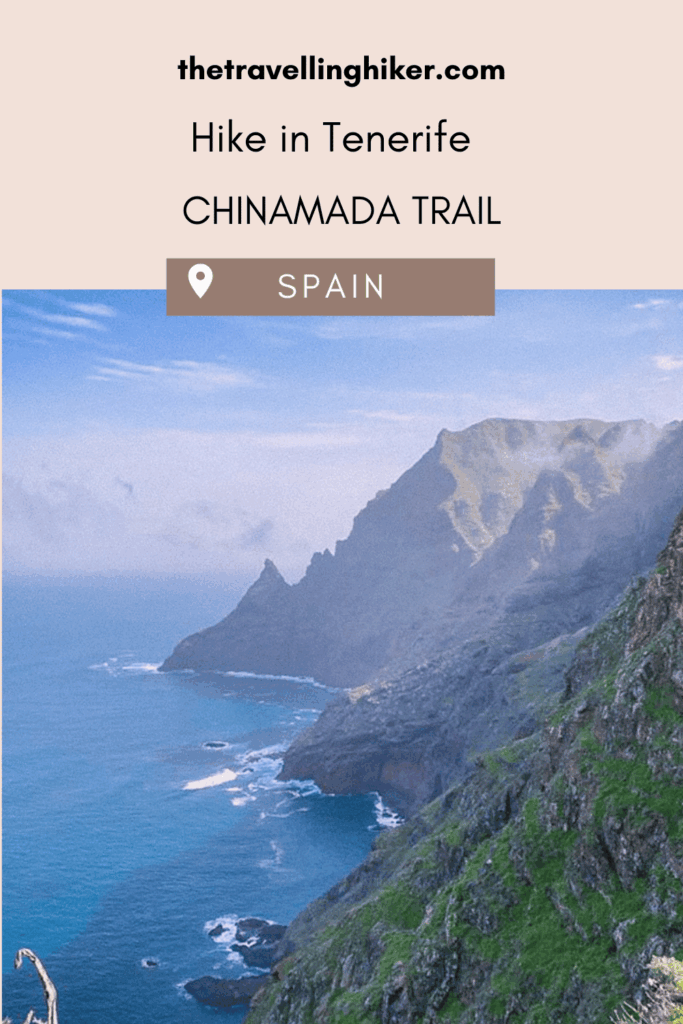
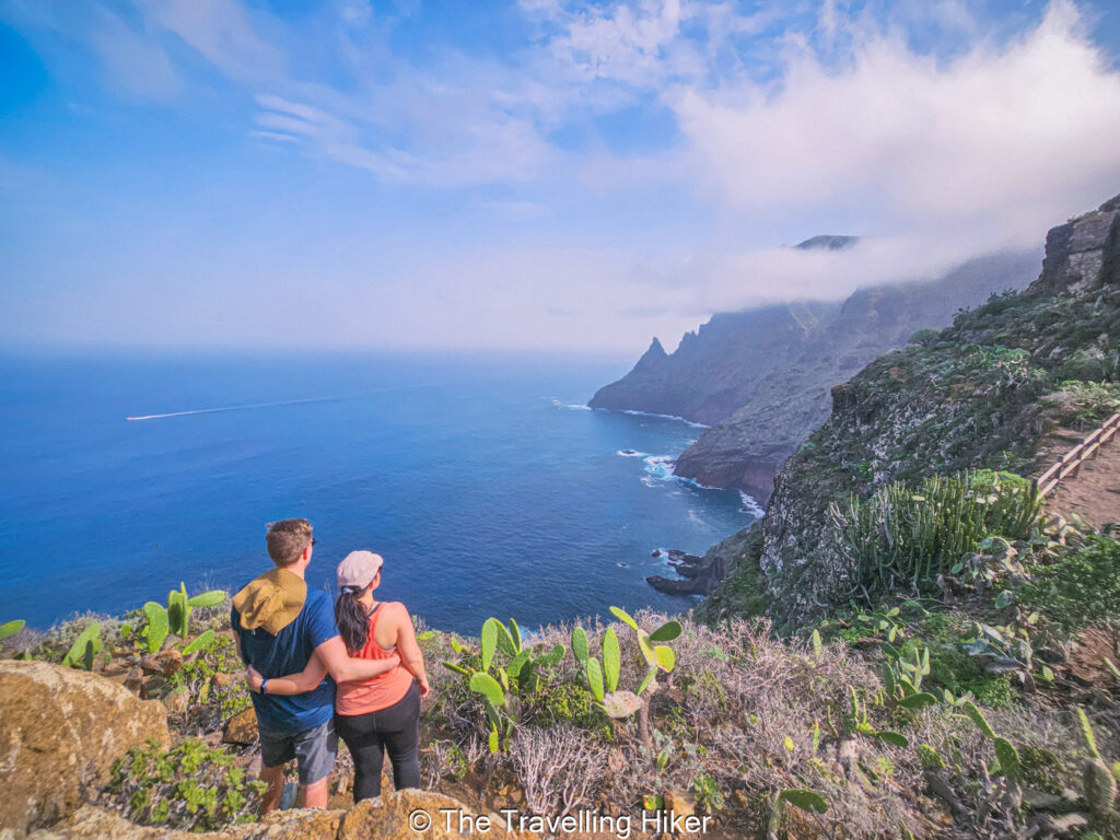
However, all of this will be forgotten as soon as you get to La Goleta Viewpoint (Mirador de La Goleta). This viewpoint was, without hesitation, the best viewpoint we saw in Tenerife. The views of the Anaga Mountains above the ocean are mind-blowing! We loved it so much that I think we spent approximately an hour here enjoying the views.
La Goleta Viewpoint - Chinamada
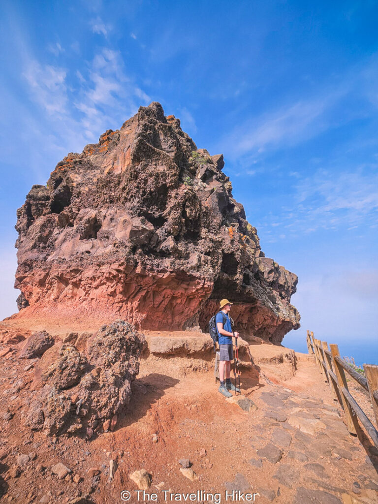
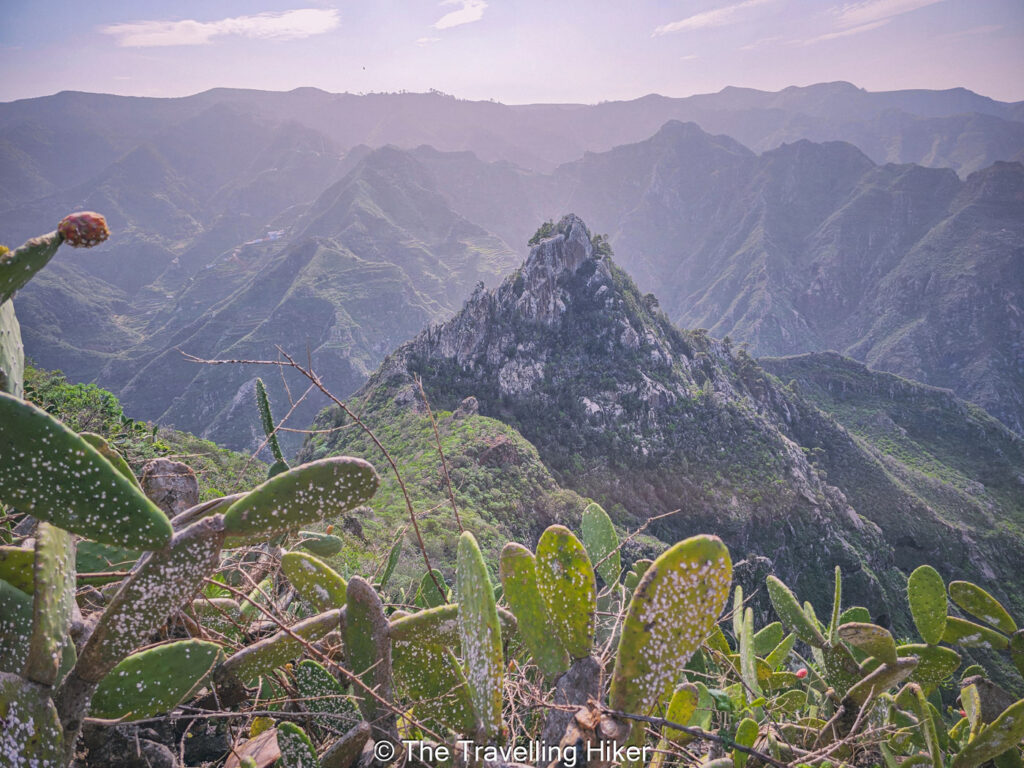
Once you’re done with these gorgeous views, it’s time to leave the coastline behind again and continue ascending through Barranco del Río. Along the way, you’ll enjoy many incredible landforms and rock formations, as well as the mountain peaks. I particularly liked the viewpoint Roque de los Pinos, a magnificent conical lava formation.
Eventually, you will reach the small village of Chinamada where you can see the local farms and house caves. If you need to grab a bite or a drink, make sure to head to Restaurante La Cueva. We were running a bit short on water, and it was so refreshing to get some cool drinks.
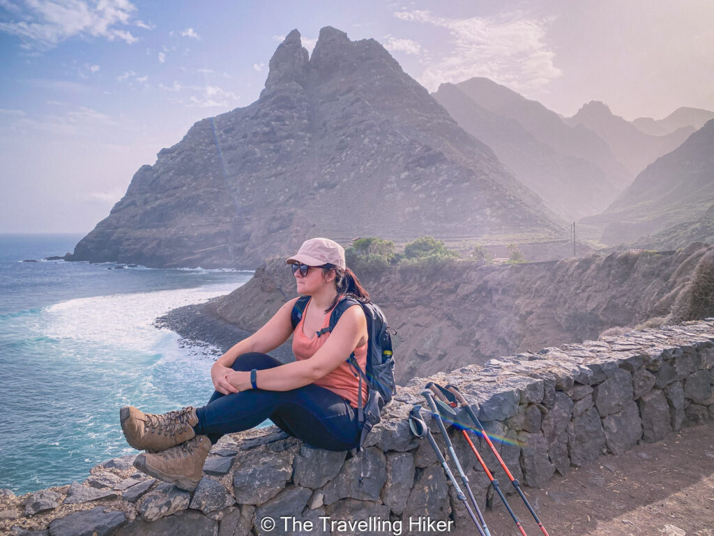
Aguaide Viewpoint
From Chinamada, you can do a short out and back hike to Aguaide Viewpoint, where you will again get beautiful views of the coastline and the Anaga Mountains.
Return hike
After enjoying the views at Aguaide Viewpoint, it’s time to retrace your steps and hike all the way back to Punta del Hidalgo. The return leg of this hike is much faster since it is almost constant downhill. However, here is where having hiking poles will come in handy for your knees.
Once we were back at Punta del Hidalgo, we decided to relax and spend the rest of the day at Playa de los Troches.
OTHER THINGS TO DO NEARBY
Looking for ideas on how to complete your day? In that case, I suggest you do one of the two following things.
Extend your trail all the way to Cruz del Carmen. Most people hiking the Chinamada Trail do it as an out and back route (explained in this blog). However, the trail does continue all the way to Cruz del Carmen. Once at Cruz del Carmen, you’ll have to take some transportation to return to your car.
Relax and watch the surfers at Playa de los Troches. Alternatively, you can do as we did and spend the rest of your day just relaxing at Playa de los Troches. This beach is a popular spot for local surfers so you can just relax and watch the catch some waves, or if you’re a surfer youself, join them!
ACCOMMODATION NEAR THE HIKE
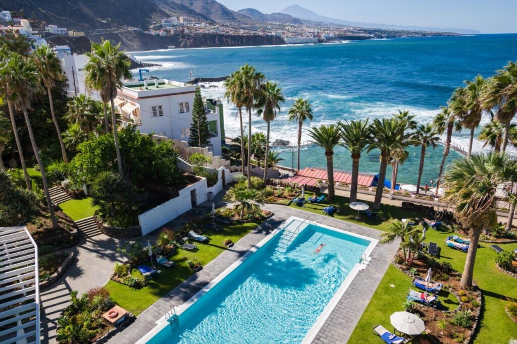
Looking for a nice place to stay not too far from the trailhead? Then I recommend you stay at Oceano Health Spa Hotel, a beautiful and relaxing hotel where you can rest and pamper yourself in the spa.
HOW TO USE THIS MAP: Click the star next to the map title to add this map to your google maps account. To view it on your phone while traveling, open Google Maps, click on the menu button and go to “Your Places”, click on Maps and you’ll see this map in your list.
HIKE SUMMARY AND INFOGRAPHIC
And that’s it for this week’s blog. I hope you liked it and found it useful. Let me know what you think in the comments!
Happy hiking!
DISCLAIMER: Did you know? This blog uses affiliate partnerships. When you click and book or make a purchase through one of my blog posts, I may receive a small commission (at no extra cost to you). Thank you for supporting The Travelling Hiker!