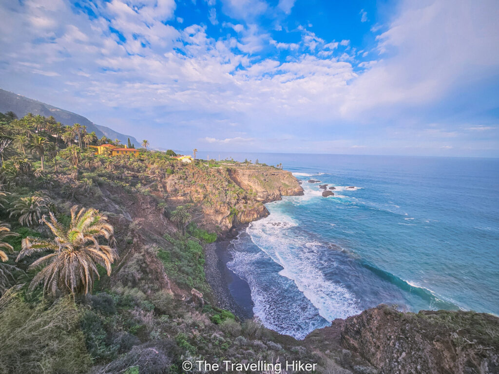
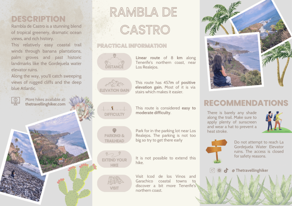
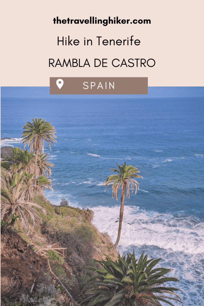
Located in the lush northern coast of Tenerife, the Rambla de Castro hike is a true gem for nature lovers and adventure seekers alike. This scenic coastal trail winds through a protected natural reserve bursting with tropical greenery, dramatic clifss, and panoramic ocean views. As you stroll along the well-maintained path, you’ll pass by historic landmarks like the Casona de Castro and the old water elevator, all while being accompanied by the sound of the gentle crash of Atlantic waves.
What makes this hike especially charming is its accesibility and variety. Towering palm trees, banana plantations, and native flora provide ample photo opportunities, while shaded spots and sea breezes make it a comfortable trek year-round. If you’re exploring the north of Tenerife, Rambla de Castro is a must-add to your itinerary.
TABLE OF CONTENTS
INTERESTING FACTS ABOUT RAMBLA DE CASTRO
Here are some interesting facts about Rambla de Castro in Los Realejos, Tenerife.
Its a protected natural reserve that covers approximately 45 hectares. This is due to its unique ecosystems, archaeological significance, and cultural heritage.
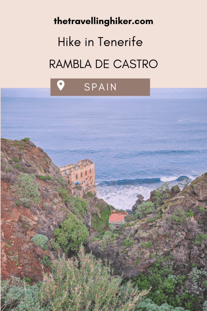
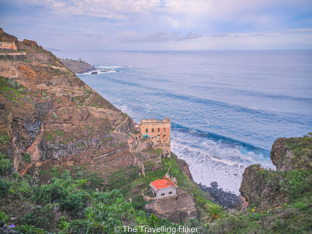
Along the trail you will find Elevador de Aguas de La Gordejuela, the first steam-powered water elevator. It was built in the early 1900s by the Hamilton company, and it was Tenerife’s first steam-powered pump, hauling water up cliffs to irrigate the banana plantations.
There are several historical landmarks along the trail like the 16th-century La Casona de Castro villa, the 18th-century Ermita de San Pedro chapel, and the 18th-century Fortin de San Fernando, which was built to prevent pirates.
PRACTICAL INFORMATION ABOUT THE HIKE
HOW DO YOU REACH THE TRAILHEAD?
Since this is a linear hike, there are two different possible trailheads for this hike, one at each end of the trail.
Trailhead near Los Roques Cliffs.
Trailhead near Mirador de San Pedro Restaurant.
🚗By Car
The easiest and most convenient way to reach either of both trailheads is by driving. Just search on your GPS the location of both parking lots (pinned in the map at the end of this blog) and follow the directions. The driving times will depend on where you’re driving from.
From Santa Cruz de Tenerife it will take approximately 1 hour and 5 minutes.
From Puerto de la Cruz it will take 53 minutes.
From the Tenerife South Airport it will take approximately 33 minutes.
🅿 Parking – Park your car in any of the two parking lots at each trailhead. The parkings are not very big so I would recommend getting there are early as possible.
If you don’t feel comfortable driving, it is also possible to reach this hike with the island’s public transport. It will just take longer to reach the trailhead.
The bus lines 383 and 363 have stops near both parkings.
EQUIPMENT NEEDED
The Rambla de Castro trail is a relatively easy and well-marked hike, but having the right gear will make your adventure even more enjoyable. Here’s a friendly checklist of what to bring.
Comfortable walking shoes or trail runners. The path is well-kept but grippy soles are are always handy.
Light backpack. Just enough to carry your essentials and a light snack.
Water bottle. Stay hydrated, especially if you’re hiking under the warm Tenerife sun.
Sun protection. Think sunglasses, sunscreen, and a hat. There’s limited shade in some parts.
Camera or smartphone. You’ll definitely want to capture the coastal views.
BEST TIME TO DO THIS HIKE
The great thing about this hike is that it can be done year-round! However, the absolute best seasons to enjoy the trail are spring and autumn. During these months, temperatures are comfortably warm without being too hot, and the landscape is especially lush.
You’ll also avoid the peak summer crowds, making it a more peaceful hike!
THE BEAUTIFUL RAMBLA DE CASTRO HIKE
HIKE STATS
Trail Start/End – Parking lot in Los Realejos
Distance – 8 km
Elevation Gain – 457 m
Level – Easy to Moderate
Route Type – Linear route
Estimated Time Needed – 2 to 3 hours. You will want to stop every few meters to enjoy the views of the coast. Playa de Castro is a great spot for a picnic.
Best Time To Visit – Spring or Fall, to get the most favorable weather conditions and fewer crowds.
HIKE MAP
I always use the AllTrails App during my hikes. The app has a GPX map that can help you stay on the right trail during your hikes. For this hike, we followed the Rambla de Castro Route.
RAMBLA DE CASTRO TRAIL - STEP BY STEP GUIDE
Hiking To La Gordejuela Viewpoint
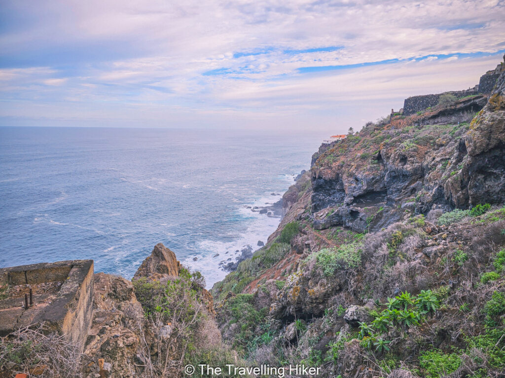
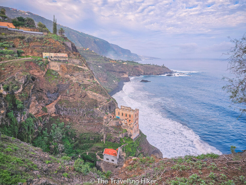
We parked our car at the parking shown by the AllTrails App, and started our hike. The first part of the hike, until you reach La Gordejuela water elevator, is relatively flat and easy.
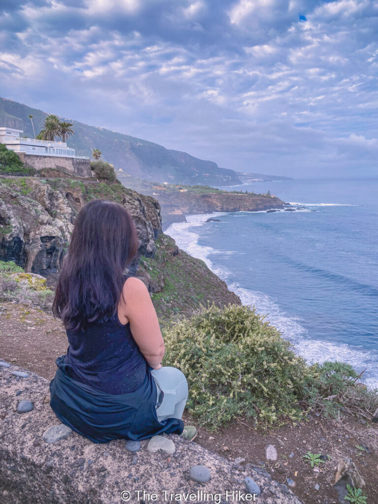
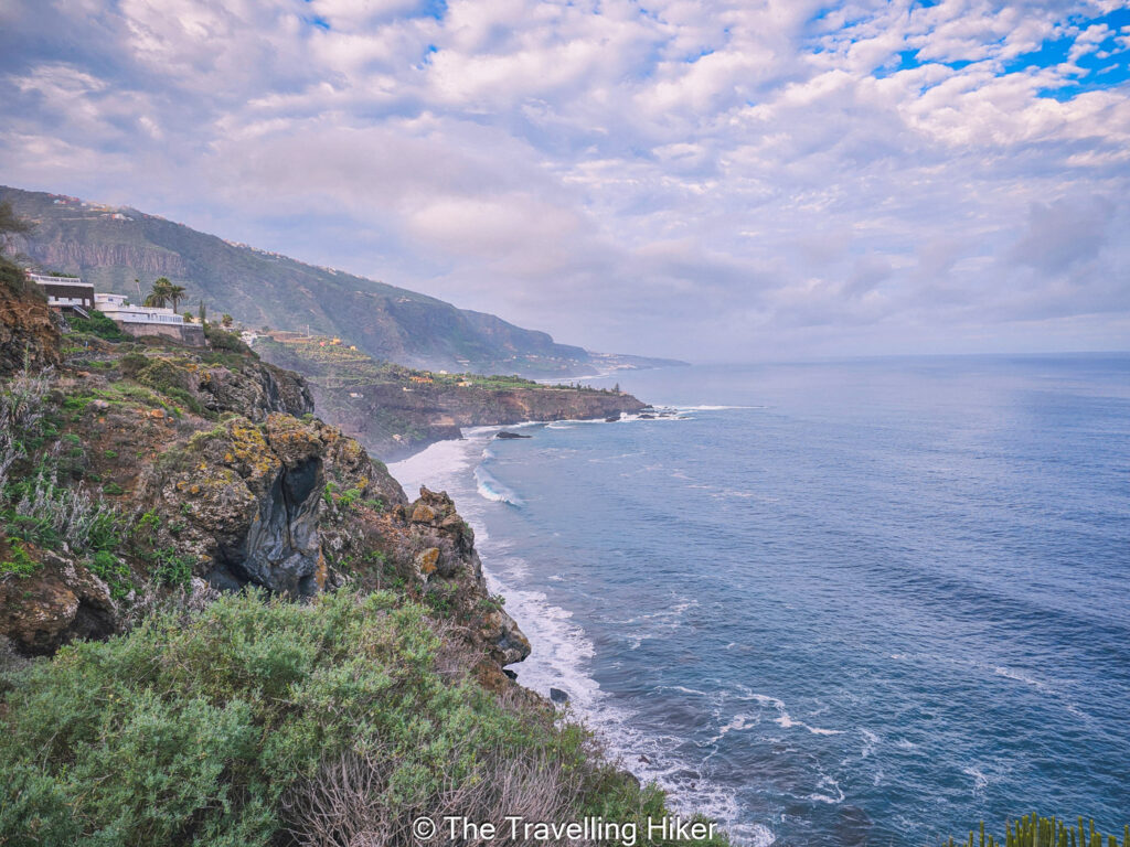
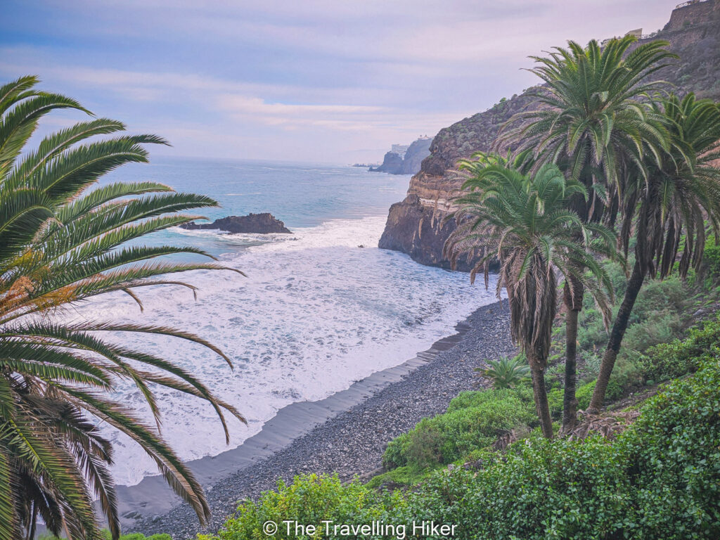
You will walk along the coast, while you admire the cliffs and watch the waves gently crash into the rocks.
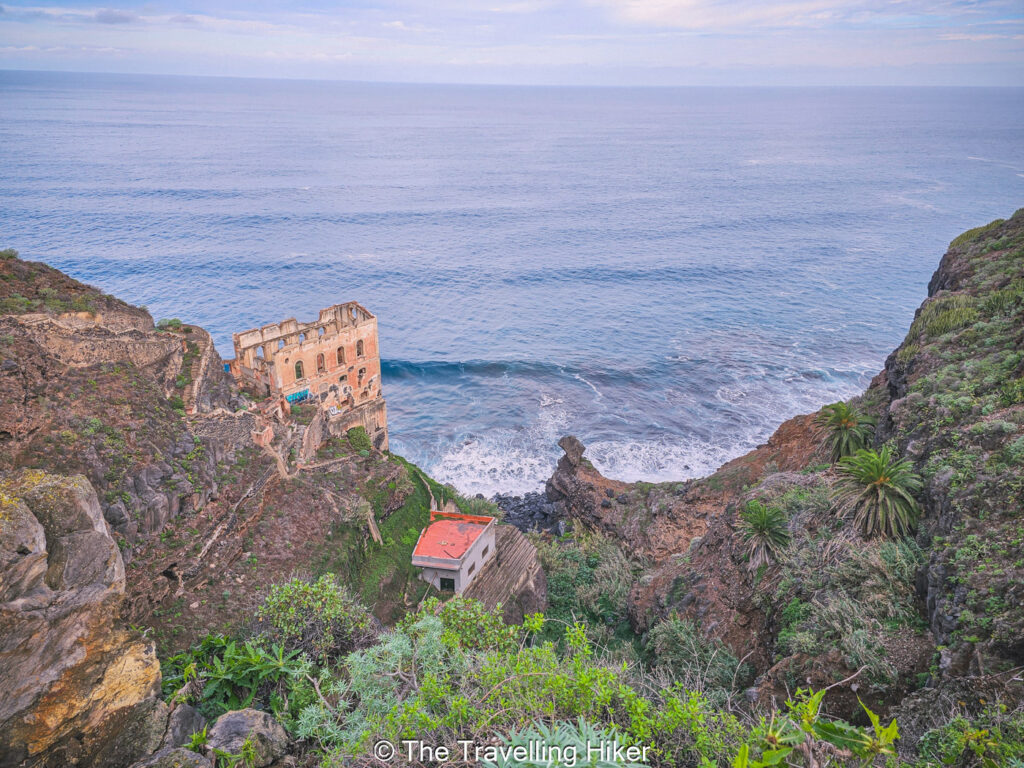
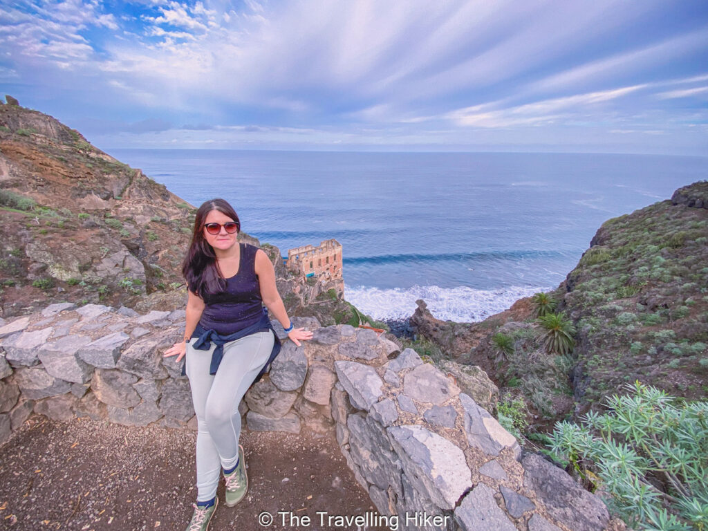
After 20 minutes walking, you will reach La Gordejuela Water Elevator. This was Tenerife’s first steam-powered water pump and was used to bring water for the banana plantation in the area. Today, it is an abandoned building that makes a beautiful contrast with the rocks and the sea.
Important: From La Gordejuela Viewpoint you will see some stairs descending to the abandoned building. Do not attempt to reach it, the path is closed by a gate due to safety reason.
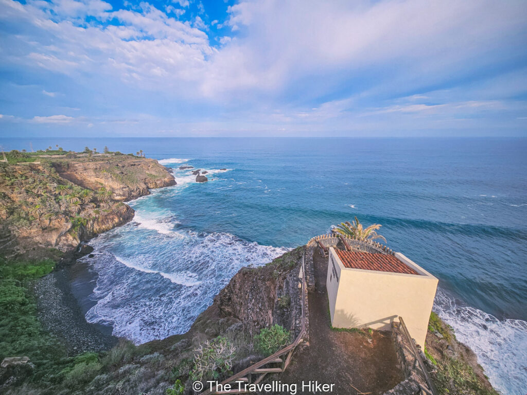
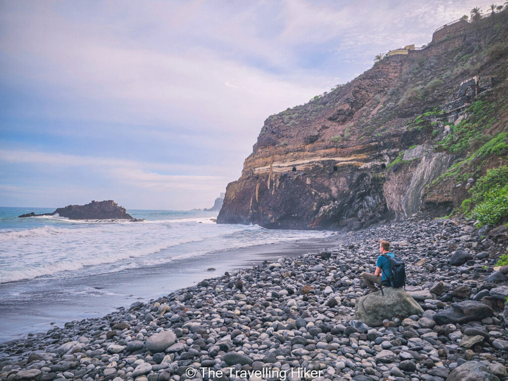
Fortin de San Fernando
From La Gordejuela Viewpoint, there is a few steep uphills and downhills until you reach Fortin de San Fernando, a former lookout point that was used to protect the coast from pirates.
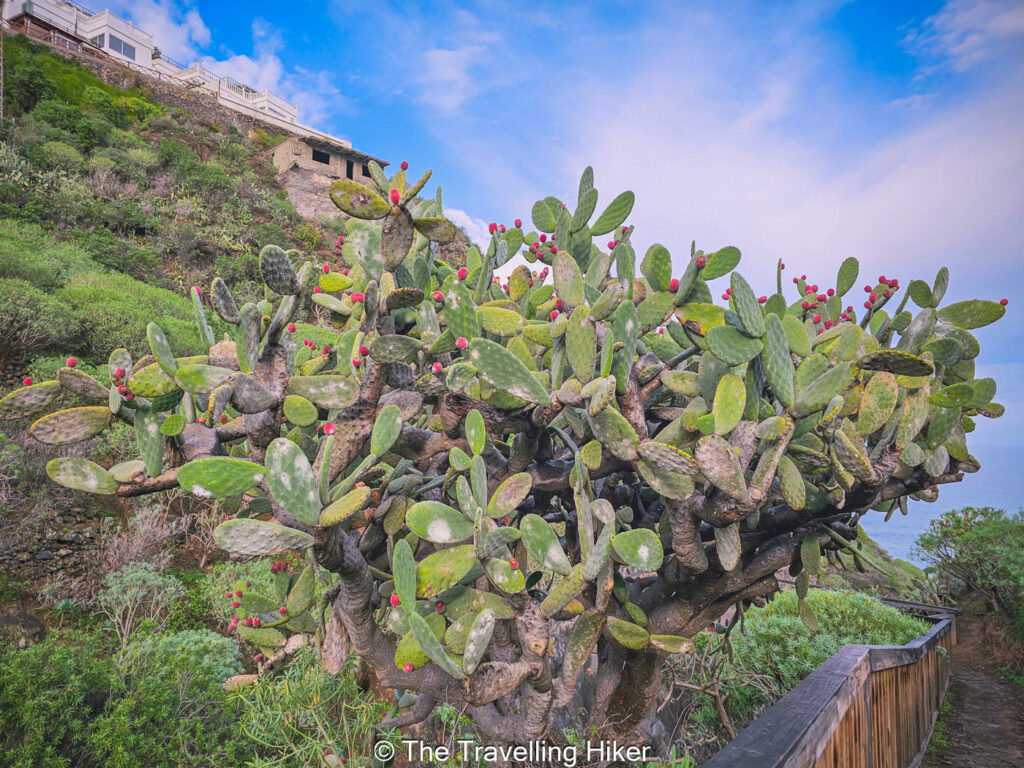
Next to the trail, you will see many banana plantations, cactus and aloe vera plants.
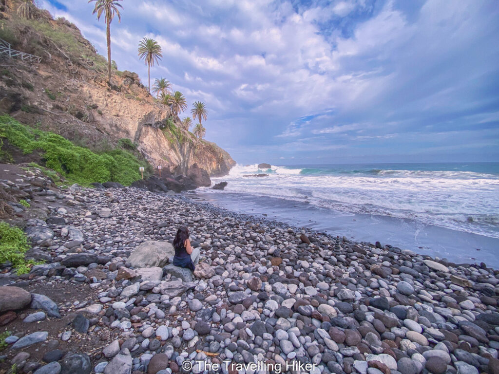
Playa de Castro (Castro Beach)
A bit further from the lookout point, you will see some stairs that descend towards Playa de Castro. The descent is quite steep but it is relatively easy thanks to the stairs.
Playa de Castro is a small pebbled beach surrounded by big palm trees that come out of the rocky cliffs. We were completely alone in here but it was so peaceful, just us and the sound of the waves breaking into the pebbled beach. We stayed here for quite a while just relaxing and enjoying the view.
Casona de Castro and Return
Once you are done relaxing at Castro Beach, you’ll have to climb back up all the stairs and follow the trail a little bit further until you reach Casona de Castro, a traditional Canarian Villa.
At that point, you will have to hike back to the same way you came until you are back at the parking lot.
OTHER THINGS TO DO NEARBY
Looking for ideas on what to do after you hike? I suggest you continue exploring the northern coast of Tenerife. There are plenty of charming small towns to explore. I particularly recommend the following.
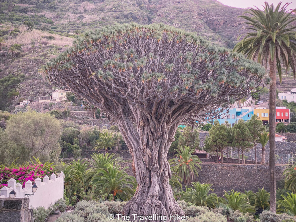
Icod de los Vinos. This town is best known for the legendary Drago Milenario, an ancient dragon tree said to be over a thousand years old. Stroll through its cobbled streets and you’ll find colorful Canarian architecture, cozy cafés, and plenty of spots to sample the local wine (which the town is famous for!).
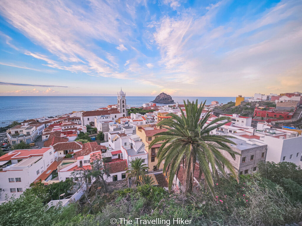
Garachico. A charming little town bursting with character. From its cobbled streets and whitewashed houses to the dramatic lava-formed rock pools that line its shore.
ACCOMMODATION NEAR THE HIKE
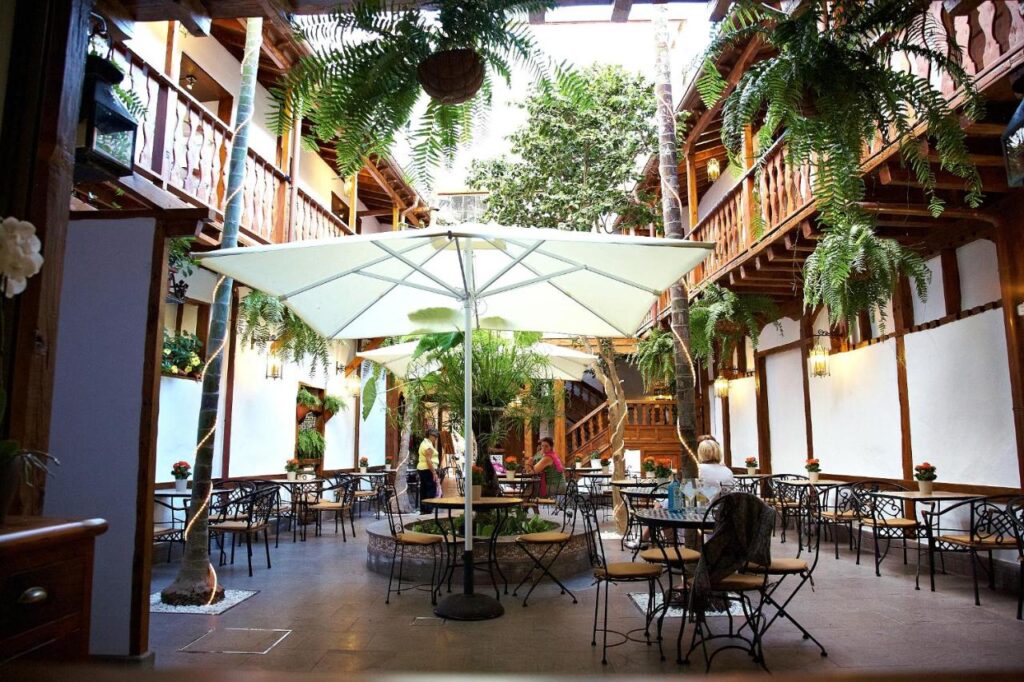
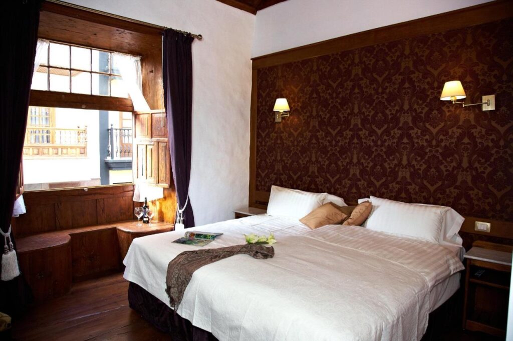
Looking for a nice place to spend the night near your hike? I recommend Hotel Emblematico San Agustin, an 18th-century Canarian-style house, in the historic center of Icod de los Vinos. The hotel is located in a charming cobbled stone street in the historic center.
HOW TO USE THIS MAP: Click the star next to the map title to add this map to your google maps account. To view it on your phone while traveling, open Google Maps, click on the menu button and go to “Your Places”, click on Maps and you’ll see this map in your list.
HIKE SUMMARY AND INFOGRAPHIC
And that’s it for this week’s blog. I hope you liked it and found it useful. Let me know what you think in the comments!
Happy hiking!
DISCLAIMER: Did you know? This blog uses affiliate partnerships. When you click and book or make a purchase through one of my blog posts, I may receive a small commission (at no extra cost to you). Thank you for supporting The Travelling Hiker!