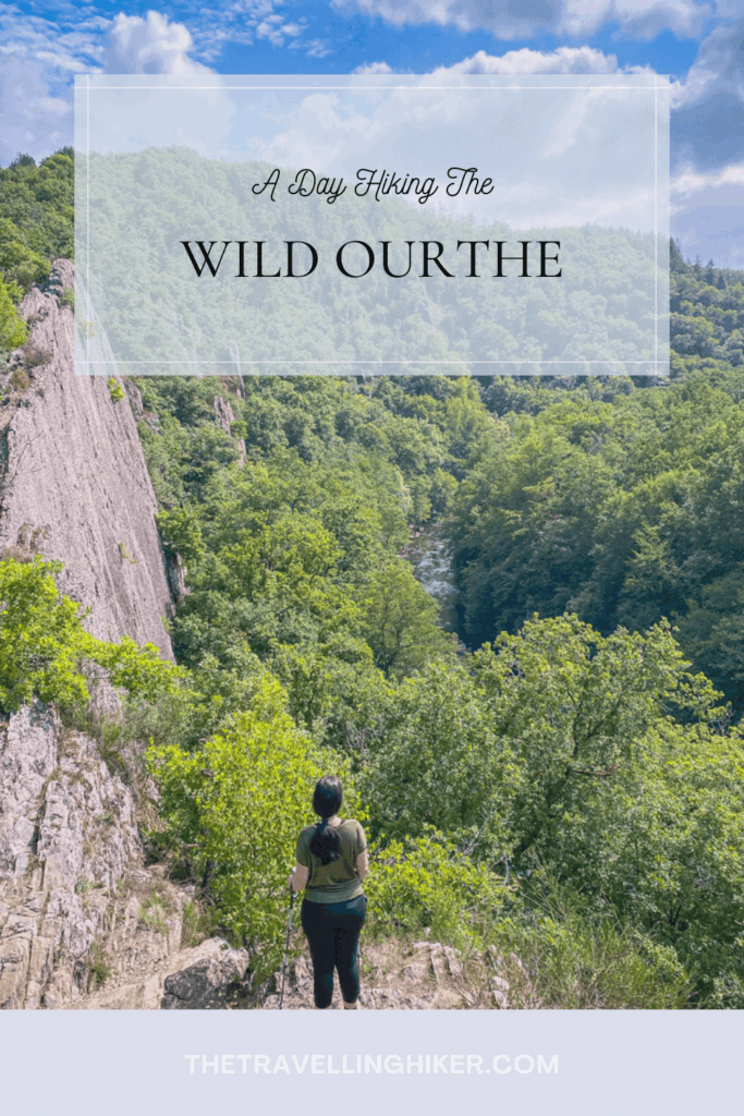
If you love valleys, steep cliffs and quiet forests, the Wild Ourthe Hike in Belgium is a perfect day hike for you. This trail sits in the heart of the Belgian Ardennes and offers one of the most dramatic landscapes in the country. I have created this simple guide to help you plan your visit, understand the route and enjoy the hike with confidence.
The Wild Ourthe Hike is an 11 kilometer loop that starts in the Ollemont village and follows the Ourthe River over small rock and forest trails to impressive viewpoints over the river.
Below you will find facts about the Ourthe River, practical travels tips, a step by step guide, where to stay nearby, and much more. Sounds interesting? Then, put on your hiking boots and let’s start walking!
TABLE OF CONTENTS
INTERESTING FACTS ABOUT THE OURTHE RIVER
The Ourthe is one of the most beautiful rivers in Belgium and plays a big role in shapping the Ardennes landscape. Here are a few interesting facts that will help you understand why this area is so special.
The Ourthe flows for abouth 165 kilometers before it meets the Meuse River.
Throughout its course, the river has created deep valleys that make for some of the most breathtaking views in the Ardennes.
The Ourthe area is part of a natural reserve, the Parc Naturel des Deux Ourthes.
There is plenty of wildlife in this natural reserve such as deer, wild boars, foxes, etc.
PRACTICAL INFORMATION ABOUT THE HIKE
HOW TO GET TO THE WILD OURTHE TRAILHEAD?
The trailhead for this hike is located near the village of Nadrin, located between La-Roche-en-Ardenne et Houffalize. To reach it, you will need a car as there is no public transport that will bring you to the trailhead. It should take approximately approximately 1 hour and 30 minutes to reach it from Brussels. I have pinned the exact location in the map at the end of this blog.
🅿️Parking: The parking lot is not too big. If for some reason, the parking is full when you arrive, there is a second parking spot located a few meters down the road.
WHAT EQUIPMENT DO YOU NEED FOR THE WILD OURTHE HIKE?
This hike is not technically difficult but it does have a few uphills and downhills. The following equipment will make your hike easier.
Sturdy hiking boots. Shoes with a good grip are your best option in this hike, and if they are waterproof, even better! The trail can get muddy after a few rainy days.
Day backpack, to carry your water and snacks.
Water & Snacks. Make sure to bring plenty of water as there are no refills or cafés on the trail. We did this hike on a really warm sunny day and we run a bit short on water by the end of the hike.
Trekking poles (optional but helpful). Your knees will thank you for them.
Map or GPS app. The trail is marked but a GPS App like AllTrails, is always very handy.
Camera or smartphone, to capture all the beautiful sights.
BEST TIME OF THE YEAR TO DO THIS HIKE
This trail is open and accessible all year long. Each season has a different atmosphere so it all depends on what you are looking for.
Spring. The spring months offer fresh green leaves, flowers and soft temperatures.
Summer. During the summer, you will have long summer days and warm temperatures. The trail will be a bit more busy but nothing too dramatic.
Autumn. Autumn is also a perfect season to do this trail. The leaves turn orange and yellow, giving the valley a dreamy atmosphere.
Winter. The winter months will grante you the most peaceful time in the trail but the path can be muddy and slippery. Make sure to wear warm clothes and start the hike early.
I have done this trail twice, the first time I did it was during the early autumn and the second time, it was in the summer and both times it was an amazing hike.
THE WILD OURTHE HIKE
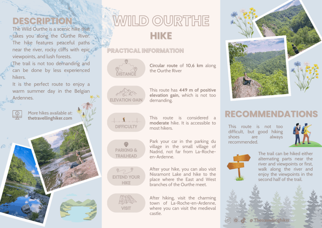
HIKE STATS
Trail Start/End – Parking du village in Nadrin (exact location at the end of this blog)
Distance – 10,6 km
Elevation Gain – 449 m
Level – Moderate to Difficult
Route Type – Circular Route
Estimated Time Needed – 5 to 6 hours. This includes plenty of time to stop for a picnic, relax, and enjoy the scenery.
Best Time To Visit – Between April and October. However, I would recommend a sunny day to enjoy as much as possible.
HIKE MAP
I always use the AllTrails App during my hikes. The app has a GPX map that can help you stay on the right trail during your hikes. For this hike, we followed the Wild Ourthe Trail.
MY EXPERIENCE HIKING THE WILD OURTHE - STEP BY STEP GUIDE
This hike has a mix of different parts walking next to the Ourthe combined with forest and uphills to get to different viewpoins over the river and the valley. You can choose to walk directly first next to the river and then, do the return through the uphill parts, but I recommend following the trail as it is defined by the app. This way, you will alternate between walking next to the river and the forest.
First Descend to the Ourthe
From the parking lot, you will first walk a few hundred meters along the road until you reach the forest. This first part is not very interesting as you will walk near some vacational houses and hotels but fortunately it doesn´t last very long.
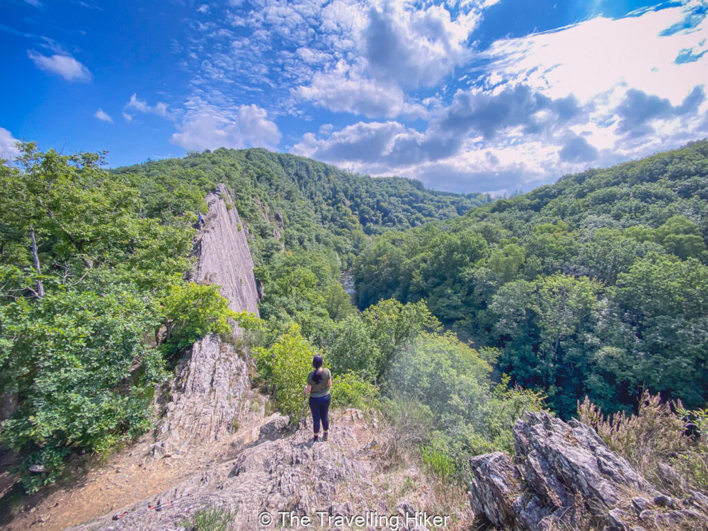
Soon enough, you will reach the forest and the trail will start to descend towards the Ourthe River. Halfway throughout your descend, you will see that there is a trail that goes to the left slightly uphill. This is not part of the route, but I recommend you take this small detour to get some epic views over the Ourthe.
Important: With this detour, you will be over an exposed cliff with quite a drop. Make sure you are sure footed and don’t take any unnecessary risks for a photo.
After this short detour, you will continue your descend until you reach the Ourthe River.
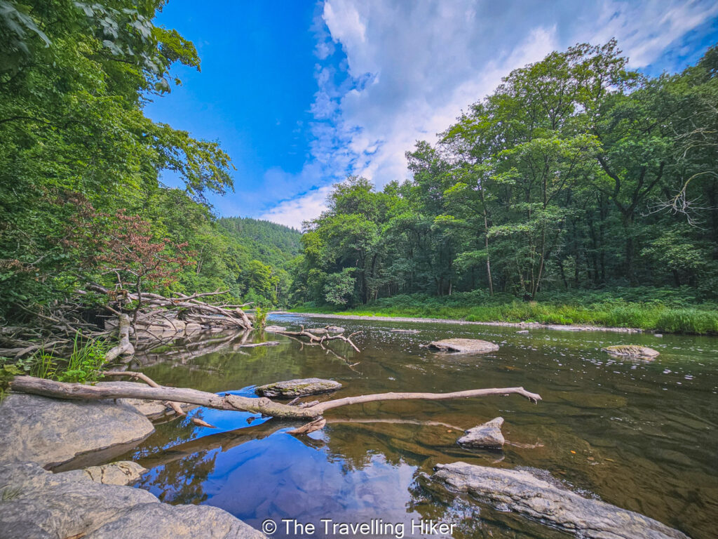
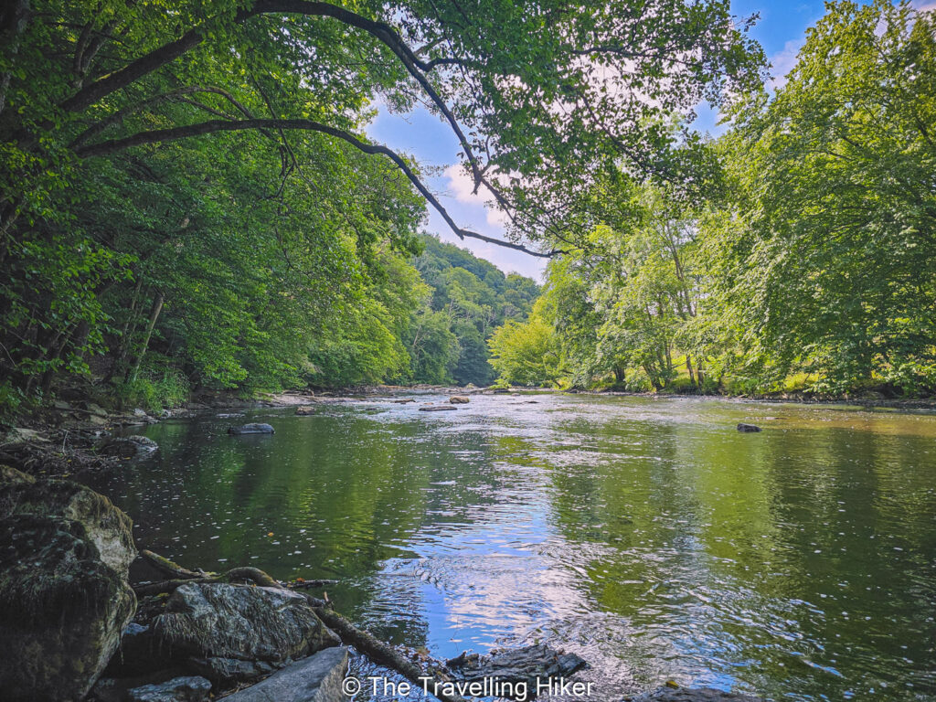
The First Segment Near The Ourthe
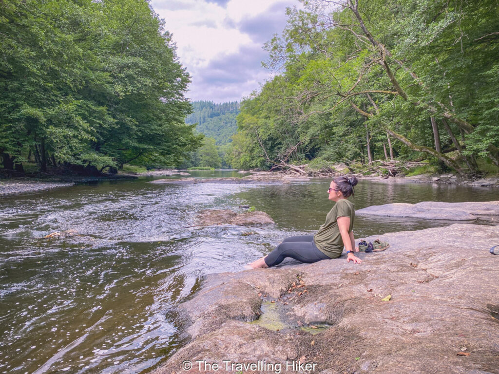
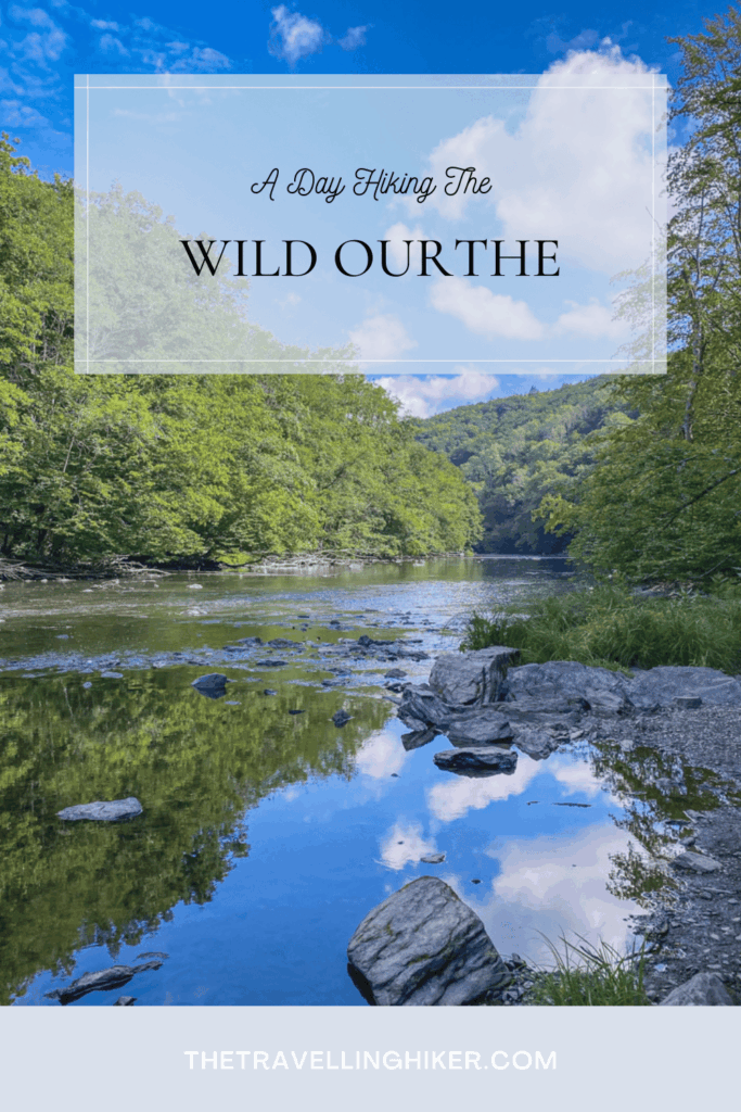
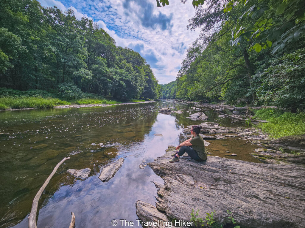
Once you reach the Ourthe, the trail will follow the river side for approximately one kilometer. This part of the trail is very nice, full of small rock outings and branches where you can admire rest and peacefully admire it.
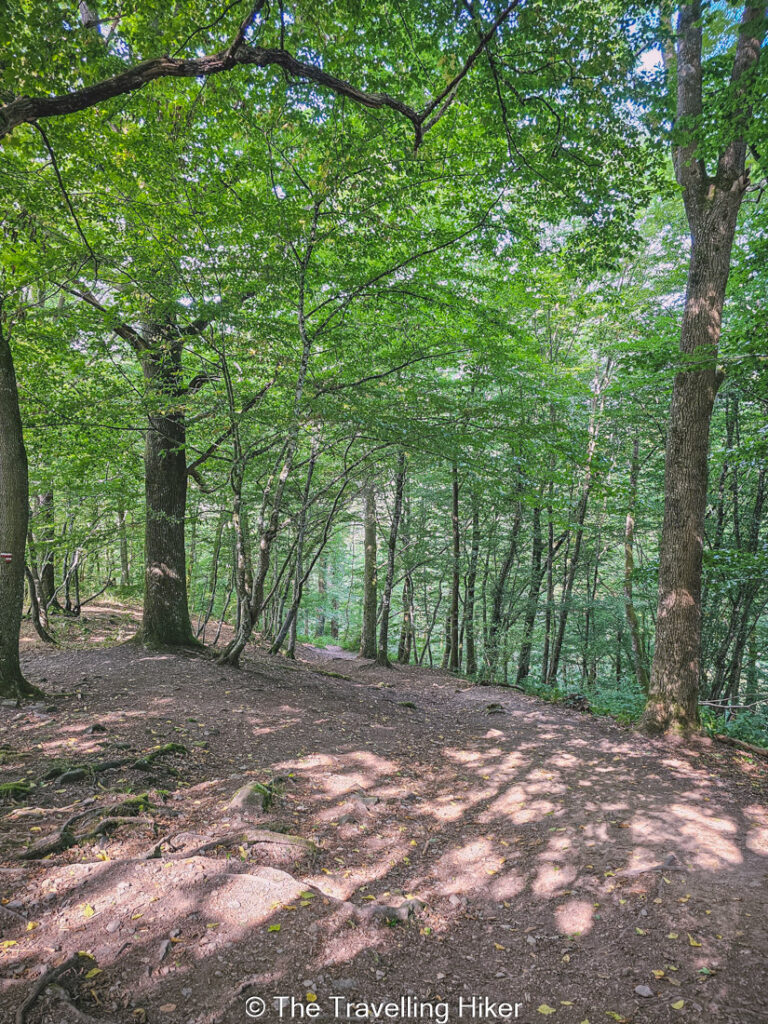
Frist Uphill
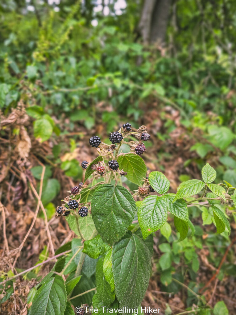
After 1 kilometer walking near the river, the trail will go inland again and it will split into two different trail paths, take the one to the right that goes uphill. This part of the trail is not spectacular as there are not many viewpoints. However, if you do the trail at the end of July like we did, you will find plenty of wild blackberries. Do not hesitate to take as many as you want, they are delicious!
Second Part Near The Ourthe
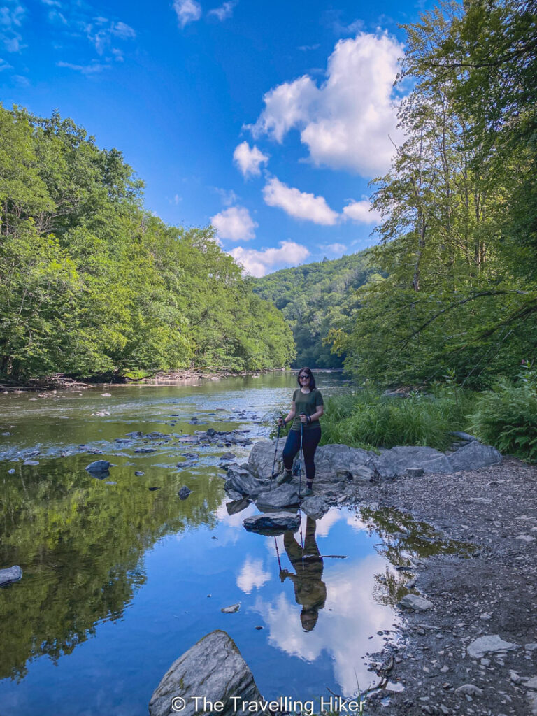
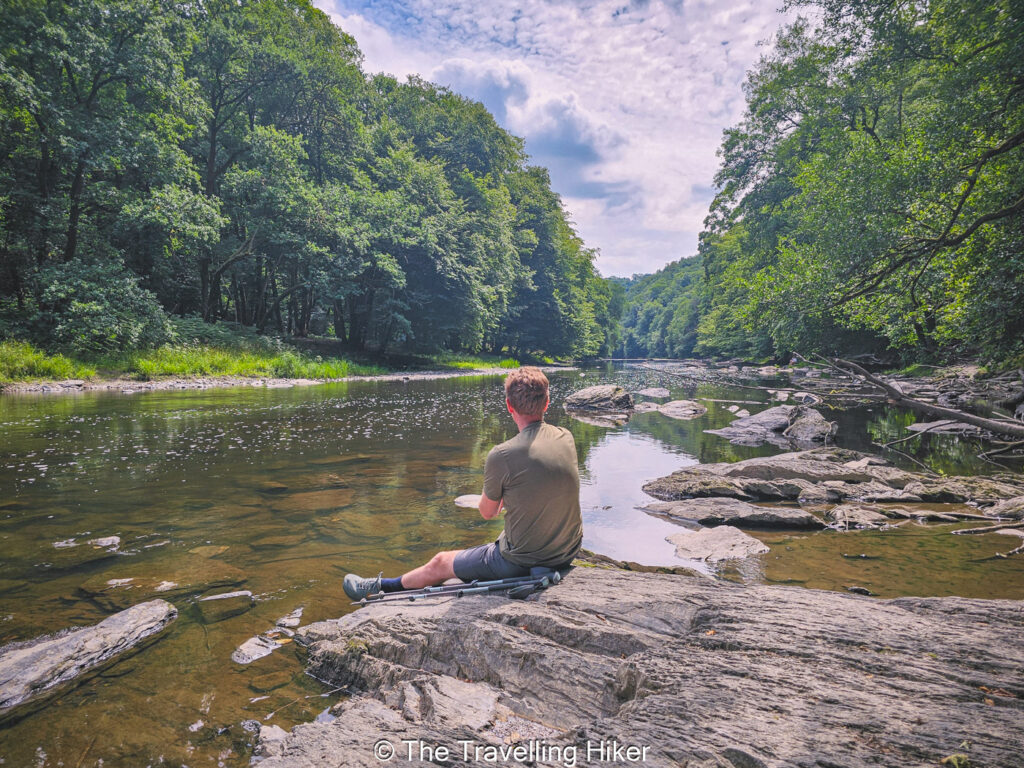
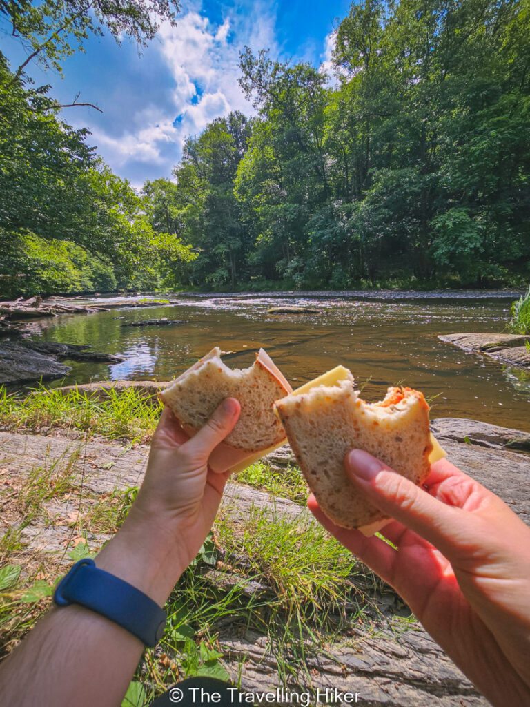
After some time, you will descend again for a second time walking near the river. This part is again approximately 1 kilometer long and just like the first one, you get plenty of rocks that give you priviledged views into the river. It is also the perfect moment to sit in one of them and have a picnic lunch.
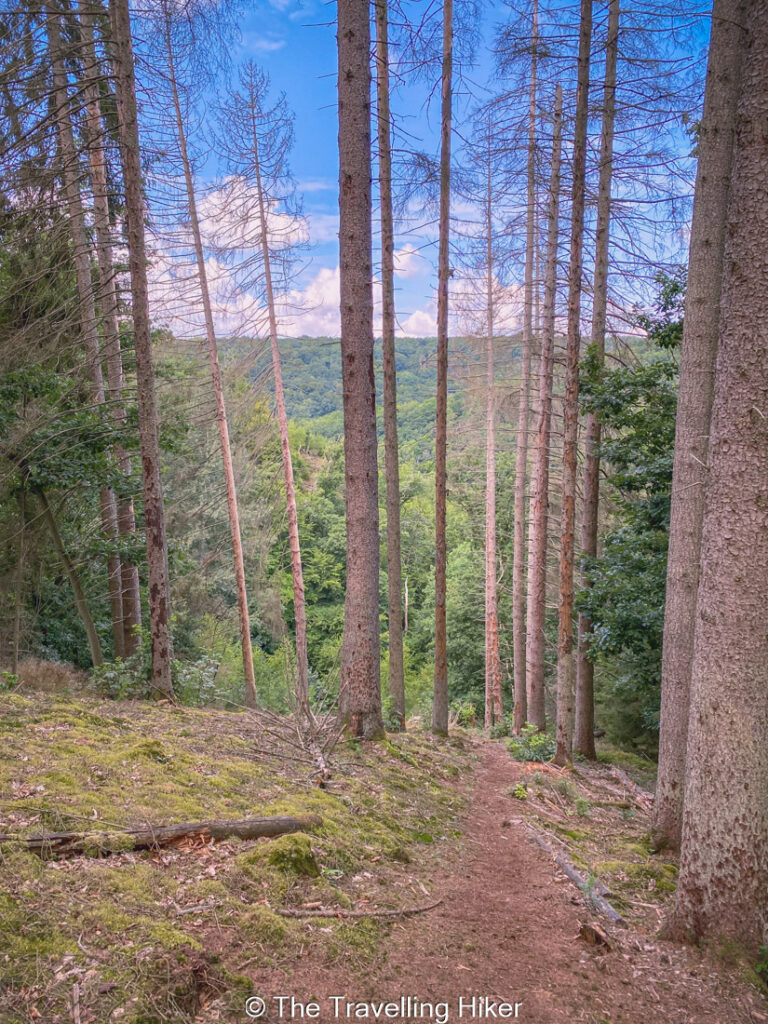
Second Uphill and Viewpoints
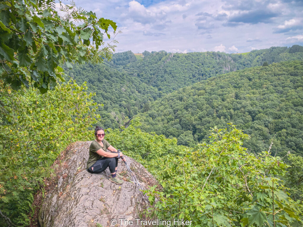
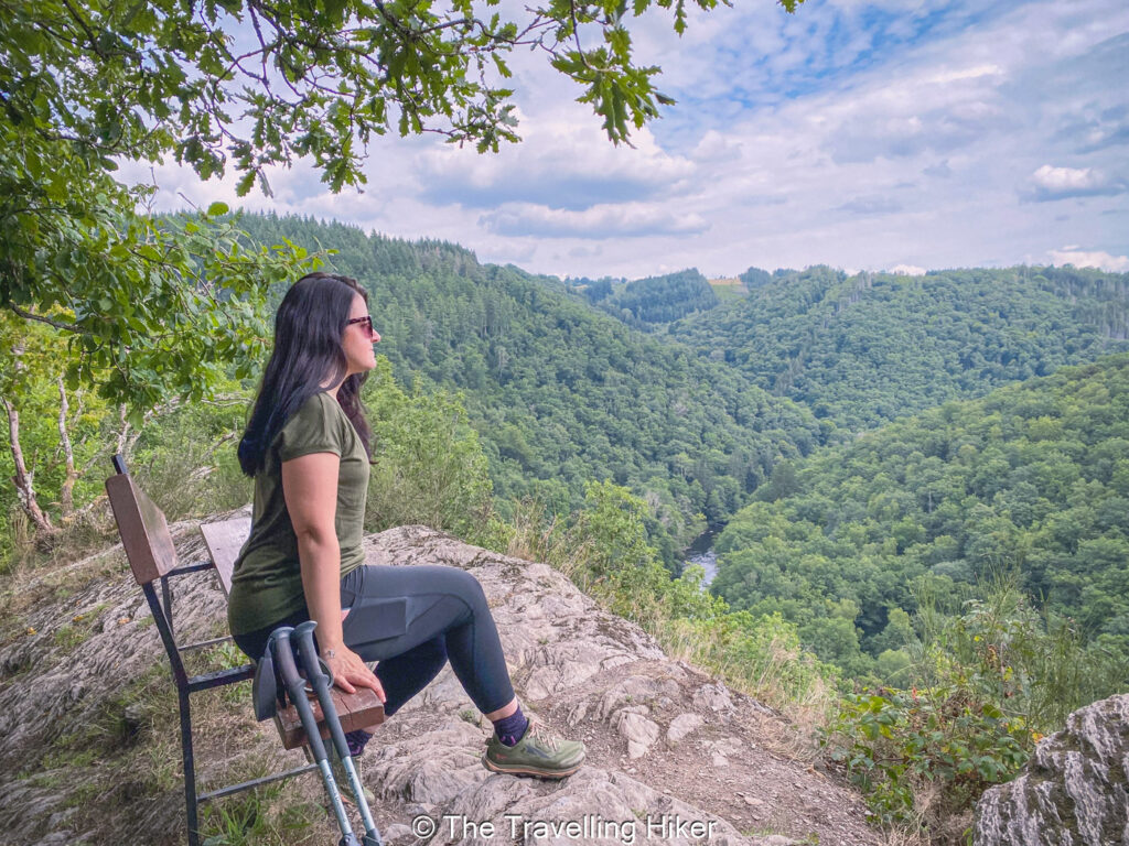
After another kilometer, the trail will separate from the river again and the second uphill will begin. First, you will reach the archeological site of Cheslé, an old celtic fortification, where you can get some nice views of the river.
Keep following the trail, and you will reach two additional viewpoints of the river and the valley.
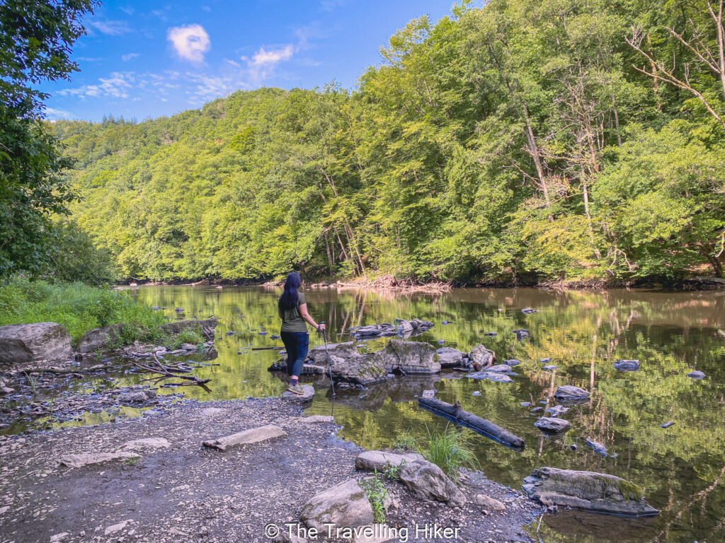
Third Segment Near The Ourthe & Final Uphill
The last part of the hike is a third segment near the river. If like us, you’re doing the hike during the summer months, this is the perfect time to relax and cool down by dipping your feet into the water.
The trail will eventually lead you to the point were you did your first uphill. If you take the trail on the left, it will slowly lead you uphill and back to the parking lot.
OTHER THINGS TO DO NEAR THE WILD OURTHE HIKE
After you hike, consider exploring:
La Roche-en-Ardenne: A charming town with a medieval castle, cafés, and great local food.
Kayaking or Paddleboarding; In the warmer months, you can drive to the nearby Nisramont Lake where you can go kayaking or paddleboarding in certain areas of the lake.
Hike around Nisramont Lake: If you still have some energy left, you can hike around Nisramont Lake and admire the point where the east and west branches of the Ourthe meet.
WHERE TO STAY NEAR THE WILD OURTHE?
Accommodation in La-Roche-en-Ardenne
Want to stay overnight and make it a weekend trip? The best place to book your accommodation is at the charming town of La Roche-en-Ardenne. I would recommend Hebergement Comfort La Fontanella. This hotel is located in a historic building just 3 minutes walking from the Feudal Castle.
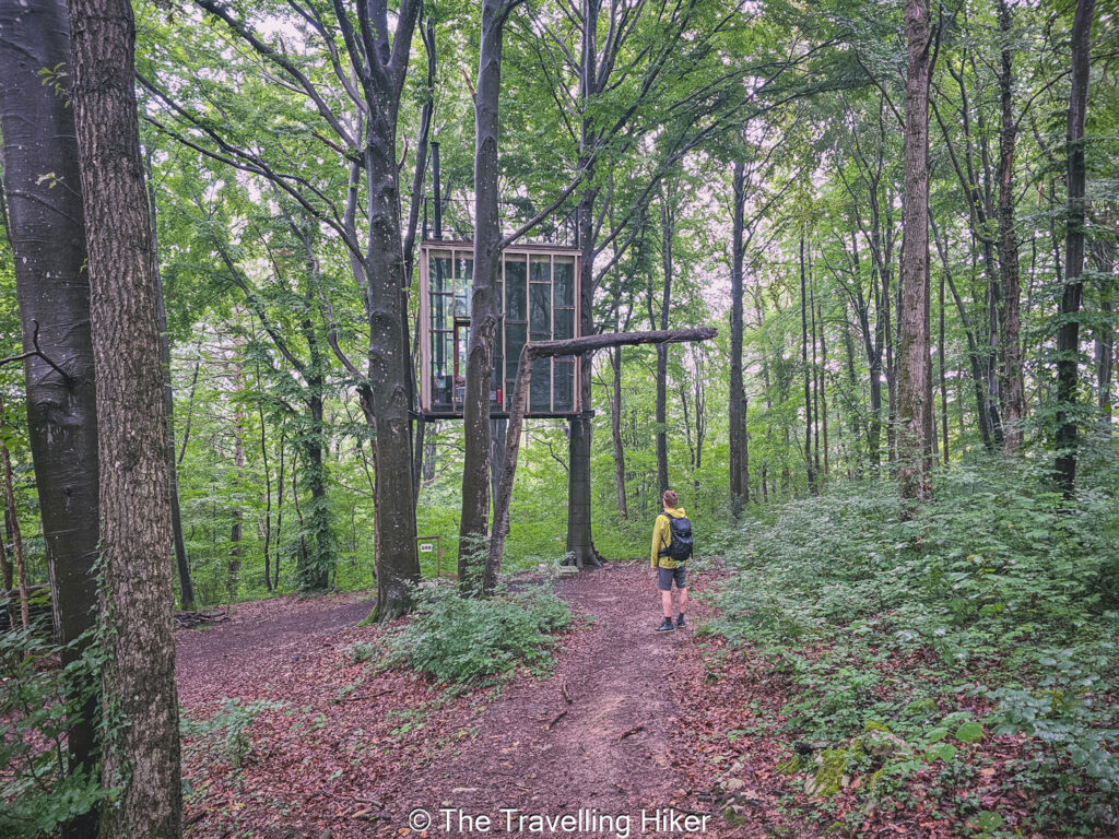
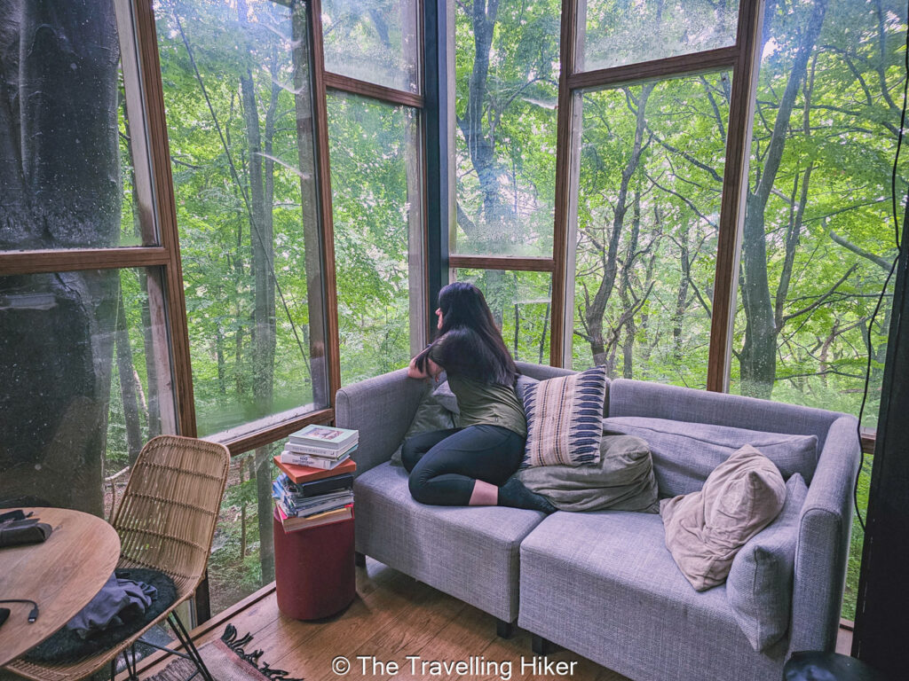
Looking for a more unique accommodation? Then, you can drive 30 minutes to Humain where you can find Stay Ici, which offers unique accommodations within the woods like hanging cabin from the trees. We chose the Glass Cube, which as it’s name says is a glass cube hanging from the trees. Here, you will have no internet connection and you can disconnect and enjoy spending a night in nature.
It was the perfect way to relax after a day of hiking. We even got to see some deer walking next to our cabin in the morning!
HOW TO USE THIS MAP: Click the star next to the map title to add this map to your google maps account. To view it on your phone while traveling, open Google Maps, click on the menu button and go to “Your Places”, click on Maps and you’ll see this map in your list.
HIKE SUMMARY AND INFOGRAPHIC
No time to read the full blog post? Here’s an infographic I’ve created with the most important information about this hike.
And that’s it for my blog about The Wild Ourthe. I hope you liked it and found it useful. Let me know what you think in the comments!
Happy hiking!
DISCLAIMER: Did you know? This blog uses affiliate partnerships. When you click and book or make a purchase through one of my blog posts, I may receive a small commission (at no extra cost to you). Thank you for supporting The Travelling Hiker!


Bonito recorrido