Croda da Lago

CRODA DA LAGO HIKE: A BEAUTIFUL LOOP TO LAGO FEDERA IN THE DOLOMITES

The Croda da Lago hike is one of the most scenic and rewarding day hikes in the Dolomites. This stunning loop around the dramatic peaks of Croda da Lago takes you through alpine forests, rugged mountain passes, and breathtaking viewoints before reaching the iconic turquoise waters of Lago Federa. With its mix of varied landscapes and postcard-perfect scenery, it’s easy to see why this trail is often considered one of the best hikes near Cortina d’Ampezzo.

In this detailed guide, you’ll find everything you need to plan your hike. From trail statistics and parking information to the best time to visit and what to pack. I’ll also walk you through the route step by step based on my own experience. The Croda da Lago hike delivers unforgettable views at every turn.

TABLE OF CONTENTS

DISCLAIMER: Did you know? This blog uses affiliate partnerships. When you click and book or make a purchase through one of my blog posts, I may receive a small commission (at no extra cost to you). Thank you for supporting The Travelling Hiker!

CRODA DA LAGO TRAIL OVERVIEW

The Croda da Lago trail is a scenic loop in the eastern Dolomites, best known for its spectacular views and the beautiful alpine lake of Lago Federa. Starting near Cortina d’Ampezzo, the trail winds through peaceful forests, crosses high mountain passes, and opens up to dramatic panoramas of rugged peaks. The highlight comes when you reach Lago Federa, where the surrounding mountains reflect in the calm water and create one of the most photogenic spots in the region. 

This hike is typically done as a loop, which keeps the scenery varied from start to finish. Throughout the hike, you’ll experience shaded woodland paths, rocky alpine terrain, alpine meadows, and wide-open viewpoints. The diversity of landscapes makes this one of the most rewarding day hikes in the area. 

Croda da Lago Hike
Our poles at Forcella de Formin

PRACTICAL INFORMATION ABOUT THE HIKE

HOW TO GET TO the trailhead?

The trailhead for the Croda da Lago loop is located on SP638 at Ponte de Ru Curto, which is on the mountain road that leads to Passo Giau, south of Cortina d’Ampezzo.

Getting there by car

Driving is the easiest and most flexible way to reach the trailhead. However, you should know that to reach the trailhead, you will have to drive through a mountain road. Make sure you are comfortable with driving through these roads before heading there. 

Rent your car with Auto Europe.

From Cortina d’Ampezzo, follow the rorad towards Passo Giau. After about 20 minutes, you will find a small parking area on the side of the road where the trail begins. I have pinned the exact location on the map at the end of this post.

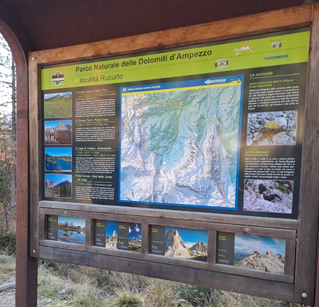
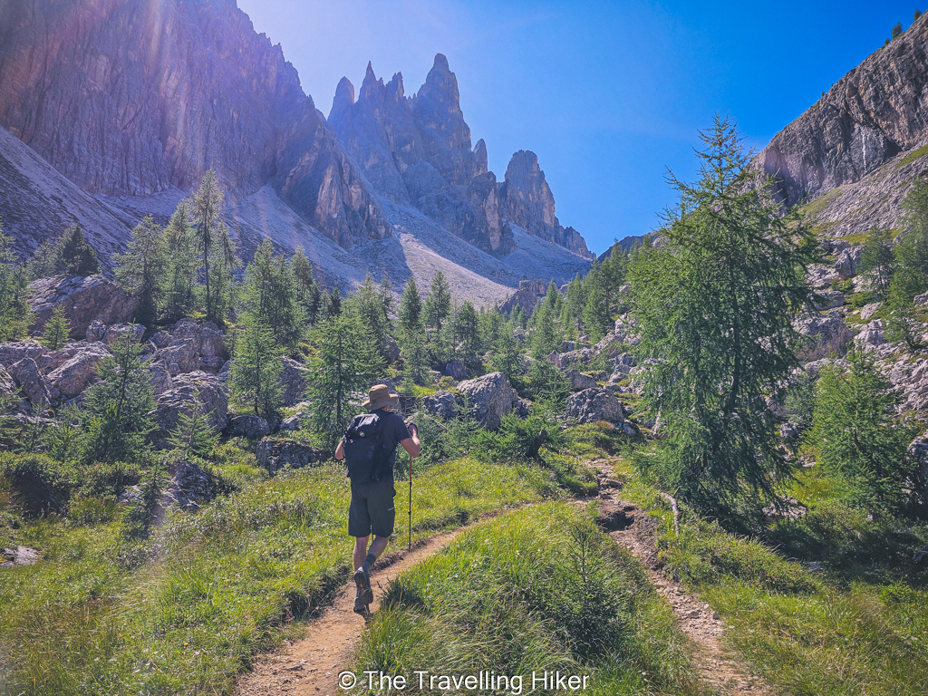
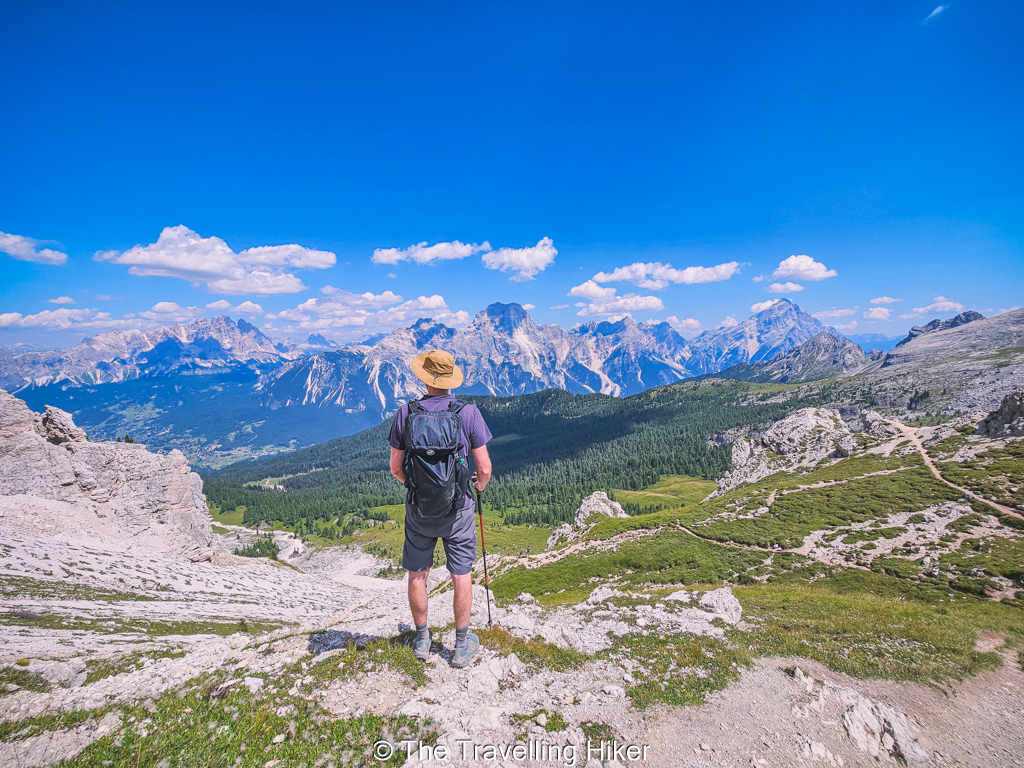
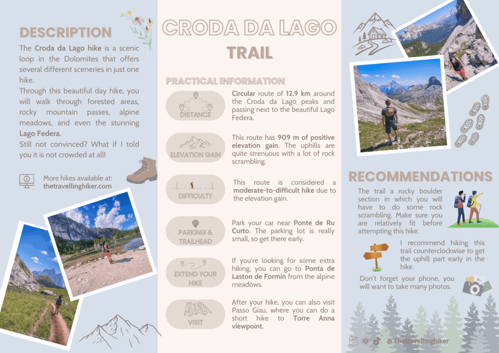
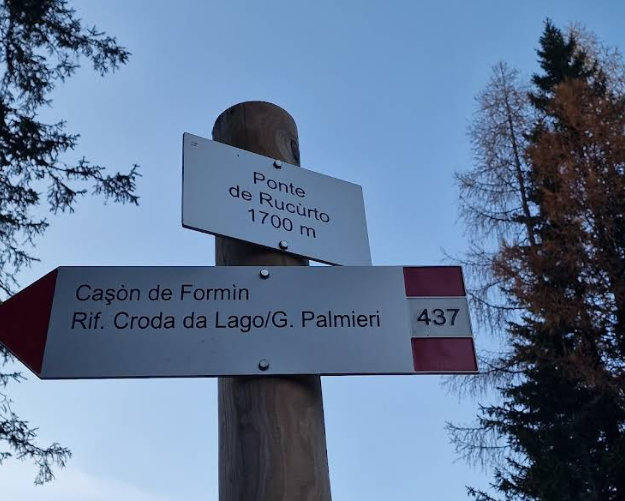
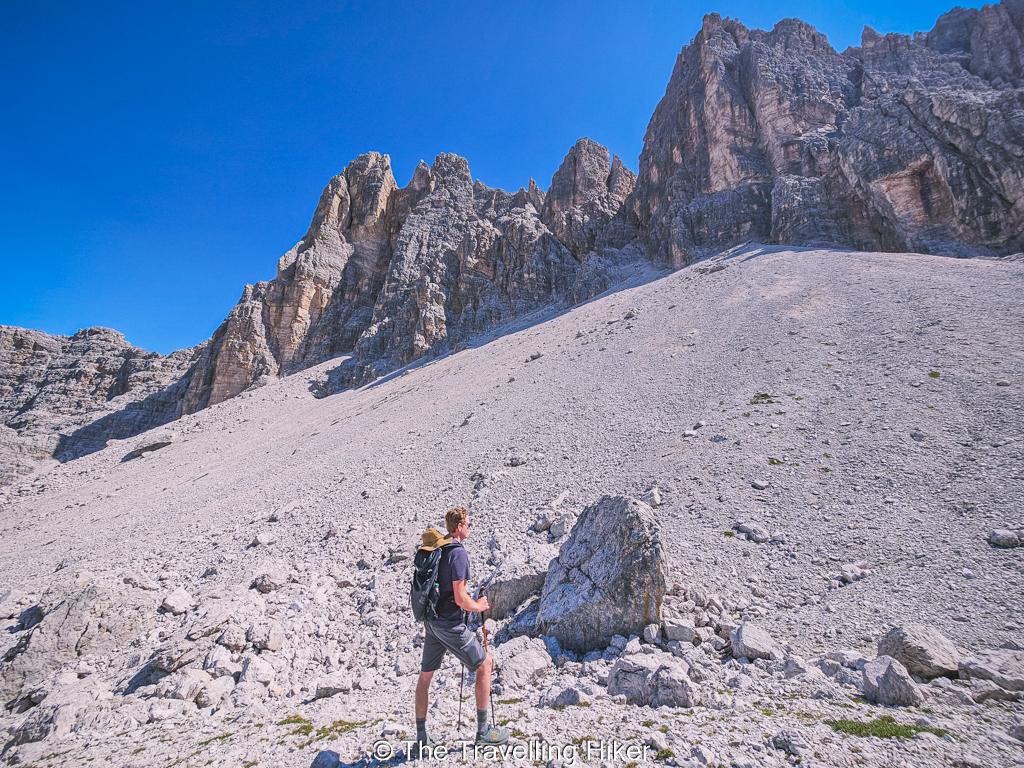
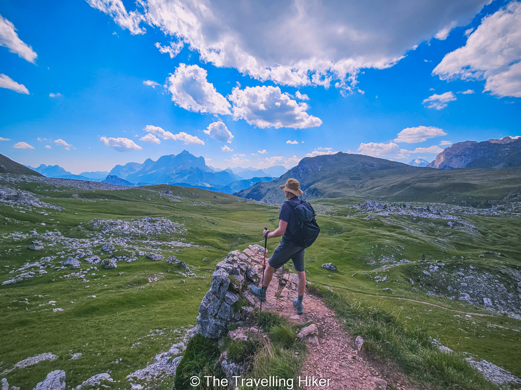
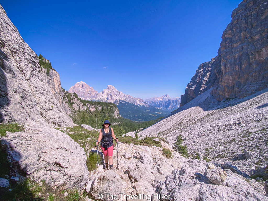
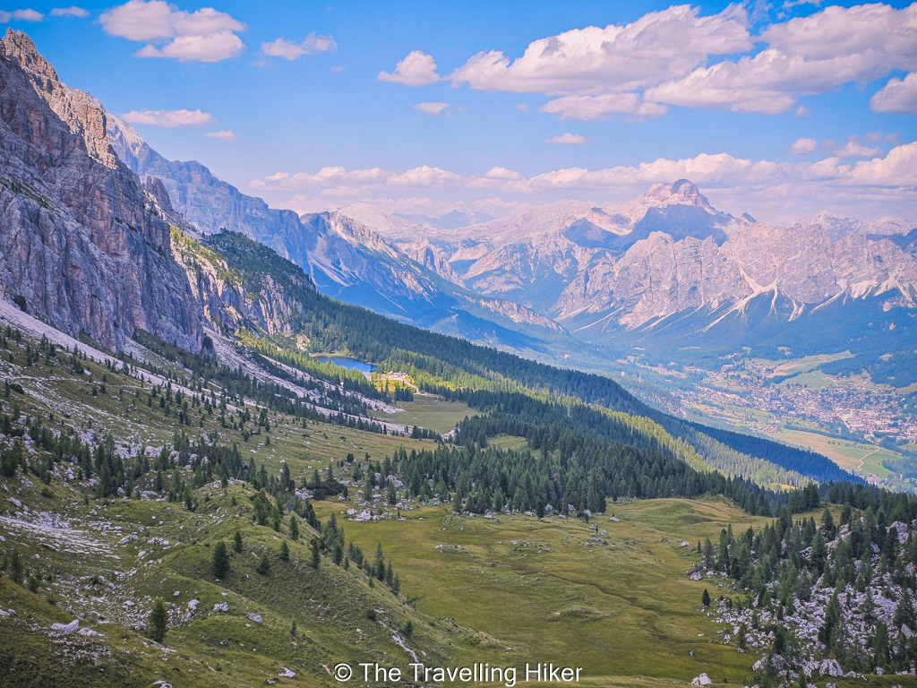
🅿️ Parking: There is a small parking lot on the side of the road next to the trailhead. Even though this hike is not as popular as other hikes in the Dolomites, it is important to arrive here early to secure one of the parking spots.

Getting there by public transport

During the summer months, it is also possible to reach the trialhead by public transport. There is bus stop a few meters away from the trailhead. However, you should always check the bus schedules in advance to ensure you will have a bus to return to Cortina. 

Forcella Rossa

WHAT EQUIPMENT DO YOU NEED TO HIKE THE CRODA DA LAGO TRAIL?

The Croda da Lago loop is a moderate to difficult mountain hike, so wearing the proper gear is important. The terrain includes forest trails, rocky sections and uneven ground.

Here is the equipment I recommend you have.

  • Sturdy hiking shoes with good grip. There is a lot of rocky terrain and loose gravel. I am bit ashamed to admit that I almost fell a few times in the section between Forcella de Formin and Forcella Ambrizzola.
  • Day backpack with enough water and snacks or a packed lunch. You can always get some drinks and food in Rifugio Croda da Lago but we always prefer to bring our own.
  • Layers and a lightweight waterproof jacket for changing mountain weather. We were really lucky with the weather on the day we hiked Croda da Lago but you never know what you will get.
  • Sun protection such as sunscreen, sunglasses and a hat. The trail is quite exposed so you have to bring protection on sunny days.
  • Hiking poles will be a great relief on the hike down.
  • Camera or phone to capture the beautiful sights. 
Croda da Lago Hike
Taking a break half way uphill

WHEN IS THE BEST TIME TO DO THE CRODA DA LAGO HIKE?

As with most of the trails in the Dolomites, the best time to do the Croda da Lago hike is from late June to early October. During this period, the trail is usually snow free and the mountain huts near Lago Federa are open.

  • Summer (July to August): Stable weather and long daylight hours. This is the most popular time, so start early for quieter trails and secure parking.
  • Early Autumn (September to early October): Cooler temperatures, fewer hikers, and beautiful golden larch trees will make the scenery even more impressive.
  • Late Spring and Early Summer (June): Snow may still be present on higher sections depending on the year. Check conditions before hiking.

CRODA DA LAGO HIKE

HIKE STATS

Trail Start/End – Ponte du Ru Curto, on the road leading to Passo Giau (exact location at the end of this post).

Distance – 12,9 km

Elevation Gain – 909 m

Level – Moderate to Difficult

Route Type – Circular trail

Estimated Time Needed – 6 to 7 hours (including plenty of time to stop for photos and enjoy the views of the Croda da Lago)

Best Time To Visit – June to September to ensure the best weather conditions.

Croda da Lago Hike

HIKE MAP

I always use the AllTrails App during my hikes. The app has a GPX map that can help you stay on the right trail during your hikes. For this hike, we followed the Ambrizzola Fork via Lake Federa Trail.

MY EXPERIENCE HIKING THE CRODA DA LAGO HIKE - STEP BY STEP GUIDE

Parking and Trailhead

We arrived at the trailhead at around 9:00 and the small parking lot was almost full. We managed to get one of the last parking spaces available so we were very happy about this.

Next to the trailhead, there is a small sign with the map of the area. You’ll first follow the trail #437 towards Casson de Formin.

Trailhead Croda da Lago
Sign at the trailhead

Hiking to Cason de Formin

Fhe first part of the trail took us through a pine forested area. As we hiked, we crossed several bridge and very gently gained altitude. The trail was a mix of loose gravel and roots from the trees that surround you. This part of the trail is quite simple with not too many lookouts a part for the small creeks, you will cross.

At approximately 1,8 km into our hike, we reached the first trail junction at Cason de Formin. At this point, you will have to decide whether you want to hike clockwise or counter clockwise. If you choose to hike clockwise, you will first hike to Lake Federa and then continue uphill until you reach Ambrizzola Fork. Alternatively, you can choose to go counter clockwise and to the rocky section first to finish your hike at Lake Federa.

In our case, we decided to hike counter clockwise, so once we reached Cason de Formin, we kept right and continue our trail. In my opinion, I think this is the best option to follow. Yes, it was quite steep uphill, but I’d rather do the steep parts uphill than downhill. 

River crossing
Forested area

Hiking to Forcella de Formin

After Cason de Formin, the trail continued through the forest for another kilometer. However, the elevation gain started getting more relevant. From time to time, the trees opened up and we got nice views of Tofana di Rozes or the Croda da Lago mountains.

After roughly one kilometer, the forested area opened up, and we got in front of us the Ambrizzola Peak and the other mountains peaks.

Croda da Lago hike: Trail to Forcella de Formin
Trail to Forcella de Formin

As we kept hiking the few remaining trees cleared up completely, and we were left facing a big rocky and boulder section. From down here, it was almost impossible to see the trail winding up but it was there. This was the hardest part of the trail, but we just took it one step at a time and stopped plenty of times to admire the views both in front of us and behind us. 

Croda da Lago Hike: View of Cima Croda da Lago
View of Cima Croda da Lago
Croda da Lago Hike: View of Cortina Valley
View of Cortina Valley

At some point the boulders got so bick that I had to fold my hiking poles and start scrambling with my hands. We kept on going steady but slow until the big boulder section was over and it flattened out until we reached Forcella de Formin, where we stopped to take one last look back at Tofana di Rozes.

Croda da Lago hike: Rock Scrambling until Forcella di Formin
Rock scrambling until Forcella de Formin
Croda da Lago Hike
Boulder section
Croda da Lago Hike: Forcella de Formin
One last look at Tofana di Rozes

Forcella de Formin to Forcella Ambrizzola

As soon as we reached Forcella de Formin, a beautiful alpine meadow appeared in front of us. The scenery was so different compared to the rocky section we had just passed. It was the perfect place to stop for a little while and taking in the views while we had our packed sandwiches!

Lunch with a view!
Croda da Lago Hike
View from Forcella de Formin

From here, the trail went down into the alpine meadow to take you to Ambrizzola Fork (Forcella Ambrizzola). However, looking at the AllTrails map, I saw the trail split into two and you could do a little detour to Forcella Rossa. This was a great decission as the views from Forcella Rossa were some of our favorite of the trail! 

Good to know: Once you reach Forcella Rossa, you have to decide whether to turn around and return to the original trail or keep following the trail you’re in. If you keep following this trail, you will get a shortcut to Lago Federa. However, if you do this you will miss the alpine meadows and Ambrizzola Fork.

We decided to turn around and follow the original trail since the meadows in front of us looked really pretty. Just be careful on this section as the trail is made of loose gravel which is very slippery!

Croda da Lago Hike: View from Forcella Rossa
View from Forcella Rossa

After the short detour to Forcella Rossa, the trail took us through a beautiful alpine meadow until we reached Ambrizzola Fork. This was my favorite part of the hike, the trail was almost flat and the views were just impressive. We had to stop every few hundred meters to capture all the views!

Croda da Lago Hike:
Walking through the alpine meadows
Croda da Lago Hike
Alpine meadows

Forcella Ambrizzola to Lago Federa

Once we reached the saddle at Forcella Ambrizzola, the whole valley opened up in front of us. The view from up here was pretty impressive too. We could see Lago Federa in the distance with Cortina even further and the Mondeval peaks to the right. 

Croda da Lago Hike
View from Ambrizzola Fork

From this point forward, the trail went down gently until Lago Federa and Rifugio Croda da Lago through a wide trail. The views of the Cortina valley were constantly in front of us so it was quite pleasent and to our right we could see cows peacefully enjoying the mountain pastures. 

Walking toward Lago Federa
Croda da Lago Trail
Looking back at Forcella Ambrizzola

Once we reached Lago Federa, we took some photos of the lake and decided to get a cold drink at the refugio. We had our water bottles but it was such a warm day that we needed something a bit colder. 

Croda da Lago: Lago Federa
Lago Federa
Lago Federa

Finishing the loop

From here the trail was downhill all the way back to the parking lot. This part of the trail was again through a forested area with the trees opening up here and there and revealing the mountain peaks. It was quite steep and with the path having loose gravel it was again quite slippery. I was happy to have my hiking poles in this part. 

Halfway down, there was a short detour to Val Negra viewpoint, where we some nice views over Cortina d’Ampezzo. It was the perfect way to end this beautiful day. 

Trail back to the parking lot
Val Negra Viewpoint

OTHER THINGS TO DO NEAR CRODA DA LAGO

This hike is quite demanding and it should probably take you somewhere around 6 to 7 hours to complete it. However, if you still have some energy after your hike, you can drive a little bit further and explore the beautiful Passo Giau. Here, you can do a short hike to Torre Anna viewpoint.

Passo Giau

CRODA DA LAGO FAQ

IS THE CRODA DA LAGO HIKE DIFFICULT?

This loop is considered a moderate to difficult hike. The trail includes some steady climbs and rocky sections, especially near Forcella de Formin pass. As long as you have a reasonable level of fitness you should have no problem completing it. 

IS IT BETTER TO HIKE CLOCKWISE OR COUNTER CLOCKWISE?

This is completely up to you! Both ways are amazing! We hiked it counterclockwise and we think this was the best solution for us as we would rather do the boulder section uphill than downhill.

IS THERE A MOUNTAIN HUT ON THE CRODA DA LAGO TRAIL?

Yes, there is a mountain hut right next to Lago Federa (Rifugio Croda da Lago). It is the only mountain hut on this trail.

Croda da Lago
Lago Federa

CAN YOU JUST HIKE TO LAGO FEDERA?

Yes, it is possible to just hike to Lago Federa as an out & back hike. It is the perfect option if you are looking for a less demanding trail. 

IS THE CRODA DA LAGO HIKE CROWDED?

We found it to be way less crowded than other popular hikes in the Dolomites. The most busy part of the hike was the part around Lago Federa since many people just get here and return to the parking lot. 

WHERE TO STAY NEAR CRODA DA LAGO?

The closest town to this trail is Cortina d’Ampezzo, so ideally you should find some accommodation near the area. However, Cortina d’Ampezzo is one of the most expensive towns in the Dolomites. If you’re looking to save some money, I recommend you look for an accommodation that is just outside the city.

Hotel Olimpia - Cortina d'Ampezzo

Hotel Olimpia is a modest hotel located right in the center of Cortina. The rooms are simple but it’s modesty is compensated by its prime location. 

Photos from Booking.com

Hotel Croda Rossa - Carbonin

Hotel Croda Rossa is located half way between Cortina d’Ampezzo and Misurina. Since it is located outside of Cortina, it is much more affordable than other accommodations in town. 

Despite its more remote location, this hotel has a premium situation in the middle of a valley with beautiful views to Monte Cristallo. The rooms are simple but comfortable. This hotel is ideal if you want to visit the Dolomites without spending a fortune. We stayed here for 6 nights and we were really happy with our choice.

MAP WITH ALL LOCATIONS

HOW TO USE THIS MAP: Click the star next to the map title to add this map to your google maps account. To view it on your phone while traveling, open Google Maps, click on the menu button and go to “Your Places”, click on Maps and you’ll see this map in your list.

HIKE SUMMARY AND INFOGRAPHIC

FINAL THOUGHTS

The Croda da Lago hike is one of those trails that perfectly captures what makes the Dolomites so special. You get a bit of everything here, quiet forest paths, dramatic mountain scenery, and unforgettable beauty  at Lago Federa. 

What makes this hike stand out is the balance. It feels adventorous without being overly difficult, and it offers incredible views without the heavy crowds you will find on some of the more famous routes. 

Make sure to include this hike in your next Dolomites route. You will not regret it!

OTHER ARTICLES ABOUT THE DOLOMITES
PIN THIS GUIDE FOR LATER!

Leave a Comment

Your email address will not be published. Required fields are marked *